Užava
Užava [1] (also Dižupe, Zirgmežupe; upstream known as Mazkaiba river, Mālupe; middle stream name Bumbuļupe) [2] is river in Latvia in Kuldīgas, Alsungas and Ventspils counties. It empties into the Baltic Sea.
| Užava | |
|---|---|
 Užava | |
 | |
| Location | |
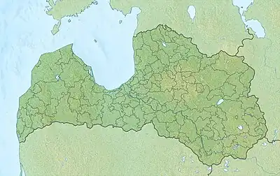
| Country | Latvia |
| Physical characteristics | |
| Source | |
| • location | Gudenieki Parish, Latvia |
| • coordinates | 56°52′44″N 21°39′43″E |
| • elevation | 46 m (151 ft) |
| Mouth | |
• location | Baltic Sea |
• coordinates | 57°14′49″N 21°24′47″E |
| Length | 67 kilometres (42 mi) |
| Basin size | 601 km2 (232 sq mi) |
| Discharge | |
| • average | 0.17 m3/s (6.0 cu ft/s) |
Geography
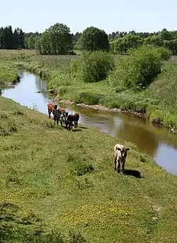
Užava begins between Gudenieki and Basu manor in Gudenieki Parish. It flows along the Piemare and Ventava plains in a north-eastern direction. Most of the flow, except for the section between Tērande and Sise, is regulated and river bed is straightened. As a result of land development and drainage, polder was built along the river. River discharges into the Baltic sea below the village of Užava.
Tributaries
- Left bank tributaries
- Saltvalks,
- Bērzkalnupe,
- Tiemene.
- Right bank tributaries
- Guļas valks (7 km),
- Stirna (10 km),
- Mārgava (6 km),
- Kauliņas River (26 km),
- Vanka (30 km),
- Gaiļvalks,
- Tērande (15 km).
See also
References
- Užava sa Geonames.org (cc-by); post updated 2010-11-05; database download sa 2016-10-20
- LGIA place name database
This article is issued from Wikipedia. The text is licensed under Creative Commons - Attribution - Sharealike. Additional terms may apply for the media files.