UK National Tide Gauge Network
The UK National Tide Gauge Network is part of the National Tidal and Sea Level Facility. It was set up in 1953 to record sea levels around the coast of the UK, after the east coast of England was affected by severe floods.

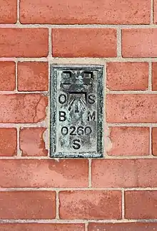
Flush bracket SO260 on the wall of Barclays Bank on Dee Lane, West Kirby. 7.8320m ASL. Also used as Tide Gauge Aux 1.
Gauges positioned at 43 locations around the UK coast record data which is archived at the British Oceanographic Data Centre in Liverpool. Once quality controlled, this data is made available for scientific use.
External links
- National Tidal & Sea Level Facility
- Tide Gauge data from the British Oceanographic Data Centre Archived 2006-06-23 at the Wayback Machine
This article is issued from Wikipedia. The text is licensed under Creative Commons - Attribution - Sharealike. Additional terms may apply for the media files.