Union Banks
Union Banks (Pagkakaisa Banks and Reefs) is a large drowned atoll in the center of Dangerous Ground in the Spratly Islands in South China Sea, 230 kilometres (120 nautical miles)[1] west of the Philippine coast, containing islands and reefs whose ownership remains disputed and controversial.[2] The closest atoll is Tizard Bank, 25 kilometres (13 nautical miles) due north of Union Banks. There are only two natural islands on the rim of the reef, Sin Cowe Island and Sin Cowe East Island.

The atoll is 55 kilometres (34 miles) long from Johnson South Reef in the southwest to Whitson Reef in the northeast, and up to 15 kilometres (9.3 miles) wide. Its total area measures 461 square kilometres (178 square miles). The central lagoon is up to 53 metres (174 feet) deep.[3]
Islands and reefs comprising Union Banks
Union Banks consists of the following islands and reefs, clockwise starting in the southwest corner:[4][5]
Key: yellow = occupied by PRC; violet = occupied by Vietnam
| Feature | Location |
|---|---|
| Johnson South Reef (Chìguā Jiāo) (Mabini Reef) (Đá Gạc Ma) | 09°43′9″N 114°16′57″E |
| Collins Reef/Johnson North Reef (Guǐhǎn Jiāo) (Roxas Reef) (Đá Cô Lin) | 09°46′14″N 114°15′27″E |
| Đá Tam Trung | 09°50′12″N 114°16′6″E |
| Loveless Reef (Huá Jiāo) (Đá Nghĩa Hành) | 09°51′13″N 114°16′47″E* |
| Gent Reef (Jíyáng Jiāo) (Đá Sơn Hà) | 09°52′45″N 114°18′21″E |
| Sin Cowe Island/Sinh Ton Island (Jǐnghóng Dǎo) (Rurok Island) (Ching-hung Tao) (Đảo Sinh Tồn) | 09°53′9″N 114°19′46″E |
| Edmund Reef (Nánmén Jiāo) (Đá Bình Khê) | 09°53′48″N 114°23′40″E* |
| McKennan Reef/Kennan Reef (Xīmén Jiāo) (Đá Ken Nan) | 09°54′12″N 114°27′56″E |
| Đá Bia | 09°53′42″N 114°29′40″E |
| Hughes Reef (Dōngmén Jiāo) (Tung-men Chiao) (Đá Tư Nghĩa) | 09°54′51″N 114°29′45″E |
| Hallet Reef (Ānlè Jiāo) (Đá Bình Sơn) | 09°55′55″N 114°31′25″E* |
| Holiday Reef (Chángxiàn Jiāo) (Đá Bãi Khung) | 09°57′55″N 114°33′53″E |
| Empire Reef (Zhǔquán Jiāo) (Đá Đức Hòa) | 09°58′44″N 114°35′23″E* |
| Whitsun Reef/Whitson Reef (Niúè Jiāo) (Julian Felipe Reef) (Đá Ba Đầu) | 10°00′10″N 114°39′58″E |
| Ross Reef (Rǎnqīngdōng Jiāo) (Đá An Bình) | 09°54′25″N 114°35′52″E |
| Grierson Reef/Sin Cowe East Island (Rǎnqīng Shāzhōu) (Jan-ch'ing Chiao) (Đảo Sinh Tồn Đông) | 09°54′8.2″N 114°33′50.7″E |
| Bamford Reef (Lóngxiā Jiāo) (Đá Vị Khê) | 09°53′25″N 114°32′7″E |
| Tetley Reef (Biǎncān Jiāo) (Đá Ninh Hòa) | 09°52′5″N 114°30′39″E |
| [Unnamed reef] | 09°51′5″N 114°29′29″E |
| Jones Reef (Zhāngxī Jiāo) (Đá Văn Nguyên) | 09°49′47″N 114°27′57″E |
| Higgens Reef/Higgen Reef (Qūyuán Jiāo) (Đá Phúc Sĩ) | 09°48′49″N 114°24′12″E |
| Lansdowne Reef (Qióng Jiāo) (Pagkakaisa Reef) (Chi'ung Chiao) (Đá Len Đao) | 09°46′43″N 114°22′14″E |
.png.webp)
See also
References
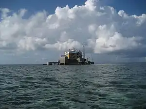
- "China expanding presence on Mabini reef". ABS CBN News / Kyodo News. 13 May 2014. Retrieved 20 May 2014.
- Dato Mohammad, Brigadier General (1991). The Conflicting Claims in the South China Sea. PA, USA: U.S. Army War College.
- Atoll Area, Depth and Rainfall, rock.geosociety.org
- China Sea Pilot - Volume II - NP 31. Taunton: United Kingdom Hydrographic Office. 2012.
- "Digital Gazetteer of Spratly Islands". www.southchinasea.org. Archived from the original on 2007-07-17. Retrieved 2008-02-08.
- Version dated 19 August 2011 is available at: "Digital Gazetteer of Spratly Islands". www.southchinasea.org. 19 August 2011. Retrieved 5 June 2014.This list includes the names of all Spratly features known to be occupied and/or above water at low tide.
| Confrontations | |
|---|---|
| Regions | |
| Occupied features | |
| Unoccupied features | |
| Related articles | |
| Pratas Island |
| ||||||||||||||||
|---|---|---|---|---|---|---|---|---|---|---|---|---|---|---|---|---|---|
| Paracel Islands |
| ||||||||||||||||
| Northeastern SCS | |||||||||||||||||
| Spratly Islands |
| ||||||||||||||||
| Southeastern SCS | |||||||||||||||||
| Southern SCS | |||||||||||||||||
| Tudjuh Archipelago | |||||||||||||||||
| History |
| ||||||||||||||||
| Transport |
| ||||||||||||||||