Istaravshan
Istaravshan (Tajik: Истаравшан; Persian: استروشن; Russian: Истаравшан) is a city in Sughd Province in Tajikistan. In 2000, the Tajik government changed the name of the city from Uroteppa (Tajik: Ӯротеппа; Ura-Tyube, Russian: Ура-Тюбе).[4]
Istaravshan
Истаравшан استروشن | |
|---|---|
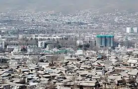
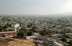 Aerial view of the city from the Mug Tepe fort. | |
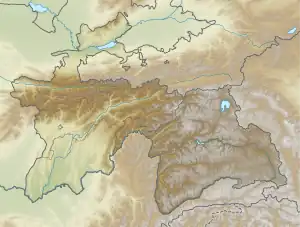 Istaravshan Location in Tajikistan | |
| Coordinates: 39°54′39″N 69°00′23″E | |
| Country | |
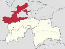
| Region | Sughd Region |
| Elevation | 992 m (3,255 ft) |
| Population (2020)[2] | |
| • City | 273,500 |
| • Urban | 65,600 |
| Time zone | UTC+5 |
| Official languages | |
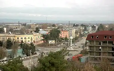
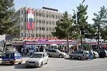
The city lies in the northern foothills of the Turkistan mountain range, 78 kilometers southwest of Khujand, on the main road connecting Tajikistan's two largest cities, Khujand and Dushanbe. Bordered by Uzbekistan in the north and west, and Kyrgyzstan in the east, Istaravshan's administrative area encompasses 1,830 square kilometers and a population of 273,500 people. Most of them (76%) live in the outlying countryside.[2]
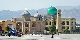
Istaravshan is one of central Asia's oldest towns of commerce and crafts. The city celebrated its 2,500th birthday in the year 2002 It was one of three proposed locations for ancient Cyropolis, which was built on the north-eastern outskirts of the Achaemenid Empire by the king Cyrus in the 6th century B.C.[5]
Climate
Istaravshan has a cold semi-arid climate (Köppen climate classification BSk). The average annual temperature in Istaravshan is 12.2 °C (54.0 °F). There is more rainfall in winter than in summer, and about 485 mm (19.09 in) of precipitation falls annually.
| Climate data for Istaravshan, 1961–1990 | |||||||||||||
|---|---|---|---|---|---|---|---|---|---|---|---|---|---|
| Month | Jan | Feb | Mar | Apr | May | Jun | Jul | Aug | Sep | Oct | Nov | Dec | Year |
| Average high °C (°F) | 4.1 (39.4) |
5.4 (41.7) |
10.2 (50.4) |
17.5 (63.5) |
23.1 (73.6) |
29.0 (84.2) |
31.1 (88.0) |
29.7 (85.5) |
25.0 (77.0) |
17.9 (64.2) |
11.7 (53.1) |
6.9 (44.4) |
17.6 (63.8) |
| Average low °C (°F) | −5.9 (21.4) |
−4.3 (24.3) |
0.9 (33.6) |
7.2 (45.0) |
11.4 (52.5) |
15.7 (60.3) |
17.8 (64.0) |
16.0 (60.8) |
11.0 (51.8) |
5.3 (41.5) |
0.7 (33.3) |
−2.9 (26.8) |
6.1 (42.9) |
| Average precipitation mm (inches) | 33.9 (1.33) |
38.0 (1.50) |
71.0 (2.80) |
81.7 (3.22) |
52.5 (2.07) |
15.2 (0.60) |
9.0 (0.35) |
3.8 (0.15) |
6.7 (0.26) |
28.5 (1.12) |
29.8 (1.17) |
31.5 (1.24) |
401.6 (15.81) |
| Average precipitation days (≥ 0.1 mm) | 10 | 12 | 14 | 16 | 14 | 8 | 5 | 4 | 4 | 8 | 9 | 10 | 114 |
| Source: World Meteorological Organization[6] | |||||||||||||
Subdivisions
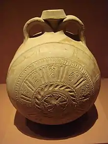
%252C_10-11th_century_CE%252C_Istaravchan%252C_Tajikistan%252C_National_Museum_of_Antiquities_of_Tajikistan_(941-3442).jpg.webp)
Before ca. 2018, Istaravshan was the seat of Istaravshan District, which covered the rural part of the present city of Istaravshan.[7] The city of Istaravshan covers Istaravshan proper and ten jamoats.[2] These are as follows:[8]
| Jamoat | Population (Jan. 2015)[8] |
|---|---|
| Chorbogh | 16,488 |
| Guli Surkh | 42,582 |
| Javkandak | 10,200 |
| Nijoni | 10,350 |
| Nofaroj | 10,875 |
| Poshkent | 19,746 |
| Qal'achai Kalon | 15,433 |
| Qalaibaland | 9,820 |
| Sabriston (Frunze) | 16,822 |
| Zarhalol | 30,683 |
Istaravshan on stamps
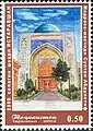 Stamps of Tajikistan, 2002
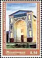 Stamps of Tajikistan, 2002
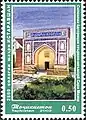 Stamps of Tajikistan, 2002
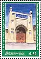 Stamps of Tajikistan, 2002
Notable people
- Ulmas Mirsaidovich Mirsaidov (born 1945), theoretical chemist and professor
See also
References
- "Climate of Vose'". Weatherbase.com. Retrieved 2 August 2014.
- "Population of the Republic of Tajikistan as of 1 January 2020" (PDF) (in Russian). Statistics office of Tajikistan. Archived from the original (PDF) on 1 June 2021. Retrieved 3 October 2020.
- "КОНСТИТУЦИЯ РЕСПУБЛИКИ ТАДЖИКИСТАН". prokuratura.tj. Parliament of Tajikistan. Retrieved 9 January 2020.
- "Istaravshan". Central Asia Guide. Retrieved 2 July 2023.
- "Istaravshan". Retrieved March 19, 2021.
- "World Weather Information Service". World Meteorological Organization – Istaravshan. Retrieved November 3, 2022.
- "Population of the Republic of Tajikistan as of 1 January 2015" (PDF) (in Russian). Statistics office of Tajikistan. Archived from the original (PDF) on 2 July 2015. Retrieved 3 October 2020.
- Jamoat-level basic indicators, United Nations Development Programme in Tajikistan, accessed 3 October 2020
Largest cities or towns in Tajikistan | |||||||||||||||||||||||||||||||||||||||||||||||||
|---|---|---|---|---|---|---|---|---|---|---|---|---|---|---|---|---|---|---|---|---|---|---|---|---|---|---|---|---|---|---|---|---|---|---|---|---|---|---|---|---|---|---|---|---|---|---|---|---|---|
| |||||||||||||||||||||||||||||||||||||||||||||||||
Capital: Khujand | |||||||||||||||||||||||||
|  | ||||||||||||||||||||||||
|
| |||||||||||||||||||||||||
| |||||||||||||||||||||||||