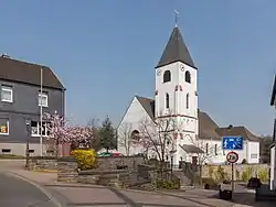
Kall, North Rhine-Westphalia
Kall is a municipality in the district of Euskirchen in the state of North Rhine-Westphalia, Germany. It is located in the Eifel hills, approximatively 20 km south-west of Euskirchen.
Kall | |
|---|---|
 | |
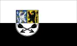 Flag  Coat of arms | |
Location of Kall within Euskirchen district 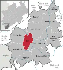 | |
 Kall  Kall | |
| Coordinates: 50°33′N 06°33′E | |
| Country | Germany |
| State | North Rhine-Westphalia |
| Admin. region | Köln |
| District | Euskirchen |
| Government | |
| • Mayor (2017–25) | Hermann-Josef Esser[1] (CDU) |
| Area | |
| • Total | 66.08 km2 (25.51 sq mi) |
| Elevation | 399 m (1,309 ft) |
| Population (2021-12-31)[2] | |
| • Total | 10,987 |
| • Density | 170/km2 (430/sq mi) |
| Time zone | UTC+01:00 (CET) |
| • Summer (DST) | UTC+02:00 (CEST) |
| Postal codes | 53925 |
| Dialling codes | 02441, 02445, 02447, 02482, 02486 |
| Vehicle registration | EU |
| Website | www.kall.de |
Kall consists of the following districts: Anstois, Benenberg, Diefenbach, Dottel, Frohnrath, Gillenberg, Golbach, Keldenich, Krekel, Rinnen, Roder, Rüth, Scheven, Sistig, Sötenich, Steinfeld, Steinfelderheistert, Straßbüsch, Urft, Wahlen, Wallenthal, Wallenthalerhöhe, and Kall itself.[3]
References
- Wahl des/der Bürgermeisters/in Gemeinde Kall 24.09.2017, accessed 20 June 2021.
- "Bevölkerung der Gemeinden Nordrhein-Westfalens am 31. Dezember 2021" (in German). Landesbetrieb Information und Technik NRW. Retrieved 20 June 2022.
- "Zahlen und Daten / Bevölkerung" (in German). Gemeinde Kall. Retrieved 31 January 2017.
External links
![]() Media related to Kall at Wikimedia Commons
Media related to Kall at Wikimedia Commons
Towns and municipalities in Euskirchen (district) | ||
|---|---|---|
Coat of Arms of Euskirchen County | ||
This article is issued from Wikipedia. The text is licensed under Creative Commons - Attribution - Sharealike. Additional terms may apply for the media files.