Vík í Mýrdal
The village of Vík (Icelandic pronunciation: [ˈviːk] ⓘ; or Vík í Mýrdal [ˈviːk iː ˈmirˌtaːl̥] in full) is the southernmost village in Iceland, located on the main ring road around the island, around 180 km (110 mi) by road southeast of Reykjavík.
Vík í Mýrdal
Vík | |
|---|---|
Town | |
 | |
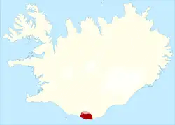 Location of the Municipality of Mýrdalshreppur | |
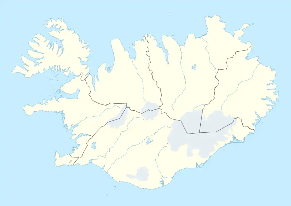 Vík í Mýrdal Location in Iceland | |
| Coordinates: 63°25′N 19°00′W | |
| Country | Iceland |
| Constituency | South Constituency |
| Region | Southern Region |
| Municipality | Mýrdalshreppur |
| Population (Town: 2016 / Metro: 2021)[1] | |
| • Town | 318 |
| • Metro | 750 |
| Time zone | UTC+0 (GMT) |
| Website | www |
Despite its small size (750 inhabitants in Mýrdalshreppur as of January 2021[1]) it is the largest settlement for some 70 km (43 mi) around and is an important staging post, and thus it is indicated on road signs from a long distance away. It is an important service center for the inhabitants of and visitors to the coastal strip between Skógar and the west edge of the Mýrdalssandur glacial outwash plain.
Overview
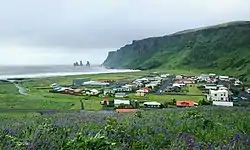
In 1991, the US journal Islands Magazine counted the beach at Vík as one of the ten most beautiful beaches on Earth. Its stretch of black basalt sand[2] is one of the wettest places in Iceland. The cliffs west of the beach are home to many seabirds, most notably puffins which burrow into the shallow soils during the nesting season. Offshore lie stacks of basalt rock, remnants of a once more extensive cliffline Reynisfjall [ˈreiːnɪsˌfjatl̥], now battered by the sea. There is no landmass between here and the Antarctic and the Atlantic rollers can attack with full force. According to folklore, the sea stacks are former trolls who tried to drag their boats out to sea only to be caught by the rising dawn. The sea around them is rather wild and stormy, and travelers will note a monument to the memory of drowned seamen on the beach.

Contemporary legends tell the story of a husband who found his wife taken by the two trolls, frozen at night. The husband made the two trolls swear to never kill anyone ever again. His wife was the love of his life, whose free spirit he was unable to provide a home for; she found her fate out among the trolls, rocks, and sea at Reynisfjara [ˈreiːnɪsˌfjaːra].
The village was affected by volcanic ash during the 2010 eruptions of Eyjafjallajökull.[3][4][5]
Danger from the Katla volcano
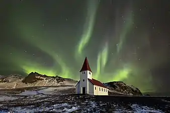
Vík lies directly south of the Mýrdalsjökull glacier, which itself is on top of the Katla volcano. Katla has not erupted since 1918, and as this is longer than typical dormant period, there has been speculation that an eruption may occur soon. An eruption of Katla could melt enough ice to trigger an enormous flash flood, potentially large enough to obliterate the entire town. The town's church, located high on a hill, is believed to be the only building that would survive such a flood.[6] Thus, the people of Vík practice periodic drills and are trained to rush to the church at the first sign of an eruption. The town has 1,400 hotel rooms for scientists and tourists, who are also briefed about Katla's dangers.[7]
Climate
Vík í Mýrdal is the warmest place in Iceland, with an annual mean temperature of 5.3 °C (41.5 °F).[8] Like most of coastal Iceland, Vík í Mýrdal has a subpolar oceanic climate (Koppen Cfc) with cold but not severe winters and cool, short summers. Its winters are among the warmest in Iceland, with an average winter day having a daytime high around 4 °C (39 °F). Because it lies on the windward side of the Gulf Stream, Vík í Mýrdal is the wettest coastal town in Iceland, with an annual rainfall of 2,250 millimetres (89 in), which is three times more than Reykjavík, five times more than Akureyri on the north coast of the island and many times more than its far northern location would normally indicate. Precipitation on the Mýrdalsjökull and Vatnajökull glaciers near the town is believed to be as high as 160 inches (4,100 mm) of rainfall equivalent, which would mean at least 160 feet (49 m) of snow at those higher altitudes.
| Climate data for Vík í Mýrdal (1961-1990); Extremes (1961-2011) | |||||||||||||
|---|---|---|---|---|---|---|---|---|---|---|---|---|---|
| Month | Jan | Feb | Mar | Apr | May | Jun | Jul | Aug | Sep | Oct | Nov | Dec | Year |
| Record high °C (°F) | 10.6 (51.1) |
13.0 (55.4) |
12.5 (54.5) |
15.8 (60.4) |
19.7 (67.5) |
21.5 (70.7) |
23.1 (73.6) |
24.4 (75.9) |
17.2 (63.0) |
16.5 (61.7) |
13.4 (56.1) |
11.9 (53.4) |
24.4 (75.9) |
| Average high °C (°F) | 3.5 (38.3) |
4.0 (39.2) |
4.4 (39.9) |
6.5 (43.7) |
9.0 (48.2) |
11.3 (52.3) |
13.2 (55.8) |
12.8 (55.0) |
10.3 (50.5) |
7.4 (45.3) |
4.7 (40.5) |
3.6 (38.5) |
7.6 (45.6) |
| Daily mean °C (°F) | 1.2 (34.2) |
2.0 (35.6) |
1.9 (35.4) |
4.0 (39.2) |
6.7 (44.1) |
8.9 (48.0) |
10.8 (51.4) |
10.6 (51.1) |
8.1 (46.6) |
5.4 (41.7) |
2.6 (36.7) |
1.3 (34.3) |
5.3 (41.5) |
| Average low °C (°F) | −1.4 (29.5) |
−0.6 (30.9) |
−0.7 (30.7) |
1.4 (34.5) |
4.1 (39.4) |
6.7 (44.1) |
8.3 (46.9) |
8.0 (46.4) |
5.4 (41.7) |
2.8 (37.0) |
−0.1 (31.8) |
−1.3 (29.7) |
2.7 (36.9) |
| Record low °C (°F) | −13.2 (8.2) |
−15.9 (3.4) |
−13.4 (7.9) |
−16.9 (1.6) |
−6.2 (20.8) |
−1.6 (29.1) |
2.5 (36.5) |
1.2 (34.2) |
−3.3 (26.1) |
−9.9 (14.2) |
−12.2 (10.0) |
−14.0 (6.8) |
−16.9 (1.6) |
| Average precipitation mm (inches) | 203.1 (8.00) |
178.6 (7.03) |
184.7 (7.27) |
155.9 (6.14) |
137.7 (5.42) |
171.7 (6.76) |
151.7 (5.97) |
211.0 (8.31) |
214.4 (8.44) |
242.2 (9.54) |
195.3 (7.69) |
206.2 (8.12) |
2,252.5 (88.69) |
| Source: Icelandic Met Office[9] | |||||||||||||
Sports
- Ungmennafélagið Katla is a sports club based in Vík í Mýrdal.
In popular culture
Vík í Mýrdal serves as the primary setting of Netflix's Icelandic original series Katla, which follows a group of the village's inhabitants as they struggle in the aftermath of the volcano's first eruption since 1918.[10]
References
- "Hagstofa Íslands, Mannfjöldi eftir sveitarfélögum". Retrieved 25 June 2021.
- "The Iceland's black sand beach".
- "Volcanic ash covers Icelandic town". BBC News. 2010-05-08.
- "Iceland volcano threatens ash cloud sequel". CBS News.
- Iceland volcano erupts; hundreds evacuated. The Washington Times
- "Threat of new, larger Icelandic eruption looms". yahoo.com. Yahoo Inc. Archived from the original on April 25, 2010. Retrieved 2010-04-26.
- "Tourists are flocking to volcano that's due for a massive eruption". 2 September 2017. Retrieved 3 September 2017.
- "Vík í Mýrdal". Icelandic Meteorological Office. Retrieved 2 May 2016.
- "Climatological Data for Vík í Mýrdal". Icelandic Meteorological Office. Retrieved 24 September 2016.
- Scott, Sheena. "'Katla': Eerie New Netflix Original Series From Iceland". Forbes. Retrieved 2021-07-01.
External links
 Media related to Vík í Mýrdal at Wikimedia Commons
 Vík í Mýrdal travel guide from Wikivoyage
- Beach at Reynisdrangar virtual tour
