Vanduzi District
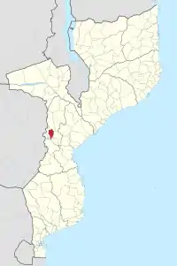
Vanduzi District is a district in Manica Province of Mozambique.

Geography
The district has an area of 2,825 km2. It is bounded on the west by Manica District, on the northwest by Barue District, on the northeast by Macossa District and Sofala Province, on the east by Gondola District, on the southeast by Chimoio District, and on the south by Macate and Sussundenga districts.[1]
Population
The district has a population of 140,476, and a population density of 50 persons per km2.[2]
Administration
.jpg.webp)
The administrative headquarters for the district is in the town of Vanduzi.
The district is divided into two administrative postos, Matsinho (two localities, Chiremera[3] and Matsinho) and Vanduzi (three localities, Chigodore, Pungué Sul, and Vanduzi).
History
Vanduzi District was created by the Mozambican legislature in 2013.[4] Prior to that, Vanduzi posto was part of Manica District, and Matsinho posto was part of Gondola District.
References
- "Anuário Estatístico da Província de Manica, 2017". Instituto Nacional de Estatística, Mozambique, 2018. Accessed 16 April 2020.
- "Anuário Estatístico da Província de Manica, 2017". Instituto Nacional de Estatística, Mozambique, 2018. Accessed 16 April 2020.
- "Descargas atmosféricas fazem dois mortos em Manica | Atmospheric discharges kill two in Manica". Jornal Notícias. 14 January 2019. Retrieved 9 December 2020.
- "Parlamento aprova criação de 13 novos distritos no país". Notícias. 22 March 2013. Retrieved 16 April 2020.