Vedensky okrug
The Vedensky okrug[lower-alpha 1] was a district (okrug) of the Terek Oblast of the Caucasus Viceroyalty of the Russian Empire. The area of the Vedensky okrug made up part of the North Caucasian Federal District of Russia. The district was eponymously named for its administrative centre, Vedeno.[1]
Vedensky okrug
Веденскій округъ | |
|---|---|
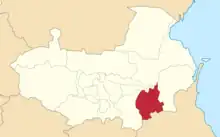 Location in the Terek Oblast | |
| Country | Russian Empire |
| Viceroyalty | Caucasus |
| Oblast | Terek |
| Established | 1905 |
| Abolished | 1921 |
| Capital | Vedeno |
| Area | |
| • Total | 3,803.05 km2 (1,468.37 sq mi) |
| Population (1916) | |
| • Total | 127,718 |
| • Density | 34/km2 (87/sq mi) |
| • Rural | 100.00% |
Administrative divisions
The subcounties (uchastoks) of the Vedensky okrug were as follows:[2]
| Name | 1912 population |
|---|---|
| 1-y uchastok (1-й участокъ) | 22,437 |
| 2-y uchastok (2-й участокъ) | 18,151 |
| 3-y uchastok (3-й участокъ) | 33,731 |
| 4-y uchastok (4-й участокъ) | 24,960 |
Demographics
Kavkazskiy kalendar
According to the 1917 publication of Kavkazskiy kalendar, the Vedensky okrug had a population of 127,718 on 14 January [O.S. 1 January] 1916, including 67,444 men and 60,274 women, 125,801 of whom were the permanent population, and 1,917 were temporary residents:[3]
| Nationality | Number | % |
|---|---|---|
| North Caucasians | 127,048 | 99.48 |
| Sunni Muslims[lower-alpha 2] | 311 | 0.24 |
| Russians | 307 | 0.24 |
| Shia Muslims[lower-alpha 3] | 26 | 0.02 |
| Armenians | 13 | 0.01 |
| Other Europeans | 7 | 0.01 |
| Georgians | 6 | 0.00 |
| TOTAL | 127,718 | 100.00 |
Notes
-
- Russian: Веде́нский о́круг, pre-reform orthography: Веде́нскій о́кругъ, romanized: Vedénsky ókrug
- Primarily Turco-Tatars.[4]
- Primarily Tatars.[4]
References
- Tsutsiev 2014.
- Кавказский календарь на 1913 год, pp. 180–187.
- Кавказский календарь на 1917 год, pp. 226–237.
- Hovannisian 1971, p. 67.
Bibliography
- Hovannisian, Richard G. (1971). The Republic of Armenia: The First Year, 1918–1919. Vol. 1. Berkeley: University of California Press. ISBN 978-0520019843.
- Кавказский календарь на 1913 год [Caucasian calendar for 1913] (in Russian) (68th ed.). Tiflis: Tipografiya kantselyarii Ye.I.V. na Kavkaze, kazenny dom. 1913. Archived from the original on 19 April 2022.
- Кавказский календарь на 1917 год [Caucasian calendar for 1917] (in Russian) (72nd ed.). Tiflis: Tipografiya kantselyarii Ye.I.V. na Kavkaze, kazenny dom. 1917. Archived from the original on 4 November 2021.
- Tsutsiev, Arthur (2014). Atlas of the Ethno-Political History of the Caucasus (PDF). Translated by Nora Seligman Favorov. New Haven: Yale University Press. ISBN 9780300153088. Archived (PDF) from the original on 17 June 2023.
This article is issued from Wikipedia. The text is licensed under Creative Commons - Attribution - Sharealike. Additional terms may apply for the media files.