Veeraghattam
Veeraghattam is an Indian town in Parvathipuram Manyam district of Andhra Pradesh. It is located in Veeraghattam mandal of Palakonda revenue division.[3]
Veeraghattam | |
|---|---|
.svg.png.webp) Veeraghattam Location in Andhra Pradesh, India  Veeraghattam Veeraghattam (India) | |
| Coordinates: 18.6833°N 83.6000°E | |
| Country | India |
| State | Andhra Pradesh |
| District | Parvathipuram Manyam |
| Population (2011)[1] | |
| • Total | 14,315 |
| Languages | |
| • Official | Telugu |
| Time zone | UTC+5:30 (IST) |
| PIN | 532460 |
| Vehicle Registration | AP30 (former) AP39 (from 30 January 2019)[2] |
| Nearest city | Parvathipuram |
History
There is no authentic history of the town. According to the elders, Veeraghattam was once ruled by a tribal chieftain belonging to the Jatapu tribe. He was known as Konda Rajulu (konda=hill, raju=king). There was a small fort covering an area of about 836 sq. metres. whose remains can still be seen. It was located towards the northern side of Ward IV. At present the Hospital and the Police Lines stand on the same spot. The town was later captured by the British from the Jatapu king. It is also said that there used to be a village named Achhapuvalasa, 3.2 km. from the town which was famous in old days as the birthplace of many brave men and was under the control of Konda Rajulu. The villagers used to pay kappani or annual tribute to him. Brave as they were. they used to guard the king. Whenever he required them they used to go to him in groups. Once when he required them to level a tank area, they ploughed the area, it is said, with tigers and not bullocks. Since their bravery was legendary even the British had a tough time in conquering them. It was believed that the villagers had some magical powers as a result of which even the bullets used to prove futile. The British had to devise other ways to conquer them. The legend is that the British had employed some agents to keep dirty clothes soiled with menstrual fluid of women under the mats or beds where these brave people used to either sit or sleep. It was the belief that a person who was having magical powers would lose the same by touching or going nearer these clothes. The villagers thus lost their bravery and the magical powers. The Konda Rajulu gave them the land near his kingdom by way of reward for their services. They named the area Achhapuvalasa. Since the town is adjacent to this legendary village, it came to be known as birth place of the brave.[4]
Geography
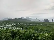
Veeraghattam is located near the Vattigedda river and Eastern Ghats. It has an average elevation of 83 metres (272 ft).
Demographics
As of 2011 census, Veeraghattam had a population of 14,315. The total population constitute, 6,911 males and 7,404 females —a sex ratio of 1071 females per 1000 males. 1,427 children are in the age group of 0–6 years, of which 741 are boys and 686 are girls. The average literacy rate stands at 70.89% with 8,638 literates, significantly higher than the district average of 61.70%.[1][5] Owing to the tropical climate, agriculture and small scale business is the major occupation of the maximum population. There is no railway transport to this location, the nearest railway station is Parvatipuram Town at a distance of 27 km.
Notables
- Kodi Rammurthy Naidu
- Karri Narayana Rao, member of 4th and 5th Lok Sabha representing Bobbili, was born in Santha Narsipuram village.
References
- "Census 2011". The Registrar General & Census Commissioner, India. Retrieved 26 July 2014.
- "New 'AP 39' code to register vehicles in Andhra Pradesh launched". The New Indian Express. Vijayawada. 31 January 2019. Retrieved 9 June 2019.
- "Mandal wise list of villages in Srikakulam district" (PDF). Chief Commissioner of Land Administration. National Informatics Centre. p. 1. Archived from the original (PDF) on 8 December 2014. Retrieved 6 March 2016.
- A. Chandra, Sekhar. "Veeraghattam A Declassified Town of Andhra Pradesh - Census 1971". Census Digital Library. Census of India. p. 47. Retrieved 16 April 2023.
- "CHAPTER 2 DEMOGRAPHY" (PDF). Government of Andhra Pradesh. p. 4. Archived from the original (PDF) on 14 July 2014. Retrieved 25 February 2015.