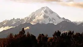
Veronica (mountain)
Veronica,[2][3][4] also called Huacrahuilki[5] ("horn pass"),[6] Huacay Huilcay,[3] Wayna Willka,[4] Waqaywillka,[3] Urubamba[7] ("spider's plain"),[6][8] or Padre Eterno,[5][3] is a 5,893 m (19,334 ft)[2] mountain in the Urubamba mountain range in the Andes of Peru. It is located in the Cusco Region, La Convención Province, Huayopata District, and in the Urubamba Province, Ollantaytambo District[9] northwest of the town of Ollantaytambo.
| Veronica | |
|---|---|
| Willka Weqe, Huacrahuilki Urubamba | |
 | |
| Highest point | |
| Elevation | 5,893 m (19,334 ft) |
| Coordinates | 13°09′51″S 72°19′33″W |
| Geography | |
 Veronica Peru | |
| Location | Peru, Cusco Region |
| Parent range | Andes, Urubamba |
| Climbing | |
| First ascent | 1- 1956 via N.E. ridge: N. face-1973: S.W. rib-1977: N.E. buttress attempt-1983 (see AAJ, 26 (1984): 208-9)[1] |
References
- Jill Neate, Mountaineering in the Andes, 1994
- Peru 1:100 000, Urubamba (27-r). IGN (Instituto Geográfico Nacional - Perú).
- Biggar, John (2005). The Andes: A Guide for Climbers. Andes. p. 113. ISBN 9780953608720.
- "Nevado Verónica - Andeshandbook". www.andeshandbook.org. Retrieved 2016-07-14.
- Echevarría, Evelio (1973). "A Survey of Andean Ascents". American Alpine Journal. 18–2 (47): 389. ISBN 9780930410704.
- "Diccionario: Quechua - Español - Quechua, Simi Taqe: Qheswa - Español - Qheswa" (PDF). Diccionario Quechua - Español - Quechua. Gobierno Regional del Cusco, Perú: Academía Mayor de la Lengua Quechua. 2005.
- Peru 1:100 000, Urubamba (244). Defense Mapping Agency / US Government.
- Teofilo Laime Ajacopa (2007). Diccionario Bilingüe: Iskay simipi yuyayk’anch: Quechua – Castellano / Castellano – Quechua (PDF). La Paz, Bolivia.
{{cite book}}: CS1 maint: location missing publisher (link) - escale.minedu.gob.pe Map of the Urubamba Province
This article is issued from Wikipedia. The text is licensed under Creative Commons - Attribution - Sharealike. Additional terms may apply for the media files.