Vrav
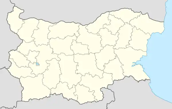
Vrav (Bulgarian: Връв [ˈvrəf]; also Vrǎv or Vruv; Romanian: Vârf)[1] is a village in northwestern Bulgaria, part of Bregovo municipality, Vidin Province. Located on the right bank of the Danube at the place where the Timok River empties into it, Vrav is the northernmost populated place in Bulgaria and the first Bulgarian port along the Danube's course. The village has a Romanian (commonly referred to as "Vlach" in Bulgaria) population and lies 30 kilometres from the provincial capital Vidin and 12 kilometres from Bregovo (the municipal center).
Vrav
Връв Vârf | |
|---|---|
Village | |
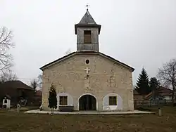
 The Church of St. Nicholas in Vrav | |
 Vrav Location of Vrav | |
| Coordinates: 44°11′N 22°44′E | |
| Country | |
| Provinces (Oblast) | Vidin |
| Government | |
| • Mayor representative | Valentina Ivanova |
| Elevation | 42 m (138 ft) |
| Population | |
| • Total | 257 |
| Time zone | UTC+2 (EET) |
| • Summer (DST) | UTC+3 (EEST) |
| Postal Code | 3779 |
| Area code | 09344 |
As of 2022, the village has a population of 257.[2] The mayor respresentative (appointed by Bregovo mayor) is Valentina Ivanova. Vrav is situated at 44°11′N 22°44′E, at an elevation of 42 metres above mean sea level.
Vrav lies opposite the Romanian village Gârla Mare in Mehedinți County, to which the residents of Vrav are related through kinship ties.[3] The area is known for its characteristic horo dance. The locals are part of the ethnographic group of the "wet Vlachs" (мокри власи, mokri vlasi), known as such because they live at the confluence of the Timok and the Danube,[4] to contrast them with the "bushy Vlachs" (рунтави власи, runtavi vlasi) of the mountains to the southwest along the Serbian border. "Vlach" is the name native Romanians in Bulgaria commonly receive.[5] The population is Eastern Orthodox and speaks an old Romanian dialect alongside Bulgarian. According to some researchers, the Romanians came to those areas in the 18th century.[6] They declare themselves to be Bulgarians, however, as the 2001 census recorded only 155 "Vlachs" and 16 Romanians in the entire Vidin Province.[7]
There are some Ancient Roman ruins near the village, presumably part of the Danubian limes: to the west was the Roman post of Dorticum and to the east was what the locals call chetate (cetate, "fortress"). Vrav already existed in the early 18th century, as it was marked on Luigi Ferdinando Marsigli's map of the area of 1711. According to semi-legendary evidence, the village was founded by seven refugee families from the Banat, with the remainder of the population coming from the surrounding Romanian villages in Serbia and Romania. Its old name was Kosheritse, but as the locals moved it to a hilltop, they changed the name accordingly. In 1900, the village had a population of 1,974 and in 1926: 2,178.[8]
References
- Romanian name according to Timocul însângerat: 132 de ani de la răscoala timoceană. In Bulgarian, the name is identical to the word for "string" or "twine", while in Romanian, vârf means "peak".
- Таблица на адресно регистрираните по постоянен и по настоящ адрес лица grao.bg (in Bulgarian). 15 September 2022 Retrieved 30 March 2023
- Şerban, Stelu (2005). "Власите в България— между "голямата" и "малката" история (The Vlachs from Bulgaria between the 'Great' and the 'Little' History)". Bulgarian Folklore (in Bulgarian) (1): 59–73.
- "Брегово" (PDF). Живо наследство (in Bulgarian). Фондация "Работилница за граждански инициативи". 2008.
- Nikolov, Ivan; Svetla Rakshieva (1995). "Власите — портрет и автопортрет (The Wallachians: A Portrait and a Self-Portrait)". Bulgarian Ethnology (in Bulgarian) (5): 107–120.
- "Етнически малцинствени общности" (in Bulgarian). Национален съвет за сътрудничество по етническите и демографските въпроси. Archived from the original on 24 August 2017. Retrieved 12 September 2008.
- "Население към 01.03.2001 г. по области и етническа група" (in Bulgarian). Национален статистически институт. Retrieved 12 September 2008.
- "Част първа". История на Ново село (in Bulgarian). NovoSelo.org. Archived from the original on 1 October 2008. Retrieved 12 September 2008.