West Virginia Route 28
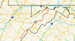
West Virginia Route 28 is a north–south route through the Potomac Highlands of the U.S. state of West Virginia. The southern terminus of the route is at West Virginia Route 39 in Huntersville. The northern terminus is at the Maryland state line in Wiley Ford, where the route continues into Cumberland as Canal Parkway upon crossing the North Branch Potomac River.
_near_Carol_Line_in_Fort_Ashby%252C_Mineral_County%252C_West_Virginia.jpg.webp)
West Virginia Route 28 | ||||
|---|---|---|---|---|
 | ||||
| Route information | ||||
| Maintained by WVDOH | ||||
| Length | 150.8 mi[1] (242.7 km) | |||
| Major junctions | ||||
| South end | ||||
| ||||
| North end | ||||
| Location | ||||
| Country | United States | |||
| State | West Virginia | |||
| Counties | Pocahontas, Pendleton, Grant, Hardy, Hampshire, Mineral | |||
| Highway system | ||||
| ||||
Attractions
- National Radio Astronomy Observatory
- Seneca Rocks National Recreation Area
- Fort Ashby
- Greater Cumberland Regional Airport
- Mineral County Fair
- North Fork Mountain
Historic sites
- Old Pine Church, Purgitsville
- Sloan–Parker House, Junction
- The Burg, Mechanicsburg
- Indian Mound Cemetery, Romney
- Davis History House, Romney
- Literary Hall, Romney
- Washington Place, Romney
- Wappocomo farm & Train Station, Romney
- Fort Forman site, Vance
- The Rocks, Wappocomo
- Hanging Rocks, Wappocomo
- Shouse-Martin House, Springfield
- Fort Ashby, Fort Ashby
- Fort Sellers, near Short Gap
Major intersections
| County | Location | mi | km | Destinations | Notes |
|---|---|---|---|---|---|
| Pocahontas | | ||||
| Dunmore | south end of WV 92 overlap | ||||
| | |||||
| Bartow | north end of WV 92 overlap; south end of US 250 overlap | ||||
| | north end of US 250 overlap | ||||
| Pendleton | Judy Gap | south end of US 33 overlap | |||
| Seneca Rocks | north end of US 33 overlap; south end of WV 55 overlap | ||||
| Grant | Petersburg | ||||
| south end of US 220 overlap | |||||
| Hardy | | US 220 South Branch Potomac River Bridge #1 | |||
| Moorefield | Winchester Avenue | Former route of West Virginia Route 55 | |||
| north end of WV 55 overlap | |||||
| | US 220 South Branch Potomac River Bridge #2 | ||||
| Hampshire | Junction | north end of US 220 overlap; south end of US 50 overlap | |||
| Romney | north end of US 50 overlap | ||||
| Mineral | Fort Ashby | ||||
| Short Gap | |||||
| Wiley Ford | |||||
| Canal Parkway (MD 61 north) – Cumberland | Maryland state line (Wiley Ford Bridge over North Branch Potomac River) | ||||
1.000 mi = 1.609 km; 1.000 km = 0.621 mi
| |||||
WV 28 Alternate
West Virginia Route 28 Alternate | |
|---|---|
| Location | Wiley Ford |
| Length | 3.0 mi[1] (4.8 km) |
_just_north_of_West_Virginia_Route_28_in_Wiley_Ford%252C_Mineral_County%252C_West_Virginia.jpg.webp)
West Virginia Route 28 Alternate is a north–south alternate route of West Virginia Route 28 around Wiley Ford in northern West Virginia. The southern terminus of the route is at WV 28 in Wiley Ford. The northern terminus is at the Maryland state line in Ridgeley, where the road continues into Cumberland as MD 942 (Bridge Street) after crossing the North Branch Potomac River. The road passes by Fort Ohio in Ridgeley.
See also
References
- Distance calculated using Microsoft MapPoint mapping software.
External links
 Media related to West Virginia Route 28 at Wikimedia Commons
