Waitakaruru
Waitakaruru is a rural community in the Hauraki District and Waikato region of New Zealand's North Island. It is situated at the mouth of Waitakaruru River[3]
Waitakaruru | |
|---|---|
Locality | |
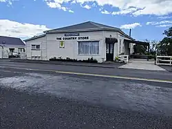 The Country Store | |
| Coordinates: 37°14′S 175°23′E | |
| Country | New Zealand |
| Region | Waikato region |
| District | Hauraki District |
| Ward | Plains Ward |
| Electorates | |
| Government | |
| • Territorial Authority | Hauraki District Council |
| • Regional council | Waikato Regional Council |
| Area | |
| • Total | 23.14 km2 (8.93 sq mi) |
| Population (2018 Census)[2] | |
| • Total | 243 |
| • Density | 11/km2 (27/sq mi) |
| Time zone | UTC+12 (NZST) |
| • Summer (DST) | UTC+13 (NZDT) |
Demographics
Waitakaruru is in an SA1 statistical area which covers 23.14 km2 (8.93 sq mi).[1] The SA1 area is part of the larger Hauraki Plains North statistical area.
| Year | Pop. | ±% p.a. |
|---|---|---|
| 2006 | 237 | — |
| 2013 | 222 | −0.93% |
| 2018 | 243 | +1.82% |
| Source: [2] | ||
The SA1 area had a population of 243 at the 2018 New Zealand census, an increase of 21 people (9.5%) since the 2013 census, and an increase of 6 people (2.5%) since the 2006 census. There were 105 households, comprising 132 males and 111 females, giving a sex ratio of 1.19 males per female. The median age was 41.8 years (compared with 37.4 years nationally), with 48 people (19.8%) aged under 15 years, 42 (17.3%) aged 15 to 29, 114 (46.9%) aged 30 to 64, and 39 (16.0%) aged 65 or older.
Ethnicities were 85.2% European/Pākehā, 28.4% Māori, 4.9% Pacific peoples, and 4.9% Asian. People may identify with more than one ethnicity.
Although some people chose not to answer the census's question about religious affiliation, 56.8% had no religion, 23.5% were Christian, 3.7% had Māori religious beliefs, 1.2% were Buddhist and 4.9% had other religions.
Of those at least 15 years old, 21 (10.8%) people had a bachelor's or higher degree, and 66 (33.8%) people had no formal qualifications. The median income was $27,100, compared with $31,800 nationally. 21 people (10.8%) earned over $70,000 compared to 17.2% nationally. The employment status of those at least 15 was that 90 (46.2%) people were employed full-time, 24 (12.3%) were part-time, and 6 (3.1%) were unemployed.[2]
Hauraki Plains North
Hauraki Plains North statistical area, which also includes Pipiroa, covers 178.74 km2 (69.01 sq mi)[1] and had an estimated population of 1,300 as of June 2022,[4] with a population density of 7.3 people per km2.
| Year | Pop. | ±% p.a. |
|---|---|---|
| 2006 | 1,089 | — |
| 2013 | 1,098 | +0.12% |
| 2018 | 1,155 | +1.02% |
| Source: [5] | ||
Hauraki Plains North had a population of 1,155 at the 2018 New Zealand census, an increase of 57 people (5.2%) since the 2013 census, and an increase of 66 people (6.1%) since the 2006 census. There were 447 households, comprising 603 males and 552 females, giving a sex ratio of 1.09 males per female. The median age was 40.7 years (compared with 37.4 years nationally), with 234 people (20.3%) aged under 15 years, 213 (18.4%) aged 15 to 29, 519 (44.9%) aged 30 to 64, and 189 (16.4%) aged 65 or older.
Ethnicities were 89.4% European/Pākehā, 17.1% Māori, 3.6% Pacific peoples, 2.9% Asian, and 2.1% other ethnicities. People may identify with more than one ethnicity.
The percentage of people born overseas was 10.6, compared with 27.1% nationally.
Although some people chose not to answer the census's question about religious affiliation, 56.6% had no religion, 29.6% were Christian, 1.0% had Māori religious beliefs, 0.5% were Buddhist and 2.1% had other religions.
Of those at least 15 years old, 93 (10.1%) people had a bachelor's or higher degree, and 231 (25.1%) people had no formal qualifications. The median income was $33,600, compared with $31,800 nationally. 138 people (15.0%) earned over $70,000 compared to 17.2% nationally. The employment status of those at least 15 was that 462 (50.2%) people were employed full-time, 168 (18.2%) were part-time, and 24 (2.6%) were unemployed.[5]
Education
Waitakaruru School is a co-educational state primary school,[6] with a roll of 100 as of April 2023.[7][8]
References
- "ArcGIS Web Application". statsnz.maps.arcgis.com. Retrieved 4 September 2022.
- "Statistical area 1 dataset for 2018 Census". Statistics New Zealand. March 2020. 7010817.
- Hariss, Gavin. "Waitakaruru, Waikato". topomap.co.nz. NZ Topo Map.
- "Population estimate tables - NZ.Stat". Statistics New Zealand. Retrieved 25 October 2022.
- "Statistical area 1 dataset for 2018 Census". Statistics New Zealand. March 2020. Hauraki Plains North (168700). 2018 Census place summary: Hauraki Plains North
- "Ministry of Education School Profile". educationcounts.govt.nz. Ministry of Education.
- "New Zealand Schools Directory". New Zealand Ministry of Education. Retrieved 12 December 2022.
- "Education Review Office Report". ero.govt.nz. Education Review Office.