Wallabadah, New South Wales
Wallabadah is a town and locality in the New England region of New South Wales, Australia. The town is located 55 kilometres south of Tamworth on the New England Highway and is in the Liverpool Plains Shire. At the 2021 census, Wallabadah had a population of 382.[1]
| Wallabadah New South Wales | |
|---|---|
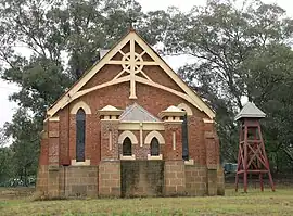
 Wallabadah church | |
 Wallabadah | |
| Coordinates | 31°32′26″S 150°49′48″E |
| Population | 746 (2006 census)[1] |
| Postcode(s) | 2343 |
| Elevation | 478 m (1,568 ft) |
| Time zone | AEST (UTC+10) |
| • Summer (DST) | AEDT (UTC+11) |
| LGA(s) | Liverpool Plains Shire |
| County | Buckland |
| State electorate(s) | Upper Hunter |
| Federal division(s) | New England |

History
The Wallabadah region was originally known as "Thalababuri" by the Kamilaroi Aboriginal people. Wallabadah's name was derived from an aboriginal word meaning "stone".[2]
The first European squatters arrived in the region in about 1830 and Wallabadah Station was established in 1835 on 44,000 acres (180 km2) of land. During the 1850s the settlement began to develop at the intersection of two mail coach runs which came from the north and northwest, and Wallabadah Post Office opened on 1 October 1856.[3]
In August 1866 Captain Thunderbolt's third daughter, Mary Ann was born at Wallabadah. On 30 May 1867 he robbed the northern mail coach at Wallabadah. Thunderbolt also worked on a property west of Wallabadah during that period.[4]
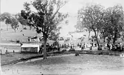
Australia's first country racing club was established at Wallabadah in 1852 and the Wallabadah Cup is still held on New Year's Day (the current racecourse was built in 1898).[5]
The Marshall MacMahon Hotel was constructed circa 1867 and a part of it is still in use. In 1877 Wallabadah was larger than Quirindi, 15 kilometres away, but a rail connection to Quirindi reduced Wallabadah's expansion. A public school was opened in 1867 with the residence dating from 1898. In 1896 the Anglican Church of the Ascension (with 1912 additions) was established while the Catholic Church was constructed in 1910 on the New England Highway.
Agriculture is the dominant industry in the area with livestock, especially beef cattle and some sheep being reared there. Wallabadah now has a primary school, a pub and one shop.
Attractions
In 2005, the First Fleet Garden, a memorial to the First Fleet immigrants was created on the banks of Quirindi Creek. Stonemason, Ray Collins, carved 1,520 names of all those who came out to Australia on the eleven ships in 1788 on tablets along the garden pathways. The stories of those who arrived on the ships, their life, and first encounters with the Australian country are presented throughout the garden. The surrounding area has a barbecue, tables, and amenities.[6]
Near the historic Wallabadah Cemetery is one of the largest undisturbed whitebox woodlands remaining in Australia, along with the indigenous trees and grasses that are peculiar to these woodlands.[7]
See also
References
- Australian Bureau of Statistics (25 October 2007). "Wallabadah (State Suburb)". 2006 Census QuickStats. Retrieved 13 February 2010.
- "Wallabadah". Geographical Names Register (GNR) of NSW. Geographical Names Board of New South Wales. Retrieved 11 August 2013.
- Premier Postal History. "Post Office List". Premier Postal Auctions. Retrieved 26 May 2011.
- Significant "Thunderbolt" Dates Retrieved 2010-8-28
- Wallabadah
- – Places to See Retrieved on 4 May 2009
- SMH: Travel Retrieved 2010-8-28
External links
![]() Media related to Wallabadah, New South Wales at Wikimedia Commons
Media related to Wallabadah, New South Wales at Wikimedia Commons