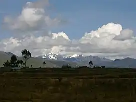
Huallanca (mountain)
Huallanca (possibly from Quechua for "mountain range"[2] and a cactus plant (Opuntia subulata)),[3] also known as Burro (Spanish for "donkey"), is a 5,470 m (17,950 ft)) high mountain in the Andes of Peru. It is the highest peak in the Huallanca mountain range.[1][4] Huallanca is located in the Ancash Region, Bolognesi Province, in the districts of Aquia and Huallanca. It is situated in the northern half of the range, southeast of the Yanashallash pass and the peaks of Tankan, Ch'uspi and Tankanqucha. Kuntur Wayi lies southwest of it. Winchus 4,795 m (15,732 ft)) is the peak west of Wallanka at the Tuna Kancha valley.[5][6]
| Huallanca | |
|---|---|
| Burro | |
 Huallanca (on the left) as seen from Wanuku Pampa | |
| Highest point | |
| Elevation | 5,470 m (17,950 ft)[1] |
| Coordinates | 9°55′11″S 77°02′13″W |
| Geography | |
 Huallanca Location in Peru | |
| Location | Peru, Ancash Region |
| Parent range | Huallanca mountain range |
| Climbing | |
| First ascent | 1968[1] |
References
- Taken from Mountaineering in the Andes by Jill Neate Peru RGS-IBG Expedition Advisory Centre, 2nd edition, May 1994
- Teofilo Laime Ajacopa (2007). Diccionario Bilingüe: Iskay simipi yuyayk’anch: Quechua – Castellano / Castellano – Quechua (PDF). La Paz, Bolivia.
{{cite book}}: CS1 maint: location missing publisher (link) - "Jatun Huancagaga". mincetur. Retrieved April 9, 2015.
- Hugh R. Clark, South America, Peru–Cordilleras Huallanca, Huayhuash and Raura, Nevado Shicra Shicra, and Other Peaks, American Alpine Journal, Vol. 18, Climbs And Expeditions, 1972
- escale.minedu.gob.pe - UGEL map of the Bolognesi Province (Ancash Region)
- Alfred J. Bodenlos, George E. Ericksen, Lead-Zing Deposits of Cordillera Blanca and Northern Cordillera Huayhuash, Peru, Geological Survey Bulletin 1017, see. sketch maps p.9-10
This article is issued from Wikipedia. The text is licensed under Creative Commons - Attribution - Sharealike. Additional terms may apply for the media files.