Warkon
Warkon is a rural locality in the Maranoa Region, Queensland, Australia.[2] In the 2016 census, Warkon had a population of 33 people.[1]
| Warkon Queensland | |||||||||||||||
|---|---|---|---|---|---|---|---|---|---|---|---|---|---|---|---|
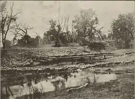
 17,000 sheep cross the Condamine River at Warkon Station, 1917 | |||||||||||||||
 Warkon | |||||||||||||||
| Coordinates | 26.9222°S 149.4108°E | ||||||||||||||
| Population | 33 (2016 census)[1] | ||||||||||||||
| • Density | 0.0350/km2 (0.0907/sq mi) | ||||||||||||||
| Postcode(s) | 4417 | ||||||||||||||
| Area | 942.5 km2 (363.9 sq mi) | ||||||||||||||
| Time zone | AEST (UTC+10:00) | ||||||||||||||
| LGA(s) | Maranoa Region | ||||||||||||||
| State electorate(s) | Warrego | ||||||||||||||
| Federal division(s) | Maranoa | ||||||||||||||
| |||||||||||||||
Geography
The Balonne River (a continuation of the Condamine River) forms the southern boundary of the locality and a number of creek flow through the locality into the river. The Roma-Condamine Road passes from west to east through the locality.[3]
Bingi Crossing (also written as Bingie Crossing) is the ford on the Balonnne River near the current River Road (27.0188°S 149.3763°E) which connects Warkon with neighbouring Noorindoo.[4]
The land use is predominantly cattle grazing and there are a number of areas of state forests: Yuleba State Forest, Wallabella State Forest 1, and Tinowon State Forest.[3]
History
The locality name derives from a pastoral run name used from 1850 and is an Aboriginal word group (possibly from the Mandandanji language) meaning plenty of water.[2]
Warkon Station was established on the Balonne River in 1850 by Henry Bingham, one of the early settlers in the Maranoa district. From 1858 to 1872 the property was operated by Alexander and Harriet Barlow. Warkon Station had Aboriginal workers from a number of different language groups. Harriet Barlow was one of the first people to record the Aboriginal languages of this region, which she called Coongarri, Wirri-Wirri, Ngoorie, Yowaleri, Cooinburri, Begumble, Cambooble and Parrungoom. She published her work in a number of journals. The Warkon Station was subsequently owned by Leonard Reynolds Schwennesen who added further notes to Barlow's material. The State Library of Queensland hold a collection of the manuscripts of Barlow and Schwennesen.[5]
Retreat Provisional School opened circa 1896. It operated from at least 1899 to 1905 as a half-time school in conjunction with Nellybri Provisional School (meaning the two schools shared a single teacher). In 1906 Retreat Provisional School became a full-time school but closed later that year.[6] Retreat is a pastoral property in Warkon (26.989°S 149.296°E).[3]
St Paul's Anglican Church opened at Bingie Crossing circa June 1914. It was served by the Bush Brotherhood.[7] Its last service was 20 December 1942.[8]
Yuleba Creek State School opened on 23 January 1967 and closed on 31 December 1999.[9][10] It was on Roma Condamine Road (26.8884°S 149.4429°E) with Yuleba Creek flowing beside the school.[11][12][3]
In the 2016 census, Warkon had a population of 33 people.[1]
References
- Australian Bureau of Statistics (27 June 2017). "Warkon (SSC)". 2016 Census QuickStats. Retrieved 20 October 2018.
- "Warkon – locality in Maranoa Region (entry 49159)". Queensland Place Names. Queensland Government. Retrieved 7 March 2022.
- "Queensland Globe". State of Queensland. Retrieved 29 April 2022.
- "Bingi Crossing – ford in the Maranoa Region (entry 2693)". Queensland Place Names. Queensland Government. Retrieved 28 July 2020.
- Crump, Des (13 August 2014). "Harriet Barlow– Aboriginal Dialects of Queensland". Aboriginal and Torres Strait Islander Languages. State Library of Queensland. Archived from the original on 27 October 2018. Retrieved 28 October 2018.
- Queensland Family History Society (2010), Queensland schools past and present (Version 1.01 ed.), Queensland Family History Society, ISBN 978-1-921171-26-0
- "Anglican Synod". The Week. Vol. LXXVII, no. 2, 009. Queensland, Australia. 26 June 1914. p. 17. Retrieved 29 April 2022 – via National Library of Australia.
- "Closed Churches". Closed Anglican Churches of Southern Queensland. Archived from the original on 3 April 2019. Retrieved 3 April 2019.
- Queensland Family History Society (2010), Queensland schools past and present (Version 1.01 ed.), Queensland Family History Society, ISBN 978-1-921171-26-0
- "Queensland state school - centre closures" (PDF). Queensland Government. 20 August 2013. Archived (PDF) from the original on 20 March 2022. Retrieved 7 April 2022.
- "Parish of Amoolee" (Map). Queensland Government. 1970. Retrieved 29 April 2022.
- "8744 Yuleba" (Map). Queensland Government. 1981. Retrieved 29 April 2022.
Further reading
- Barlow, Harriet (1873), Vocabulary of Aboriginal dialects of Queensland (PDF)
External links
![]() Media related to Warkon, Queensland at Wikimedia Commons
Media related to Warkon, Queensland at Wikimedia Commons