Avonlea Creek
Avonlea Creek[1] is a river in the southern part of the Canadian province of Saskatchewan. It is in a region called the Prairie Pothole Region of North America, which extends throughout three Canadian provinces and five U.S. states. It is also within Palliser's Triangle and the Great Plains ecoregion.[2] Avonlea Creek is a main tributary of the Moose Jaw River, which is part of the Upper Qu'Appelle Watershed[3] and the Hudson Bay drainage basin.
| Avonlea Creek | |
|---|---|
 The Red River drainage basin, with the Qu'Appelle River highlighted | |
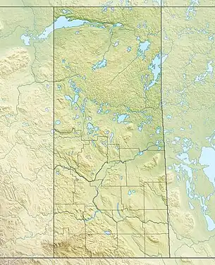
 Location in Saskatchewan  Avonlea Creek (Canada) | |
| Location | |
| Country | |
| Provinces | |
| Physical characteristics | |
| Source | Piapot Cree First Nation 75G |
| • coordinates | 49°45′47″N 104°40′15″W |
| • elevation | 640 m (2,100 ft) |
| Mouth | Moose Jaw River |
• location | 4 miles south-west of Rouleau |
• coordinates | 50°9′0″N 104°57′2″W |
| Basin features | |
| River system | Red River |
Course
Avonlea Creek begins at Piapot Cree First Nation 75G, about 5 kilometres (3.1 mi) south-east of the intersection of Highway 6 and Highway 712. From there, it travels in a north-westerly direction past Parry, paralleling the Moose Jaw River until it empties into the Watson Reservoir, south-east of the village of Avonlea. From the reservoir, the river heads north until it meets the Moose Jaw River near Rouleau.
The headwaters of the river are in the Missouri Coteau[4] and The Dirt Hills to the west are the source of several tributaries.
Watson Reservoir
Reg Watson Reservoir, also known as Avonlea Reservoir (49.9778°N 104.9964°W),[5] was created with the building of Avonlea Dam between 1963 and 1964[6] across Avonlea Creek. The dam was originally built by the Prairie Farm Rehabilitation Administration and is now operated by the Saskatchewan Water Security Agency. The dam is 16.6 metres high and the reservoir holds 7,400 dam3 (260,000,000 cu ft) of water and has a surface area of 201.5 hectares (498 acres). It is located about 5 kilometres (3.1 mi) south-east of Avonlea and is the source of water for the village. The dam was upgraded in 2003.
The reservoir is stocked every second year with fish. Northern pike, walleye, burbot, and yellow perch are found in the lake and there are several boat launches around the lake for access.[7]
Dunnet Regional Park
Dunnet Regional Park (49.9931°N 105.0115°W), built in 1967, is a regional park located on the west side of Reg Watson Reservoir. It was named after a local medical doctor. The park consists of 50 acres in a naturally treed valley and features RV parking, camping, fishing, boating, mini golf, a heated swimming pool, and eight baseball diamonds.[8][9]
To the north of the park, along the west bank of Avonlea Creek, is an 18-hole championship golf course called Long Creek Golf & Country Club.[10]
See also
References
- "Avonlea Creek". Canadian Geographical Names Database. Government of Canada. Retrieved 7 May 2022.
- "Drought in Palliser's Triangle | the Canadian Encyclopedia".
- "Our Watershed". WUQWATR. Retrieved 19 September 2021.
- "Our Watershed". Moose Jaw River. Moose Jaw River Watershed Stewards. Retrieved 29 December 2022.
- "Watson Reservoir". Canadian Geographical Names Database. Government of Canada. Retrieved 20 December 2022.
- "Dams & Reservoirs".
- "Angler's Atlas".
- "Dunnet Regional Park | Tourism Saskatchewan".
- "Dunnet".
- "Long Creek Golf & Country Club - Golf Canada".