West Tofts
West Tofts is a deserted village dating back to the medieval period, which was emparked in the 18th century.[1] It is located in the civil parish of Lynford within Breckland, in the English county of Norfolk.[2] Records dating back to 1391 indicate human settlement at West Tofts.[3]
| West Tofts | |
|---|---|
| village | |
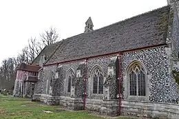
 St Mary's Church, West Tofts | |
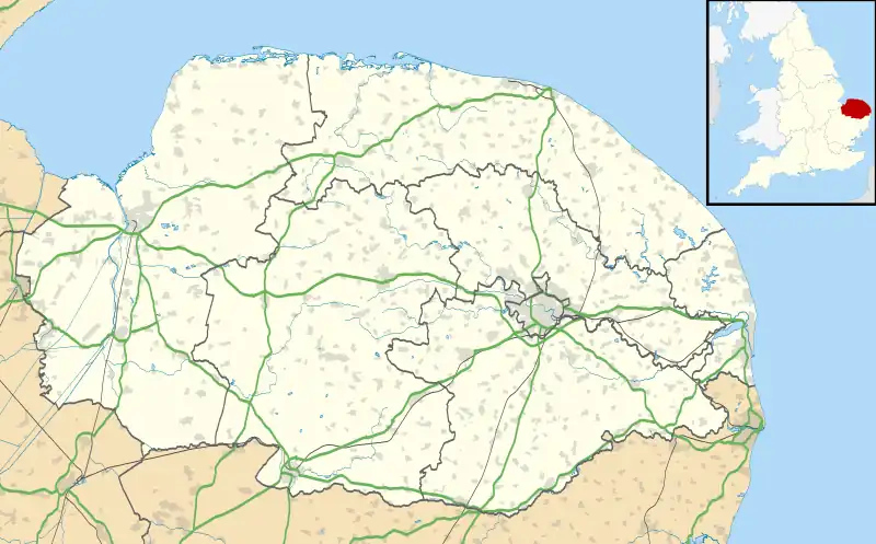
 West Tofts Location within Norfolk | |
| Population | 0 (2001 Census) |
| OS grid reference | TL 8360 9301 |
| Civil parish | |
| District | |
| Shire county | |
| Region | |
| Country | England |
| Sovereign state | United Kingdom |
| Post town | THETFORD |
| Postcode district | IP24 |
| UK Parliament | |
Earthworks at West Tofts indicate the presence of a former rectory or similar country house along with its gardens and parkland. Built before 1797, the West Tofts country house was constructed to replace Caston Hall. It subsequently became the rectory, but was demolished after the Second World War, though a wall dating from the 19th century used as part of its vinery is still standing.[1]
The village became officially deserted when it was taken over by the British Army during the Second World War, becoming part of the much larger Stanford Battle Area, an infantry training area that is still in use today. The area of the former village, now known as West Tofts Army Camp,[4] and most of the parish are within a prohibited area owned and controlled by the Ministry of Defence (MoD). Public access is not allowed without special permission from the Army.
A 500,000 year old stone hand axe which contains a Cretaceous bivalve mollusc, Spondylus spinosus fossil shell incorporated, was found here in 1911. It is now in the Museum of Archaeology and Anthropology at the University of Cambridge.[5][6]
Army camp
A camp was known to exist at West Tofts before 1935 to house refugees from Belgium. In 1935, the Ministry of Labour, a department of the UK Government, started construction of a labour camp of Nissen huts to house unemployed workers from the north of England, at the same time becoming an army camp. Two World War II-era air raid shelters were also constructed.[4]
References
- "West Tofts deserted medieval village and site of great house – Norfolk Heritage Explorer, NHER number: 5149". Heritage.Norfolk.gov.uk. Norfolk Historic Environment Service, Norfolk County Council. 2007–2023. Retrieved 22 August 2023.
- Speck, Gary B. (1998–2017). "Guide to the Ghost Towns and Deserted Villages of Great Britain". Freepages.RootsWeb.com. Moreno Valley, CA: Gary B Speck Publications, RootsWeb.com. Retrieved 22 August 2023.
- Blomefield, Francis (October 1805) [written c. 1736]. "An Essay Towards A Topographical History of the County of Norfolk: The Hundred of Wayland: Thompson". Fersfield, Norfolk: William Miller, London. pp. 366–373. Retrieved 22 August 2023 – via British History Online.
- "West Tofts Army Camp – Norfolk Heritage Explorer". Heritage.Norfolk.gov.uk. Norfolk Historic Environment Service, Norfolk County Council. 2007–2023. Retrieved 22 August 2023.
- "Artist unknown : Handaxe knapped around a fossil shell, West Tofts, Norfolk, England". NasherSculptureCenter.org. Dallas, Texas: Nasher Sculpture Center. n.d. Retrieved 22 August 2023.
- Moore, Mark W. (n.d.). "Acheulean Handaxe". StoneToolsMuseum.com. University of New England, Australia: Museum of Stone Tools. Retrieved 22 August 2023.
Further reading
- Blomefield, Francis (October 1805) [written c. 1736]. "An Essay Towards A Topographical History of the County of Norfolk: The Hundred of Grimeshou: West Tofts". Fersfield, Norfolk: William Miller, London. pp. 256–262 – via British History Online.
- "Life in the labour camp". Eastern Daily Press. 15 February 2005.