West Virginia Route 41
West Virginia Route 41 (WV 41) is a 64.8-mile-long (104.3 km) north–south state highway in the central part of the U.S. state of West Virginia. Its southern terminus is at WV 210 in Beckley. Its northern terminus is at WV 55 about 1 mile (1.6 km) west of Calvin.
West Virginia Route 41 | ||||
|---|---|---|---|---|
| Route information | ||||
| Maintained by WVDOH | ||||
| Length | 64.8 mi[1] (104.3 km) | |||
| Major junctions | ||||
| South end | ||||
| ||||
| North end | ||||
| Location | ||||
| Country | United States | |||
| State | West Virginia | |||
| Counties | Raleigh, Fayette, Nicholas | |||
| Highway system | ||||
| ||||

_at_U.S._Route_19_in_Summersville%252C_Nicholas_County%252C_West_Virginia.jpg.webp)
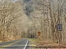
WV 41 in Prince

WV 41 crosses the New River at the Thomas Burford Pugh Memorial Bridge near Prince.
South of Summersville, WV 41 follows the route of U.S. Route 19 (US 19) prior to the construction of Corridor L of the Appalachian Development Highway System.
Major intersections
| County | Location | mi | km | Destinations | Notes |
|---|---|---|---|---|---|
| Raleigh | Beckley | Southern terminus | |||
| Southern end of US 19 concurrency | |||||
| Northern end of US 19 concurrency | |||||
| | Southern terminus of WV 61 | ||||
| Fayette | | Southern end of US 60 concurrency | |||
| | Northern end of US 60 concurrency | ||||
| Nicholas | Mount Nebo | Eastern terminus of WV 129 | |||
| | Southern end of US 19 concurrency | ||||
| Summersville | Northern end of US 19 concurrency | ||||
| Southern end of WV 39 concurrency | |||||
| Northern end of WV 39 concurrency | |||||
| | Northern terminus | ||||
1.000 mi = 1.609 km; 1.000 km = 0.621 mi
| |||||
See also
References
- Distance calculated using Microsoft MapPoint mapping software.
This article is issued from Wikipedia. The text is licensed under Creative Commons - Attribution - Sharealike. Additional terms may apply for the media files.