Shire of West Wimmera
The Shire of West Wimmera is a local government area in the western part of the Wimmera region of Victoria, Australia, located in the western part of the state. It covers an area of 9,108 square kilometres (3,517 sq mi) and in June 2018 had a population of 3,862.[1] It includes the towns of Apsley, Edenhope, Goroke, Gymbowen, Harrow, Kaniva, Minimay, Nurcoung and Serviceton. It was formed in 1995 from the amalgamation of the Shire of Kaniva and parts of the Shire of Kowree, Shire of Arapiles and Shire of Glenelg.[2]
| Shire of West Wimmera Victoria | |||||||||||||||
|---|---|---|---|---|---|---|---|---|---|---|---|---|---|---|---|
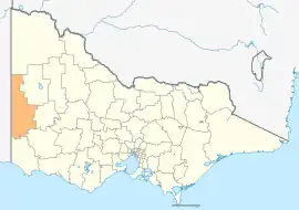 Location in Victoria | |||||||||||||||
| Population | 3,862 (2018)[1] | ||||||||||||||
| • Density | 0.42402/km2 (1.09821/sq mi) | ||||||||||||||
| Established | 1995 | ||||||||||||||
| Gazetted | 20 January 1995[2] | ||||||||||||||
| Area | 9,108 km2 (3,516.6 sq mi)[1] | ||||||||||||||
| Mayor | Cr Bruce Meyer | ||||||||||||||
| Council seat | Edenhope | ||||||||||||||
| Region | Grampians | ||||||||||||||
| State electorate(s) | Lowan | ||||||||||||||
| Federal division(s) | Mallee | ||||||||||||||
 | |||||||||||||||
| Website | Shire of West Wimmera | ||||||||||||||
| |||||||||||||||
The Shire is governed and administered by the West Wimmera Shire Council; its seat of local government and administrative centre is located at the council headquarters in Edenhope, it also has a service centre located in Kaniva. The Shire is named after the Wimmera region, in which the LGA occupies the western portion. The LGA is also located entirely to the west of the Wimmera River, which actually meanders through another municipality to the east, that is the Rural City of Horsham.
Council
Current composition
The council is composed of five councillors elected to represent an unsubdivided municipality.[3] Council Composition as of November 2022.[4]
| Ward | Councillor | Notes | |
|---|---|---|---|
| Unsubdivided | Tim Meyer | Mayor | |
| Trevor Domaschenz | |||
| Bruce Meyer | |||
| Tom Houlihan | |||
| Jodie Pretlove | Deputy Mayor | ||
Administration and governance
The council meets in the council chambers in the Edenhope and Kaniva Municipal Offices. It also provides customer services at both centres.
Controversies
In April 2022, Mayor Bruce Meyer caused outrage by likening requests to display the internationally recognised LGBTIQ+ pride flag to mark the International Day Against Homophobia, Biphobia, Intersexism and Transphobia (IDAHOBIT) to the promotion of pedophilia.[5]
Townships and localities
The 2021 census, the shire had a population of 4,006 up from 3,903 in the 2016 census[6]
| Population | ||
|---|---|---|
| Locality | 2016 | 2021 |
| Apsley | 277 | 329 |
| Benayeo | 61 | 69 |
| Big Desert^ | 3 | 8 |
| Bringalbert | 12 | 6 |
| Broughton^ | 145 | 65 |
| Charam | 38 | 42 |
| Chetwynd^ | 86 | 85 |
| Connewirricoo | 24 | 23 |
| Dergholm^ | 43 | 57 |
| Dorodong | 38 | 21 |
| Population | ||
|---|---|---|
| Locality | 2016 | 2021 |
| Douglas^ | 65 | 74 |
| Edenhope | 946 | 937 |
| Goroke | 299 | 295 |
| Grass Flat^ | * | # |
| Gymbowen | 52 | 60 |
| Harrow^ | 200 | 184 |
| Kadnook | 41 | 41 |
| Kaniva^ | 803 | 891 |
| Karnak | 12 | 9 |
| Langkoop | 111 | 100 |
| Population | ||
|---|---|---|
| Locality | 2016 | 2021 |
| Lawloit | 15 | 14 |
| Lillimur | 110 | 112 |
| Miga Lake | 28 | 33 |
| Minimay | 84 | 64 |
| Miram | 40 | 36 |
| Mitre^ | 69 | 66 |
| Neuarpurr | 55 | 56 |
| Nurcoung | 40 | 33 |
| Ozenkadnook | 30 | 25 |
| Population | ||
|---|---|---|
| Locality | 2016 | 2021 |
| Patyah | 62 | 58 |
| Peronne | 48 | 49 |
| Poolaijelo | 40 | 26 |
| Powers Creek | 15 | 5 |
| Serviceton | 120 | 129 |
| Tarrayoukyan^ | 21 | 25 |
| Telopea Downs | 45 | 44 |
| Ullswater | 43 | 47 |
| Wombelano | 41 | 49 |
^ - Territory divided with another LGA
* - Not noted in 2016 Census
# - Not noted in 2021 Census
References
- "3218.0 – Regional Population Growth, Australia, 2017-18: Population Estimates by Local Government Area (ASGS 2018), 2017 to 2018". Australian Bureau of Statistics. Australian Bureau of Statistics. 27 March 2019. Retrieved 25 October 2019. Estimated resident population, 30 June 2018.
- Victoria Government Gazette – Online Archive (1837–1997). "S4 of 1995: Order estg (Part 15) the Shire of West Wimmera". State Library of Victoria. State Government of Victoria (published 20 January 1995). pp. 5–6. Retrieved 10 January 2014.
- "West Wimmera Shire Council election results 2020". Victorian Electoral Commission. 2020. Retrieved 14 September 2022.
- "Young Meyer new West Wimmera Mayor". The Weekly Advertiser. 2020. Retrieved 25 February 2023.
- Michael Burge (22 April 2022). "The bare minimum: Victoria's gay community decries council decision not to fly rainbow flag". The Guardian Australia. Retrieved 24 April 2022.
- "Census | Australian Bureau of Statistics". www.abs.gov.au. 11 January 2023.
External links
![]() Media related to Shire of West Wimmera at Wikimedia Commons
Media related to Shire of West Wimmera at Wikimedia Commons
- West Wimmera Shire Council official website
- Metlink local public transport map
- Link to Land Victoria interactive maps
Localities in the Shire of West Wimmera | ||
|---|---|---|
| Town | 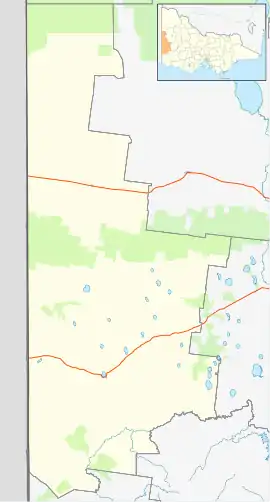 | |
| Locality |
| |
^ - Territory divided with another LGA | ||