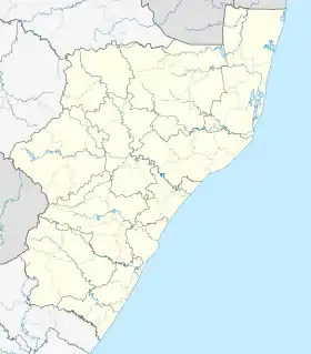
Westbrook, South Africa
Westbrook, also known as Westbrook Beach is a coastal village on the North Coast of the KwaZulu-Natal province of South Africa, approximately 35 kilometres (22 mi) north-east of Durban and 7 kilometres (4 mi) east of oThongathi.
Westbrook | |
|---|---|
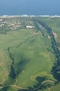 A view of Westbrook with the ocean in the background | |
 Westbrook  Westbrook | |
| Coordinates: 29°35′32″S 31°09′23″E | |
| Country | South Africa |
| Province | KwaZulu-Natal |
| Municipality | eThekwini |
| Area | |
| • Total | 1.58 km2 (0.61 sq mi) |
| Population (2011)[1] | |
| • Total | 1,526 |
| • Density | 970/km2 (2,500/sq mi) |
| Racial makeup (2011) | |
| • Black African | 20.5% |
| • Coloured | 2.9% |
| • Indian/Asian | 30.3% |
| • White | 46.0% |
| • Other | 0.3% |
| First languages (2011) | |
| • English | 69.3% |
| • Zulu | 14.1% |
| • Afrikaans | 11.7% |
| • Xhosa | 1.9% |
| • Other | 3.0% |
| Time zone | UTC+2 (SAST) |
| Postal code (street) | 4399 |
| PO box | 4406 |
| Area code | 032 |
Overview
Situated just south of the uThongathi River, Westbrook is the northernmost coastal suburb of the eThekwini Metropolitan Municipality. It is a quiet and small coastal village covered in dense milkwood trees typical of this coastline with very limited public facilities. The nearest urban centres are oThongathi (7 km), Ballito (10 km) and uMhlanga (19 km).[2]
Westbrook is often included as part of the Greater oThongathi area, sharing the same postal code and this is even despite Westbrook being statistically recognised as a separate main place from oThongathi.[3][4]
Transport
Westbrook is bypassed by the major N2 toll freeway to the west, heading north from Durban to KwaDukuza and is connected to the N2 by Ushukela Drive at the exit 202. The M4 (Leo Boyd Highway) runs through Westbrook heading north from uMhlanga to Ballito and is an untolled alternative route to the N2 toll freeway. The M43 (Ushukela Drive) originates from the traffic circle with the M4 and heads west towards oThongathi.
References
- "Main Place Westbrook". Census 2011.
- "Westbrook Beach Area Info". www.propertymatchmaker.co.za. Retrieved 2023-09-25.
- "The Post Code Site >> Fast South African post code lookups :: Suburb detail". www.postcodesite.co.za. Retrieved 2023-09-25.
- "Tongaat in KwaZulu Natal Area Overview". northcoast.seeff.com. Retrieved 2023-09-25.