White Rock Creek (Kansas)
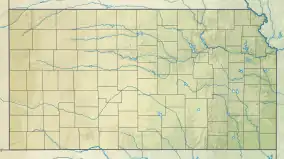
White Rock Creek is a river in the central Great Plains of North America. A tributary of the Republican River, it flows through northern Kansas.
| White Rock Creek | |
|---|---|
 Location of the mouth of White Rock Creek | |
| Native name | Riviere Amiable (French) |
| Location | |
| Country | United States |
| State | Kansas |
| Physical characteristics | |
| Source | |
| • location | Republic County, Kansas |
| • coordinates | 39°57′19″N 98°40′01″W[1] |
| Mouth | Republican River |
• location | Jewell County, Kansas |
• coordinates | 39°55′10″N 97°51′21″W[1] |
• elevation | 1,473 ft (449 m) |
History
The mouth of White Rock Creek was the location where a group of six buffalo hunters from Waterville, Kansas were killed by Cheyenne Dog Soldiers in May 1869.[2] Also in May of 1869, the Excelsior Colony from New York, took claims along White Rock Creek and built a blockhouse north of the present town of Mankato. By June 1869, all of the settlers had left because of conflicts with the Indians.[3]
See also
References
- "White Rock Creek". Geographic Names Information System. United States Geological Survey, United States Department of the Interior. Retrieved 2019-03-15.
- Switzer, Dale (December 2009). "White Rock and Lovewell". www.lovewellhistory.com. Retrieved 2019-03-15.
- "Jewell County, Kansas Genealogy and History". genealogytrails.com. December 2009. Retrieved 2019-03-15.
This article is issued from Wikipedia. The text is licensed under Creative Commons - Attribution - Sharealike. Additional terms may apply for the media files.