Whites Creek (Hunter Creek tributary)
Whites Creek is an Ozark stream in Douglas County, Missouri.[1] It is a tributary of Hunter Creek.
| Whites Creek | |
|---|---|
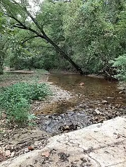 Whites Creek adjacent to Missouri Route 14 six miles east of Ava | |
| Location | |
| Country | United States |
| State | Missouri |
| Region | Douglas County |
| Physical characteristics | |
| Source | |
| • coordinates | 36°54′22″N 92°38′18″W |
| • elevation | 1,250 ft (380 m) |
| Mouth | |
• coordinates | 36°55′28″N 92°32′36″W |
• elevation | 863 ft (263 m) |
| [1] | |
The headwaters are at an elevation of about 1,250 feet[2] and the mouth is at an elevation of 863 feet.[1]
Whites Creek begins as a south flowing stream on the south side of Table Rock Knob just southeast of Ava and flows south for a short distance before turning east. The stream runs parallel to Missouri Route 14 and is bridged where the road turns south. Hoffmeister Spring emerges from a bluff along the north side of the stream a few hundred yards east of the bridge at 36°54′51″N 92°33′12″W and an elevation of 892 feet.[3][4]
Whites Creek has the name of a pioneer citizen with the surname White.[5]
See also
References
- U.S. Geological Survey Geographic Names Information System: Whites Creek (Hunter Creek tributary)
- Ava, Missouri 7.5 Minute Topographic Quadrangle, USGS, 1982
- GNIS for Hoffmeister Spring
- Missouri Atlas & Gazetteer, DeLorme, 1998, First edition, p. 63, ISBN 0-89933-224-2
- "Douglas County Place Names, 1928–1945 (archived)". The State Historical Society of Missouri. Archived from the original on 2016-06-24. Retrieved 28 September 2016.
This article is issued from Wikipedia. The text is licensed under Creative Commons - Attribution - Sharealike. Additional terms may apply for the media files.