Whitethorn Creek (Banister River tributary)
Whitethorn Creek is a 15.01 mi (24.16 km) long 4th order tributary to the Banister River in Pittsylvania County, Virginia. The Whitehorn Creek watershed and its tributary, Mill Creek, are the location of one of the largest uranium deposits in the United States on Cole Hill.[6]
| Whitethorn Creek Tributary to Banister River | |
|---|---|
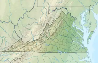 Location of Whitethorn Creek mouth  Whitethorn Creek (Banister River tributary) (the United States) | |
| Location | |
| Country | United States |
| State | Virginia |
| County | Pittsylvania |
| Physical characteristics | |
| Source | Frying Pan Creek divide |
| • location | about 0.5 miles south-southeast of Pickerel, Virginia |
| • coordinates | 36°57′58″N 079°24′22″W[1] |
| • elevation | 1,000 ft (300 m)[2] |
| Mouth | |
• location | Markham, Virginia |
• coordinates | 36°52′26″N 079°14′33″W[1] |
• elevation | 479 ft (146 m)[3] |
| Length | 15.01 mi (24.16 km)[4] |
| Basin size | 65.54 square miles (169.7 km2)[5] |
| Discharge | |
| • location | Banister River |
| • average | 78.43 cu ft/s (2.221 m3/s) at mouth with Banister River[5] |
| Basin features | |
| Progression | Banister River → Dan River → Roanoke River → Albemarle Sound → Pamlico Sound → Atlantic Ocean |
| River system | Roanoke River |
| Tributaries | |
| • left | Long Branch Georges Creek Dry Branch |
| • right | Mill Creek Dry Branch |
| Bridges | VA 40, Terry Road, US 29, Coles Road, S Meadows Road |
Variant names
According to the Geographic Names Information System, it has also been known historically as:[1]
- Whitehorn Creek
Course
Whitethorn Creek rises about 0.5 miles south-southeast of Pickerel, Virginia and then flows southeast to join the Banister River at Markham.[3]
Watershed
Whitethorn Creek drains 65.54 square miles (169.7 km2) of area, receives about 45.5 in/year of precipitation, has a wetness index of 432.34, and is about 46% forested.[5]
See also
External links
References
- "GNIS Detail - Whitethorn Creek". geonames.usgs.gov. US Geological Survey. Retrieved 8 August 2021.
- "Get Maps". USGS Topoview. US Geological Survey. Retrieved 8 August 2021.
- "Get Maps". USGS Topoview. US Geological Survey. Retrieved 8 August 2021.
- "ArcGIS Web Application". epa.maps.arcgis.com. US EPA. Retrieved 8 August 2021.
- "Whitethorn Creek Watershed Report". US EPA Geoviewer. US EPA. Retrieved 8 August 2021.
- "TECHNICAL REPORT ON THE COLES HILL URANIUM PROPERTY PITTSYLVANIA COUNTY. VIRGINIA" (PDF). Nuclear Regulatory Commission. Retrieved 9 August 2021.
This article is issued from Wikipedia. The text is licensed under Creative Commons - Attribution - Sharealike. Additional terms may apply for the media files.