Whitewater River (Keowee River tributary)
The Whitewater River is a 14.6-mile-long (23.5 km) river that flows south from headwaters in Transylvania County, North Carolina, over Upper Whitewater Falls and Lower Whitewater Falls before crossing into South Carolina and entering Lake Jocassee, the reservoir behind Lake Jocassee Dam.
| Whitewater River Tributary to Keowee River | |
|---|---|
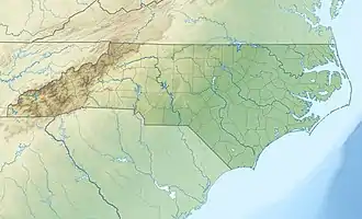
 Location of Hyco River mouth  Whitewater River (Keowee River tributary) (the United States) | |
| Location | |
| Country | United States |
| State | North Carolina South Carolina |
| County | Oconee (SC) Jackson (NC) Transylvania (NC) |
| Physical characteristics | |
| Source | divide between Whitewater River and Chattooga River |
| • location | about 0.5 miles south of Chimneytop Mountain |
| • coordinates | 35°05′29″N 083°03′54″W[1] |
| • elevation | 3,550 ft (1,080 m)[2] |
| Mouth | Keowee River |
• location | Lake Jocassee |
• coordinates | 34°58′35″N 082°56′03″W[1] |
• elevation | 1,108 ft (338 m)[2] |
| Length | 12.08 mi (19.44 km)[3] |
| Basin size | 16.97 square miles (44.0 km2)[4] |
| Discharge | |
| • location | Keowee River (Lake Jocassee) |
| • average | 75.70 cu ft/s (2.144 m3/s) at mouth with Keowee River[4] |
| Basin features | |
| Progression | northwest |
| River system | Keowee River |
| Tributaries | |
| • left | Silver Run Happy Hollow Democrat Creek Waddle Branch Corbin Creek |
| • right | Little Whitewater River |
| Waterbodies | Lake Jocassee |
| Bridges | NC 107 (x2), Whitewater Road |
In Lake Jocassee the Whitewater River is joined by the Toxaway River to form the Keowee River. The confluence is submerged beneath the waters of Lake Jocassee. Via the Keowee and Seneca rivers, the Whitewater River is part of the Savannah River watershed.
References
- "GNIS Detail - Whitewater River". geonames.usgs.gov. US Geological Survey. Retrieved 16 October 2019.
- "Whitewater River Topo Map, Oconee County SC (Salem Area)". TopoZone. Locality, LLC. Retrieved 16 October 2019.
- "ArcGIS Web Application". epa.maps.arcgis.com. US EPA. Retrieved 16 October 2019.
- "Whitewater River Watershed Report". Waters Geoviewer. US EPA. Retrieved 16 October 2019.
This article is issued from Wikipedia. The text is licensed under Creative Commons - Attribution - Sharealike. Additional terms may apply for the media files.