Whittier Creek (Bull Creek tributary)
Whittier Creek is a 3.85 mi (6.20 km) long 2nd order tributary to Bull Creek in Surry County, North Carolina.
| Whittier Creek Tributary to Bull Creek | |
|---|---|
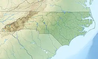 Location of Whittier Creek mouth  Whittier Creek (Bull Creek tributary) (the United States) | |
| Location | |
| Country | United States |
| State | North Carolina |
| County | Surry |
| Physical characteristics | |
| Source | Beaver Creek divide |
| • location | Blackwater, North Carolina |
| • coordinates | 36°23′41″N 080°37′11″W[1] |
| • elevation | 1,200 ft (370 m)[2] |
| Mouth | |
• location | about 2 miles south of Ash Hill, North Carolina |
• coordinates | 36°22′37″N 080°34′34″W[1] |
• elevation | 925 ft (282 m)[3] |
| Length | 3.85 mi (6.20 km)[4] |
| Basin size | 7.11 square miles (18.4 km2)[5] |
| Discharge | |
| • location | Bull Creek |
| • average | 10.34 cu ft/s (0.293 m3/s) at mouth with Bull Creek[5] |
| Basin features | |
| Progression | Bull Creek → Ararat River → Yadkin River → Pee Dee River → Winyah Bay → Atlantic Ocean |
| River system | Yadkin River |
| Tributaries | |
| • left | unnamed tributaries |
| • right | unnamed tributaries |
| Bridges | Key Road, Rock Hill Church, Nurse Road |
Variant names
According to the Geographic Names Information System, it has also been known historically as:[1]
- Whittaker Creek
Course
Whittier Creek rises about 2 miles south of Ash Hill, North Carolina, in Surry County and then flows south and east to join Bull Creek at Blackwater.[3]
Watershed
Whittier Creek drains 7.11 square miles (18.4 km2) of area, receives about 47.9 in/year of precipitation, has a wetness index of 372.49, and is about 37% forested.[5]
See also
References
- "GNIS Detail - Whittier Creek". geonames.usgs.gov. US Geological Survey. Retrieved 13 July 2021.
- "GNIS Detail - Whittier Creek". geonames.usgs.gov. US Geological Survey. Retrieved 13 July 2021.
- "Get Maps". USGS Topoview. US Geological Survey. Retrieved 13 July 2021.
- "ArcGIS Web Application". epa.maps.arcgis.com. US EPA. Retrieved 12 July 2021.
- "Whittier Creek Watershed Report". US EPA Geoviewer. US EPA. Retrieved 13 July 2021.
This article is issued from Wikipedia. The text is licensed under Creative Commons - Attribution - Sharealike. Additional terms may apply for the media files.