Willamette Floodplain
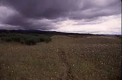
The Willamette Floodplain consists of 713 acres (289 ha) of natural grassland, near the Willamette River, that was made a National Natural Landmark in May 1987.[1] The floodplain is within the William L. Finley National Wildlife Refuge and located about 10 miles (16 km) south of Corvallis in Benton County, Oregon.
| Willamette Floodplain | |
|---|---|
 Grassland of the Willamette Floodplain | |
 | |
| Location | Benton County, Oregon, US |
| Nearest city | Corvallis |
| Coordinates | 44°24′49″N 123°17′57″W |
| Area | 713 acres (289 ha) |
| Designated | 1987 |
| Administered by | U.S. Fish and Wildlife Service |
It is the largest remaining native unplowed example of bottomland interior valley grassland in the North Pacific Border natural region. It was classified as a natural landmark because such grassland and shrubland areas are exceedingly rare, with most having been cultivated or turned into pastureland.
References
- "Willamette Floodplain". National Park Service. March 31, 2011. Retrieved April 11, 2011.
This article is issued from Wikipedia. The text is licensed under Creative Commons - Attribution - Sharealike. Additional terms may apply for the media files.