Wilmington Island, Georgia
Wilmington Island is a census-designated place (CDP) in Chatham County, Georgia. The population was 15,129 at the time of the 2020 U.S. Census.[1] It is part of the Savannah metropolitan area. The communities of Wilmington Island form a large and affluent suburb of Savannah, where most residents work. The island lies east of Savannah between the town of Thunderbolt and the beach community of Tybee Island.
Wilmington Island, Georgia | |
|---|---|
 Wilmington Island as seen from Skidaway Island - Eureka Club-Farr's Point is on the right, which is on the National Register of Historic Places. | |
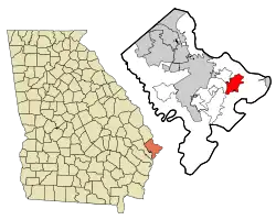 Location in Chatham County and the state of Georgia | |
| Coordinates: 32°0′12″N 80°58′31″W | |
| Country | United States |
| State | Georgia |
| County | Chatham |
| Area | |
| • Total | 9.65 sq mi (24.99 km2) |
| • Land | 8.30 sq mi (21.50 km2) |
| • Water | 1.34 sq mi (3.48 km2) |
| Elevation | 10 ft (3 m) |
| Population (2020) | |
| • Total | 15,129 |
| • Density | 1,822.33/sq mi (703.63/km2) |
| Time zone | UTC-5 (Eastern (EST)) |
| • Summer (DST) | UTC-4 (EDT) |
| ZIP code | 31410 |
| Area code | 912 |
| FIPS code | 13-83168[3] |
| GNIS feature ID | 1867248[2] |
Geography
Wilmington Island is located at 32°00′12″N 80°58′31″W.[4]
According to the United States Census Bureau, the CDP has a total area of 9.5 square miles (24.7 km2), of which 8.2 square miles (21.2 km2) is land and 1.3 square miles (3.4 km2), or 13.94%, is water.[5]
Demographics
| Census | Pop. | Note | %± |
|---|---|---|---|
| 1970 | 3,284 | — | |
| 1980 | 7,546 | 129.8% | |
| 1990 | 11,230 | 48.8% | |
| 2000 | 14,213 | 26.6% | |
| 2010 | 15,138 | 6.5% | |
| 2020 | 15,129 | −0.1% | |
| U.S. Decennial Census[6] 1990 U.S. Census[7] 1980 U.S Census[8] | |||
2020 census
| Race | Num. | Perc. |
|---|---|---|
| White (non-Hispanic) | 13,052 | 86.27% |
| Black or African American (non-Hispanic) | 406 | 2.68% |
| Native American | 23 | 0.15% |
| Asian | 444 | 2.93% |
| Pacific Islander | 8 | 0.05% |
| Other/Mixed | 654 | 4.32% |
| Hispanic or Latino | 542 | 3.58% |
As of the 2020 United States census, there were 15,129 people, 6,478 households, and 4,322 families residing in the CDP.
2000 census
As of the census[3] of 2000, there were 14,213 people, 5,613 households, and 4,058 families residing in the CDP. The population density was 1,682.9 inhabitants per square mile (649.8/km2). There were 5,946 housing units at an average density of 704.0 per square mile (271.8/km2). The racial makeup of the CDP was 92.26% White, 3.93% African American, 0.12% Native American, 2.51% Asian, 0.04% Pacific Islander, 0.35% from other races, and 0.79% from two or more races. Hispanic or Latino of any race were 1.32% of the population.
There were 5,613 households, out of which 35.8% had children under the age of 18 living with them, 60.6% were married couples living together, 8.7% had a female householder with no husband present, and 27.7% were non-families. 22.0% of all households were made up of individuals, and 6.0% had someone living alone who was 65 years of age or older. The average household size was 2.53 and the average family size was 2.99.
In the CDP, the population was spread out, with 25.8% under the age of 18, 6.3% from 18 to 24, 33.6% from 25 to 44, 24.8% from 45 to 64, and 9.5% who were 65 years of age or older. The median age was 37 years. For every 100 females, there were 93.9 males. For every 100 females age 18 and over, there were 91.7 males.
The median income for a household in the CDP was $58,689, and the median income for a family was $67,983. Males had a median income of $47,220 versus $31,836 for females. The per capita income for the CDP was $27,654. About 2.3% of families and 3.6% of the population were below the poverty line, including 2.5% of those under age 18 and 2.3% of those age 65 or over.
Education

It is in Savannah-Chatham County Public Schools.[10] Schools include:
- May Howard Elementary School[11]
Gallery
 Wilmington Island Post Office
See also
References
- "2020 U.S. Gazetteer Files". United States Census Bureau. Retrieved December 18, 2021.
- U.S. Geological Survey Geographic Names Information System: Wilmington Island, Georgia
- "U.S. Census website". United States Census Bureau. Retrieved January 31, 2008.
- "US Gazetteer files: 2010, 2000, and 1990". United States Census Bureau. February 12, 2011. Retrieved April 23, 2011.
- "Geographic Identifiers: 2010 Demographic Profile Data (G001): Wilmington Island CDP, Georgia". U.S. Census Bureau, American Factfinder. Archived from the original on February 12, 2020. Retrieved July 24, 2014.
- "Census of Population and Housing". Census.gov. Retrieved June 4, 2016.
- "1990 Census of Population" (PDF). Census.gov. Retrieved February 15, 2022.
- "1980 Census of Population" (PDF). Census.gov. Retrieved February 17, 2022.
- "Explore Census Data". data.census.gov. Retrieved December 14, 2021.
- "2020 CENSUS - SCHOOL DISTRICT REFERENCE MAP: Chatham County, GA" (PDF). U.S. Census Bureau. Retrieved March 19, 2023. - Text list
- "Home". May Howard Elementary School. Retrieved March 19, 2023.
115 Wilmington Island Road Savannah, GA 31410
- Despite the Savannah address, it is in the Wilmington Island CDP.
Municipalities and communities of Chatham County, Georgia, United States | ||
|---|---|---|
| Cities |  Map of Georgia highlighting Chatham County | |
| Towns | ||
| CDPs | ||
| Unincorporated communities | ||