Wolf Creek (Slippery Rock Creek tributary)
Wolf Creek is a 24.74 mi (39.82 km) long tributary to Slippery Rock Creek that rises from Pine Swamp in Mercer County and flows south to Butler County, Pennsylvania. Wolf Creek drains the Borough of Grove City, Pennsylvania.
| Wolf Creek Tributary to Slippery Rock Creek | |
|---|---|
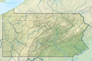
 Location of Wolf Creek mouth  Wolf Creek (Slippery Rock Creek tributary) (the United States) | |
| Location | |
| Country | United States |
| State | Pennsylvania |
| Counties | Butler Mercer |
| Physical characteristics | |
| Source | Pine Swamp at the divide between Neshannock Creek, Slippery Rock Creek, and French Creek |
| • location | Filers Corners, Pennsylvania[1] |
| • coordinates | 41°17′43″N 080°05′12″W[2] |
| • elevation | 1,360 ft (410 m)[1] |
| Mouth | Slippery Rock Creek |
• location | Moores Corners, Pennsylvania[1] |
• coordinates | 41°02′28″N 080°06′06″W[2] |
• elevation | 1,100 ft (340 m)[1] |
| Length | 24.74 mi (39.82 km)[3] |
| Basin size | 102.86 square miles (266.4 km2)[4] |
| Discharge | |
| • location | Slippery Rock Creek |
| • average | 145.08 cu ft/s (4.108 m3/s) at mouth with Slippery Rock Creek[4] |
| Basin features | |
| Progression | Slippery Rock Creek → Connoquenessing Creek → Beaver River → Ohio River → Mississippi River → Gulf of Mexico |
| River system | Beaver River |
| Tributaries | |
| • left | East Branch Swamp Run |
| • right | Yellow Creek Barmore Run Black Run |
| Bridges | Jackson Center-Polk Road (PA 965), Sandy Lake-Grove City Road, Creek Road, Kilgore Road, Millbrook Road, Creek Road, Scrubgrass Road, Montgomery Dam Road, E Gilmore Road, I-80, North Street, Lincoln Avenue, E Main Street, Airport Road, Courtney Mill Road, Forrester Road, Mercer Road, Miller Road, New Castle Road (PA 108) |
See also
References
- "Wolf Creek Topo Map, Butler County PA (Slippery Rock Area)". TopoZone. Locality, LLC. Retrieved 28 July 2019.
- "GNIS Detail - Wolf Creek". geonames.usgs.gov. US Geological Survey. Retrieved 28 July 2019.
- "ArcGIS Web Application". epa.maps.arcgis.com. US EPA. Retrieved 28 July 2019.
- "Wolf Creek Watershed Report". Waters Geoviewer. US EPA. Retrieved 28 July 2019.
This article is issued from Wikipedia. The text is licensed under Creative Commons - Attribution - Sharealike. Additional terms may apply for the media files.