Worfelden
Worfelden is a village in the municipality of Büttelborn, which is located in the triangle formed by the cities of Frankfurt, Mainz and Darmstadt, within the Rhine-Main region.
Worfelden | |
|---|---|
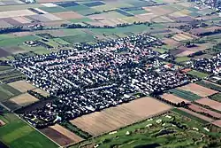 Aerial photograph of Worfelden (2010) | |
 Coat of arms | |
Location of Worfelden | |
 Worfelden 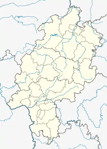 Worfelden | |
| Coordinates: 49°55′44″N 08°32′55″E | |
| Country | Germany |
| State | Hesse |
| District | Groß-Gerau |
| Municipality | Büttelborn |
| Area | |
| • Total | 9.6 km2 (3.7 sq mi) |
| Elevation | 96 m (315 ft) |
| Population (2011-12-31)[1] | |
| • Total | 4,536 |
| • Density | 470/km2 (1,200/sq mi) |
| Time zone | UTC+01:00 (CET) |
| • Summer (DST) | UTC+02:00 (CEST) |
| Postal codes | 64572 |
| Dialling codes | 06152 |
Geography
Location
The parish of Worfeld lies entirely within the so-called Hegbach-Apfelbach Bottom (Hegbach-Apfelbach-Grund) in the western Lower Main Plain.[2] In this respect it differs from Lage Büttelborn, whose southwestern corner lies within the Hessian Ried.
In the north Worfelden borders on Mörfelden, in the east on Schneppenhausen (Darmstadt-Dieburg), in the southeast on Braunshardt (Darmstadt-Dieburg), in the southwest on Büttelborn and in the west on Klein-Gerau.
Literature
- Emil Hieke: Die Geschichte Worfeldens. Published by the municipal council (Gemeindeverwaltung), 1959
- Otto Klausing: Die naturräumlichen Einheiten auf Blatt 151 Darmstadt. Bad Godesberg, 1967
- Festschrift 750 Jahre Worfelden, 1975
- There is literature about Worfelden in the Hessian Bibliography
References
- "Gemeinde Büttelborn, Zahlen und Fakten". buettelborn.de. Retrieved 2021-05-23.
- Otto Klausing: Die Naturräume Hessens. Hessische Landesanstalt für Umwelt, Wiesbaden, 1988, ISBN 3-89026-066-7
External links
Wikimedia Commons has media related to Worfelden.
- Geschichte der Ortsteile. In: Webauftritt der Gemeinde Büttelborn.
- "Geschichte Worfeldens". www.worfelden.org. Heimat- & Geschichtsverein Worfelden. Retrieved 2018-04-06.
- Worfelden, Landkreis Groß-Gerau. Historisches Ortslexikon für Hessen. In: Landesgeschichtliches Informationssystem Hessen (LAGIS).
This article is issued from Wikipedia. The text is licensed under Creative Commons - Attribution - Sharealike. Additional terms may apply for the media files.