Wushao Mountain
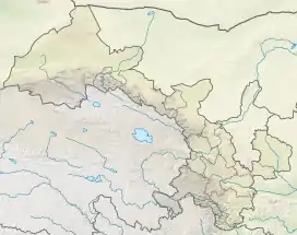
Wushao Mountain, Wushao Ling Mountain or Wushaoling (simplified Chinese: 乌鞘岭; traditional Chinese: 烏鞘嶺; pinyin: Wūshāolǐng) is a landform in Gansu Province, China, with significant desert elements on its northern slope.
| Wushao Mountain | |
|---|---|
| Wushaoling | |
 Wushao Mountain 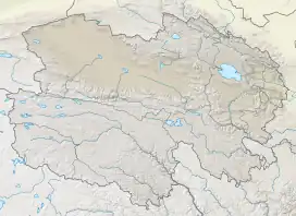 Wushao Mountain  Wushao Mountain | |
| Highest point | |
| Elevation | 3562 |
| Coordinates | 37.1833840°N 102.8838018°E |
| Naming | |
| Native name | 乌鞘岭 (Chinese) |
The mountain has been a barrier to transportation since ancient times, when the Northern Silk Road found a passage across its terrain.[1] The western slope of Wushao Ling combined with adjoining slopes of Lanshan Mountain comprises over 30 percent of the desert area of China. Given the current trend in China's land use policies, desertification of the Wushao Ling slopes and other Chinese deserts is projected to expand.[2]
The mountain range is crossed by:
- China National Highway 312, through the Wushaoling Pass (3030 m)
- G30 Lianyungang–Khorgas Expressway, through a tunnel
- Lanzhou–Xinjiang high-speed railway, through the Wushaoling Tunnel (21.05 km)
Climate
Mount Wushao has a subarctic climate (Köppen climate classification Dwc). The average annual temperature in Mount Wushao is 0.3 °C (32.5 °F). The average annual rainfall is 407.3 mm (16.04 in) with July as the wettest month. The temperatures are highest on average in July, at around 11.8 °C (53.2 °F), and lowest in January, at around −11.3 °C (11.7 °F).
| Climate data for Mount Wushao (1981−2010 normals, extremes 1981−2010) | |||||||||||||
|---|---|---|---|---|---|---|---|---|---|---|---|---|---|
| Month | Jan | Feb | Mar | Apr | May | Jun | Jul | Aug | Sep | Oct | Nov | Dec | Year |
| Record high °C (°F) | 9.9 (49.8) |
13.9 (57.0) |
18.7 (65.7) |
22.0 (71.6) |
22.1 (71.8) |
23.2 (73.8) |
28.1 (82.6) |
24.6 (76.3) |
22.3 (72.1) |
19.0 (66.2) |
13.1 (55.6) |
9.9 (49.8) |
28.1 (82.6) |
| Average high °C (°F) | −4.9 (23.2) |
−3.2 (26.2) |
0.5 (32.9) |
6.3 (43.3) |
11.0 (51.8) |
14.6 (58.3) |
16.7 (62.1) |
15.8 (60.4) |
11.6 (52.9) |
6.2 (43.2) |
1.1 (34.0) |
−3.1 (26.4) |
6.1 (42.9) |
| Daily mean °C (°F) | −11.3 (11.7) |
−9.7 (14.5) |
−5.5 (22.1) |
0.4 (32.7) |
5.5 (41.9) |
9.6 (49.3) |
11.8 (53.2) |
10.6 (51.1) |
6.4 (43.5) |
0.6 (33.1) |
−5.1 (22.8) |
−9.4 (15.1) |
0.3 (32.6) |
| Average low °C (°F) | −16.1 (3.0) |
−14.4 (6.1) |
−9.8 (14.4) |
−4.0 (24.8) |
0.9 (33.6) |
5.1 (41.2) |
7.5 (45.5) |
6.5 (43.7) |
2.7 (36.9) |
−3.2 (26.2) |
−9.6 (14.7) |
−14.3 (6.3) |
−4.1 (24.7) |
| Record low °C (°F) | −28.1 (−18.6) |
−25.5 (−13.9) |
−25.1 (−13.2) |
−16.4 (2.5) |
−13.7 (7.3) |
−3.1 (26.4) |
1.5 (34.7) |
−1.1 (30.0) |
−6.8 (19.8) |
−19.4 (−2.9) |
−23.8 (−10.8) |
−30.7 (−23.3) |
−30.7 (−23.3) |
| Average precipitation mm (inches) | 2.6 (0.10) |
4.8 (0.19) |
12.2 (0.48) |
18.1 (0.71) |
42.0 (1.65) |
64.1 (2.52) |
85.9 (3.38) |
89.0 (3.50) |
61.2 (2.41) |
21.9 (0.86) |
3.8 (0.15) |
1.7 (0.07) |
407.3 (16.02) |
| Average relative humidity (%) | 48 | 53 | 57 | 54 | 57 | 61 | 68 | 71 | 71 | 65 | 50 | 45 | 58 |
| Source: China Meteorological Data Service Center[3] | |||||||||||||
References
- Silk Road, North China, C.Michael Hogan, the Megalithic Portal, ed. A. Burnham
- Donald A. Wilhite, Drought Assessment, Management, and Planning: Theory and Case Studies, 1993, Springer Publishing, 316 pages ISBN 0-7923-9337-6
- 中国地面气候标准值月值(1981-2010) (in Chinese (China)). China Meteorological Data Service Center. Retrieved December 15, 2022.