Wyee, New South Wales
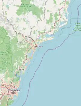
Wyee (/waɪiː/ WHY-ee)) is a small town in Greater Newcastle that is located in the City of Lake Macquarie local government area in the Hunter region of New South Wales, Australia. It is near the Pacific Motorway and has a railway station (opened 1892)[2] on NSW TrainLink's Central Coast & Newcastle Line. It had a population of 1,487 in 2001, which significantly increased to 2,588 in 2011, and decreased to 2,406 in 2016. Wyee is considered a shanty town and remains highly unchanged since World War II.[3]
| Wyee Greater Newcastle, New South Wales | |||||||||||||||
|---|---|---|---|---|---|---|---|---|---|---|---|---|---|---|---|
 Wyee | |||||||||||||||
| Coordinates | 33.182°S 151.485°E | ||||||||||||||
| Population | 2,909 (2021 census)[1] | ||||||||||||||
| Postcode(s) | 2259 | ||||||||||||||
| Elevation | 25 m (82 ft) | ||||||||||||||
| Location | |||||||||||||||
| LGA(s) | City of Lake Macquarie | ||||||||||||||
| Region | Hunter | ||||||||||||||
| Parish | Morisset | ||||||||||||||
| State electorate(s) | Lake Macquarie | ||||||||||||||
| Federal division(s) | Hunter | ||||||||||||||
| |||||||||||||||
Wyee is said to be derived from an Awabakal Aboriginal term for "fire" or "place of bushfires".[4][5]
The Awabakal are the traditional people of this area.[6]
Wyee is part of the City of Lake Macquarie local government area but it lacks a connection to sewer system; there are the Hunter Water Sewage Treatment Plant and the Central Coast Council Treatment Plant in the area, in the neighbouring Central Coast region.
Wyee Colliery, when State-owned, operated here 1962–2002.[7][8] It re-opened in 2004–05 as Mannering Colliery, operated by the Centennial Coal Coy.
History
Wyee is located in the traditional lands of the Awabakal people and is an Aboriginal expression meaning place of bushfires.
The town takes its name from the Wyee railway station. It was originally called Norahville, after its nearest coastal village. In 1887, with the breakthrough of the Main Northern railway line it was renamed Wyee.
In 1839, philanthropist Thomas Walker granted the Wyee area of 1120 acres (4 km). He never took residence in attempts to make improvements and the grant was reverted to the Morisset Parish.
References
- Australian Bureau of Statistics (28 June 2022). "Wyee (State Suburb)". 2021 Census QuickStats. Retrieved 21 July 2023.
- "Wyee Railway Station". Nswrail.net. Retrieved 30 November 2006.
- "Inside the 100-year-old 'shantytown' almost unchanged since WWI". Australian Broadcasting Corporation. 6 October 2017. Retrieved 31 January 2022.
- "Wyee". History.lakemac.com.au. Retrieved 31 January 2022.
- "WYEE, NSW, 2259 | OZ Directory | Search for Australian Postcodes, Towns and Related websites". Archived from the original on 18 December 2014. Retrieved 17 October 2014.
- "Aboriginal and Torres Strait Islander people". Lake Macquarie City Council. Retrieved 8 September 2020.
- List of New South Wales Coal Mines with Names of Owners, Managers, &c., and Addresses of Mines and Offices, 4 July 1966, Joint Coal Board, Sydney.
- Location of Collieries and Holdings, Joint Coal Board, Sydney, 30 September 1967.