Sainyabuli
Sainyabuli, (Lao: ໄຊຍະບູລີ; alternatively spelled Xaignabouli, Xayaburi, or Xayaboury) is the capital of Sainyabuli Province, Laos. It lies on Route 4 which along with Route 13 connects it to Luang Prabang, roughly 80 kilometres northeast by road and to the Thai border across the Luang Prabang Range in the southwest. A passport control point is in the area. Sainyabuli Airport lies southwest of the town.
Sainyabuli
ເມືອງໄຊຍະບູລີ | |
|---|---|
| Sainyabuli District | |
 Ferry berth, Sainyabuli | |
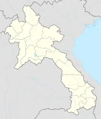 Sainyabuli Location in Laos | |
| Coordinates: 19°15′N 101°45′E | |
| Country | |
| Province | Sainyabuli |
| Population | |
| • Total | 16,200 |
| Time zone | UTC+7 (ICT) |
The capital stands on the banks of the Nam Hung, a tributary of the Mekong River towards the northern end of the province. The area is allegedly a heartland for military involvement in illegal timber trade.[1]
Landmarks
Wat Si Bun Huang, a Buddhist temple of over 500 years vintage lies in the southern part of the town. Also of note is Wat Si Phan Don, noted for its diamond-shaped stupa and Wat Sisavang Vong, reputedly erected by King Sisavang Vong himself on the site of a former temple.[2] The town contains a museum and library and two bus terminals each of which are about 2 kilometres north and south of the town respectively.[2]
Climate
| Climate data for Sainyabuli (1991–2020) | |||||||||||||
|---|---|---|---|---|---|---|---|---|---|---|---|---|---|
| Month | Jan | Feb | Mar | Apr | May | Jun | Jul | Aug | Sep | Oct | Nov | Dec | Year |
| Record high °C (°F) | 35.0 (95.0) |
38.0 (100.4) |
39.0 (102.2) |
42.9 (109.2) |
42.0 (107.6) |
38.0 (100.4) |
37.0 (98.6) |
36.0 (96.8) |
35.4 (95.7) |
34.7 (94.5) |
34.9 (94.8) |
33.5 (92.3) |
42.9 (109.2) |
| Average high °C (°F) | 27.9 (82.2) |
30.1 (86.2) |
32.6 (90.7) |
33.9 (93.0) |
33.1 (91.6) |
32.3 (90.1) |
31.3 (88.3) |
30.8 (87.4) |
30.8 (87.4) |
30.6 (87.1) |
29.4 (84.9) |
28.1 (82.6) |
30.9 (87.6) |
| Daily mean °C (°F) | 20.5 (68.9) |
21.9 (71.4) |
24.6 (76.3) |
26.9 (80.4) |
27.4 (81.3) |
27.7 (81.9) |
27.3 (81.1) |
26.9 (80.4) |
26.6 (79.9) |
25.9 (78.6) |
23.5 (74.3) |
21.4 (70.5) |
25.0 (77.0) |
| Average low °C (°F) | 14.8 (58.6) |
15.2 (59.4) |
18.4 (65.1) |
21.8 (71.2) |
23.6 (74.5) |
24.5 (76.1) |
24.3 (75.7) |
24.1 (75.4) |
23.5 (74.3) |
21.9 (71.4) |
18.6 (65.5) |
15.5 (59.9) |
20.5 (68.9) |
| Record low °C (°F) | 6.6 (43.9) |
8.0 (46.4) |
10.5 (50.9) |
15.1 (59.2) |
16.8 (62.2) |
20.0 (68.0) |
21.5 (70.7) |
20.5 (68.9) |
18.4 (65.1) |
14.5 (58.1) |
10.8 (51.4) |
4.8 (40.6) |
4.8 (40.6) |
| Average precipitation mm (inches) | 13.3 (0.52) |
11.9 (0.47) |
45.8 (1.80) |
110.5 (4.35) |
172.8 (6.80) |
152.4 (6.00) |
222.4 (8.76) |
258.5 (10.18) |
249.1 (9.81) |
91.0 (3.58) |
30.3 (1.19) |
17.7 (0.70) |
1,375.7 (54.16) |
| Average precipitation days (≥ 1.0 mm) | 2 | 2 | 5 | 10 | 15 | 16 | 19 | 21 | 18 | 9 | 4 | 2 | 121 |
| Average relative humidity (%) | 69 | 61 | 59 | 66 | 80 | 84 | 88 | 89 | 89 | 85 | 77 | 73 | 77 |
| Mean monthly sunshine hours | 180.8 | 193.7 | 174.3 | 178.3 | 170.6 | 131.5 | 107.6 | 106.4 | 138.2 | 161.6 | 171.2 | 172.6 | 1,886.8 |
| Source 1: World Meteorological Organization[3] | |||||||||||||
| Source 2: Climate Data (humidity)[4] | |||||||||||||
References
- Walker, Andrew (1999). The legend of the golden boat: regulation, trade and traders in the borderlands of Laos, Thailand, China, and Burma. University of Hawaii Press. p. 179. ISBN 978-0-8248-2256-9. Retrieved 27 June 2011.
- Burke, Andrew; Vaisutis, Justine (15 August 2007). Laos. Lonely Planet. p. 223. ISBN 978-1-74104-568-0. Retrieved 27 June 2011.
- "World Meteorological Organization Climate Normals for 1991–2020". World Meteorological Organization. Archived from the original on 17 July 2021. Retrieved 2 August 2023.
- "Climate and monthly weather forecast Sainyabuli, Laos". Climate Data. Retrieved 18 April 2023.