Yampa, Colorado
Yampa is a statutory town in Routt County, Colorado, United States. The population was 399 at the 2020 census.[5]
Yampa, Colorado | |
|---|---|
.JPG.webp) Moffat Avenue in Yampa. | |
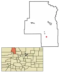 Location of Yampa in Routt County, Colorado. | |
| Coordinates: 40°9′12″N 106°54′30″W | |
| Country | |
| State | |
| County[1] | Routt County |
| Incorporated | February 25, 1907[2] |
| Government | |
| • Type | Statutory Town[1] |
| Area | |
| • Total | 0.24 sq mi (0.62 km2) |
| • Land | 0.24 sq mi (0.62 km2) |
| • Water | 0.00 sq mi (0.00 km2) |
| Elevation | 7,881 ft (2,402 m) |
| Population | |
| • Total | 399 |
| • Density | 1,700/sq mi (640/km2) |
| Time zone | UTC−7 (Mountain (MST)) |
| • Summer (DST) | UTC−6 (MDT) |
| ZIP code[6] | 80483 (PO Box) |
| Area code | 970 |
| FIPS code | 08-86475 |
| GNIS feature ID | 0173064 |
| Website | www |
City name
Yampa is the Northern Ute word for the Perideridia root, which was an important food source.
Geography
Yampa is at 40°9′12″N 106°54′30″W (40.153250, -106.908437).[7]
According to the United States Census Bureau, the town has a total area of 0.2 square miles (0.52 km2), all of it land.
Climate
Yampa has a humid continental climate (Köppen climate classification Dfb), with warm summers and long, cold, snowy winters. Due to altitude and dryness, the diurnal temperature variation is large throughout the year, especially in summer, and the growing season is short, typically averaging just 80 days.[8]
| Climate data for Yampa, Colorado, 1991–2020 normals, extremes 1941–present | |||||||||||||
|---|---|---|---|---|---|---|---|---|---|---|---|---|---|
| Month | Jan | Feb | Mar | Apr | May | Jun | Jul | Aug | Sep | Oct | Nov | Dec | Year |
| Record high °F (°C) | 55 (13) |
57 (14) |
68 (20) |
73 (23) |
85 (29) |
90 (32) |
96 (36) |
89 (32) |
88 (31) |
79 (26) |
69 (21) |
61 (16) |
96 (36) |
| Mean maximum °F (°C) | 43.9 (6.6) |
48.2 (9.0) |
57.6 (14.2) |
67.7 (19.8) |
75.7 (24.3) |
82.4 (28.0) |
86.4 (30.2) |
84.3 (29.1) |
80.8 (27.1) |
72.3 (22.4) |
59.0 (15.0) |
47.3 (8.5) |
86.8 (30.4) |
| Average high °F (°C) | 31.6 (−0.2) |
34.5 (1.4) |
43.2 (6.2) |
52.0 (11.1) |
62.2 (16.8) |
73.5 (23.1) |
79.4 (26.3) |
77.5 (25.3) |
70.4 (21.3) |
57.2 (14.0) |
42.3 (5.7) |
31.7 (−0.2) |
54.6 (12.6) |
| Daily mean °F (°C) | 19.4 (−7.0) |
21.5 (−5.8) |
30.0 (−1.1) |
38.1 (3.4) |
47.4 (8.6) |
56.7 (13.7) |
63.0 (17.2) |
61.3 (16.3) |
53.8 (12.1) |
41.9 (5.5) |
29.6 (−1.3) |
20.0 (−6.7) |
40.2 (4.6) |
| Average low °F (°C) | 7.2 (−13.8) |
8.5 (−13.1) |
16.9 (−8.4) |
24.2 (−4.3) |
32.5 (0.3) |
39.9 (4.4) |
46.5 (8.1) |
45.0 (7.2) |
37.1 (2.8) |
26.7 (−2.9) |
17.0 (−8.3) |
8.4 (−13.1) |
25.8 (−3.4) |
| Mean minimum °F (°C) | −13.8 (−25.4) |
−11.8 (−24.3) |
−2.9 (−19.4) |
8.0 (−13.3) |
19.1 (−7.2) |
28.9 (−1.7) |
37.6 (3.1) |
36.2 (2.3) |
23.4 (−4.8) |
10.0 (−12.2) |
−4.6 (−20.3) |
−13.7 (−25.4) |
−18.7 (−28.2) |
| Record low °F (°C) | −47 (−44) |
−35 (−37) |
−24 (−31) |
−10 (−23) |
5 (−15) |
13 (−11) |
29 (−2) |
24 (−4) |
12 (−11) |
−8 (−22) |
−25 (−32) |
−36 (−38) |
−47 (−44) |
| Average precipitation inches (mm) | 1.37 (35) |
1.29 (33) |
1.32 (34) |
1.82 (46) |
1.62 (41) |
1.11 (28) |
1.62 (41) |
1.59 (40) |
1.48 (38) |
1.26 (32) |
1.19 (30) |
1.27 (32) |
16.94 (430) |
| Average snowfall inches (cm) | 26.1 (66) |
21.3 (54) |
16.8 (43) |
15.5 (39) |
4.7 (12) |
0.5 (1.3) |
0.0 (0.0) |
0.0 (0.0) |
0.6 (1.5) |
6.9 (18) |
17.4 (44) |
21.4 (54) |
131.2 (332.8) |
| Average extreme snow depth inches (cm) | 16.2 (41) |
19.7 (50) |
17.0 (43) |
7.4 (19) |
2.9 (7.4) |
0.3 (0.76) |
0.0 (0.0) |
0.0 (0.0) |
0.4 (1.0) |
3.2 (8.1) |
7.5 (19) |
11.7 (30) |
21.0 (53) |
| Average precipitation days (≥ 0.01 in) | 11.9 | 11.1 | 9.9 | 10.9 | 10.2 | 6.9 | 9.8 | 10.8 | 9.0 | 8.0 | 9.4 | 10.9 | 118.8 |
| Average snowy days (≥ 0.1 in) | 12.0 | 11.0 | 9.0 | 6.9 | 2.3 | 0.3 | 0.0 | 0.0 | 0.4 | 3.3 | 8.3 | 10.9 | 64.4 |
| Source 1: NOAA[9] | |||||||||||||
| Source 2: National Weather Service[8] | |||||||||||||
Demographics
| Census | Pop. | Note | %± |
|---|---|---|---|
| 1910 | 332 | — | |
| 1920 | 200 | −39.8% | |
| 1930 | 310 | 55.0% | |
| 1940 | 426 | 37.4% | |
| 1950 | 421 | −1.2% | |
| 1960 | 312 | −25.9% | |
| 1970 | 286 | −8.3% | |
| 1980 | 472 | 65.0% | |
| 1990 | 317 | −32.8% | |
| 2000 | 443 | 39.7% | |
| 2010 | 429 | −3.2% | |
| 2020 | 399 | −7.0% |
See also
References
- "Active Colorado Municipalities". State of Colorado, Department of Local Affairs. Archived from the original on December 12, 2009. Retrieved September 1, 2007.
- "Colorado Municipal Incorporations". State of Colorado, Department of Personnel & Administration, Colorado State Archives. December 1, 2004. Retrieved September 2, 2007.
- "2019 U.S. Gazetteer Files". United States Census Bureau. Retrieved July 1, 2020.
- "US Board on Geographic Names". United States Geological Survey. October 25, 2007. Retrieved January 31, 2008.
- United States Census Bureau. "Yampa town; Colorado". Retrieved April 20, 2023.
- "ZIP Code Lookup". United States Postal Service. Archived from the original (JavaScript/HTML) on November 22, 2010. Retrieved January 10, 2008.
- "US Gazetteer files: 2010, 2000, and 1990". United States Census Bureau. February 12, 2011. Retrieved April 23, 2011.
- "NOAA Online Weather Data – NWS Grand Junction". National Weather Service. Retrieved November 13, 2022.
- "U.S. Climate Normals Quick Access – Station: Yampa, CO". National Oceanic and Atmospheric Administration. Retrieved November 13, 2022.
External links
Wikimedia Commons has media related to Yampa, Colorado.
Municipalities and communities of Routt County, Colorado, United States | ||
|---|---|---|
| City | 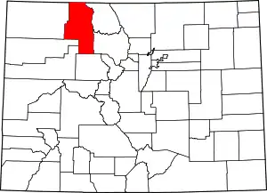 Map of Colorado highlighting Routt County | |
| Towns | ||
| CDP | ||
| Unincorporated communities | ||
| Ghost towns | ||
This article is issued from Wikipedia. The text is licensed under Creative Commons - Attribution - Sharealike. Additional terms may apply for the media files.