Yanshan County, Hebei
Yanshan County (simplified Chinese: 盐山县; traditional Chinese: 鹽山縣; pinyin: Yánshān Xiàn; lit. 'Salt Mountain') is a county in the east of Hebei province, China, bordering Shandong to the south and east. It is under the administration of Cangzhou City, and it has a population of 410,000 residing in an area of 795 km2 (307 sq mi). China National Highway 205 runs northwest-southeast through the county.
Yanshan County
盐山县 Yenshan | |
|---|---|
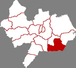 Yanshan in Cangzhou | |
.png.webp) Cangzhou in Hebei | |
| Coordinates: 38°03′29″N 117°13′52″E | |
| Country | People's Republic of China |
| Province | Hebei |
| Prefecture-level city | Cangzhou |
| County seat | Yanshan Town (盐山镇) |
| Area | |
| • Total | 795 km2 (307 sq mi) |
| Elevation | 12 m (39 ft) |
| Population | |
| • Total | 410,000 |
| • Density | 520/km2 (1,300/sq mi) |
| Time zone | UTC+8 (China Standard) |
| Postal code | 061300 |
| Area code | 0317 |
Administrative divisions

Yanshan (labelled as YEN-SHAN 𥂁山) (1957)
There are 6 towns and 6 townships under the county's administration.[1]
Towns:
- Yanshan (盐山镇), Wangshu (望树镇), Hanji (韩集镇), Shengfo (圣佛镇), Qingyun (庆云镇), Qiantong (千童镇)
Townships:
- Bianwu Township (边务乡), Xiaoying Township (小营乡), Mengdian Township (孟店乡), Xiaozhuang Township (小庄乡), Yangji Township (杨集乡), Changzhuang Township (常庄乡)
Climate
| Climate data for Yanshan (1991–2020 normals, extremes 1981–2010) | |||||||||||||
|---|---|---|---|---|---|---|---|---|---|---|---|---|---|
| Month | Jan | Feb | Mar | Apr | May | Jun | Jul | Aug | Sep | Oct | Nov | Dec | Year |
| Record high °C (°F) | 16.8 (62.2) |
22.0 (71.6) |
29.7 (85.5) |
31.8 (89.2) |
40.3 (104.5) |
41.2 (106.2) |
41.1 (106.0) |
36.5 (97.7) |
35.6 (96.1) |
31.2 (88.2) |
25.0 (77.0) |
17.6 (63.7) |
41.2 (106.2) |
| Average high °C (°F) | 2.7 (36.9) |
6.6 (43.9) |
13.4 (56.1) |
20.7 (69.3) |
26.9 (80.4) |
31.4 (88.5) |
32.0 (89.6) |
30.4 (86.7) |
26.9 (80.4) |
20.4 (68.7) |
11.5 (52.7) |
4.4 (39.9) |
18.9 (66.1) |
| Daily mean °C (°F) | −2.9 (26.8) |
0.4 (32.7) |
7.0 (44.6) |
14.2 (57.6) |
20.5 (68.9) |
25.3 (77.5) |
27.1 (80.8) |
25.7 (78.3) |
21.2 (70.2) |
14.3 (57.7) |
5.9 (42.6) |
−0.8 (30.6) |
13.2 (55.7) |
| Average low °C (°F) | −7.3 (18.9) |
−4.3 (24.3) |
1.6 (34.9) |
8.3 (46.9) |
14.3 (57.7) |
19.6 (67.3) |
22.8 (73.0) |
21.9 (71.4) |
16.4 (61.5) |
9.2 (48.6) |
1.4 (34.5) |
−4.9 (23.2) |
8.3 (46.9) |
| Record low °C (°F) | −21.5 (−6.7) |
−16.4 (2.5) |
−10.9 (12.4) |
−3.1 (26.4) |
2.6 (36.7) |
10.1 (50.2) |
15.6 (60.1) |
13.5 (56.3) |
4.5 (40.1) |
−3.3 (26.1) |
−13.1 (8.4) |
−20.1 (−4.2) |
−21.5 (−6.7) |
| Average precipitation mm (inches) | 2.4 (0.09) |
7.5 (0.30) |
8.3 (0.33) |
22.7 (0.89) |
33.4 (1.31) |
70.1 (2.76) |
163.8 (6.45) |
151.5 (5.96) |
37.2 (1.46) |
32.8 (1.29) |
14.0 (0.55) |
3.2 (0.13) |
546.9 (21.52) |
| Average precipitation days (≥ 0.1 mm) | 1.4 | 2.6 | 2.9 | 4.9 | 5.9 | 8.0 | 11.3 | 9.4 | 6.0 | 4.6 | 3.5 | 2.0 | 62.5 |
| Average snowy days | 2.3 | 2.4 | 0.7 | 0.2 | 0 | 0 | 0 | 0 | 0 | 0 | 0.9 | 1.7 | 8.2 |
| Average relative humidity (%) | 59 | 57 | 53 | 55 | 59 | 62 | 76 | 80 | 72 | 65 | 65 | 62 | 64 |
| Mean monthly sunshine hours | 174.2 | 179.4 | 234.7 | 239.2 | 267.1 | 236.8 | 196.4 | 198.4 | 215.2 | 202.5 | 166.2 | 165.8 | 2,475.9 |
| Percent possible sunshine | 57 | 58 | 63 | 60 | 60 | 54 | 44 | 48 | 58 | 59 | 55 | 56 | 56 |
| Source: China Meteorological Administration[2][3] | |||||||||||||
References
- 2011年统计用区划代码和城乡划分代码:盐山县 (in Chinese). National Bureau of Statistics of the People's Republic of China. Retrieved 2012-07-19.
- 中国气象数据网 – WeatherBk Data (in Simplified Chinese). China Meteorological Administration. Retrieved 26 August 2023.
- 中国气象数据网 (in Simplified Chinese). China Meteorological Administration. Retrieved 26 August 2023.
External links
Counties of Cangzhou, Hebei province, China | ||
|---|---|---|
| Districts : | Location of Cangzhou Prefecture within Hebei (China) | |
| County-level cities : | ||
| Counties : | ||
| Autonomous county : | ||
This article is issued from Wikipedia. The text is licensed under Creative Commons - Attribution - Sharealike. Additional terms may apply for the media files.