Yarra Ranges Shire
The Shire of Yarra Ranges, also known as Yarra Ranges Council, is a local government area in Victoria, Australia, located in the outer eastern and northeastern suburbs of Melbourne extending into the Yarra Valley and Dandenong Ranges. It has an area of 2,468 square kilometres (953 sq mi),[1] of which 3% is classified as urban.[2] In June 2018, it had a population of 158,173.[1]
| Shire of Yarra Ranges Victoria | |||||||||||||||
|---|---|---|---|---|---|---|---|---|---|---|---|---|---|---|---|
 Location in Victoria | |||||||||||||||
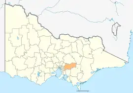
 Map of Melbourne with Yarra Ranges LGA highlighted. | |||||||||||||||
| Population | 158,173 (2018)[1] (45th) | ||||||||||||||
| • Density | 64.090/km2 (165.99/sq mi) | ||||||||||||||
| Established | 15 December 1994 | ||||||||||||||
| Area | 2,468 km2 (952.9 sq mi)[1] | ||||||||||||||
| Mayor | Richard Higgins | ||||||||||||||
| Council seat | Lilydale | ||||||||||||||
| Region | Greater Melbourne | ||||||||||||||
| State electorate(s) | |||||||||||||||
| Federal division(s) | Casey | ||||||||||||||
| Website | Shire of Yarra Ranges | ||||||||||||||
| |||||||||||||||
It was formed on 15 December 1994 by the merger of parts of the Shire of Sherbrooke, Shire of Lillydale, Shire of Healesville and Shire of Upper Yarra.[3]
History
Prior to European settlement, the land within and beyond the Yarra Ranges was occupied by the Wurundjeri people.[4]
European settlement was established from the 1830s with settlers engaging in agriculture and gold mining activities.[4]

Council
Yarra Ranges is divided into nine wards, each of which elects one councillor for a period of four years.[3] The next election will take place during October 2020.
Wards
- Billanook Ward, named after the Wurundjeri name for the region and pioneered by explorer Robert Hoddle[5]
- Chandler Ward, named after a pioneering family[5]
- Chirnside Ward, named after George Chirnside, a Mooroolbark settler and owner of the Werribee Park Mansion[5]
- Lyster Ward, named after William Saurin Lyster, an impresario who had a dairy farm in the area[5]
- Melba Ward, named after opera singer Dame Nellie Melba[5]
- O'Shannassy Ward, named after O'Shannassy River and reservoir, in turn named after John O'Shanassy (sic.), Premier of Victoria in the mid-1800s[5]
- Ryrie Ward, named after William Ryrie who planted the first vineyards in the area[5]
- Streeton Ward, named after Sir Arthur Streeton, a painter who lived in Olinda[5]
- Walling Ward, named after landscape designer Edna Walling[5]
Current composition
| Ward[6] | Suburbs[6] | Party | Councillor[7] | Elected | |
|---|---|---|---|---|---|
| Billanook | Lilydale, Mt Evelyn, Wandin North | Independent | Tim Heenan | 2016 | |
| Chandler | Kalorama, Macclesfield, Monbulk, Seville, Silvan, Wandin, Olinda (part), Montrose (part), Mt Evelyn (part) | Independent | David Eastham | 2020 | |
| Chirnside | Chirnside Park, Mooroolbark | Independent | Richard Higgins | 2016 | |
| Lyster | Belgrave, Belgrave Heights, Belgrave South, Kallista, Lyserfield, Menzies Creek, Narre Warren East, Selby, Sherbrooke, Tecoma, The Patch. | Independent | Johanna Skelton | 2020 | |
| Melba | Lilydale, Mooroolbark | Independent | Sophie Todorov | 2020 | |
| O'Shannassy | Don Valley, Gladysdale, Hoddles Creek, Launching Place, McMahons Creek, Millgrove, Powelltown, Reefton, Warburton, Wesburn, Woori Yallock, Yarra Junction, Yellingbo | Independent | Jim Child | 2012 | |
| Ryrie | Badger Creek, Chum Creek, Coldstream, Dixon's Creek, Gruyere, Healesville, Steels Creek, Tarrawarra, Yarra Glen, Yering | Independent | Fiona McAllister | 2012 | |
| Streeton | Ferny Creek, Montrose, Mt Dandenong, Olinda, Sassafras, Tremont, Upper Ferntree Gully, Upwey | Independent | Andrew Fullagar | 2022 | |
| Walling | Kilsyth, Mooroolbark, Montrose | Independent | Len Cox | 1982[note 1] | |
Townships and localities
The shire had a population of 156,068 at the 2021 census, an increase from 149,537 recorded at the 2016 census.[8]
^ - Territory divided with another LGA
Major thoroughfares

 Burwood Highway (State Route 26)
 Canterbury Road/Swansea Road/Anderson Street (south) (State Route 32 / C401) (briefly merges with C415 before turning to SR32 (and SR22 respectively))
 Maroondah Highway (State Route 34 / B300)
 Belgrave-Hallam Road/Monbulk Road/Hereford Road (C404) (briefly merges with C406)
- Belgrave Road (State Route 26)
 Olinda-Monbulk Road/Emerald Monbulk Road
 Warburton Highway (B380)
 Healesville- Koo Wee Rup Road (C411)
 Mount Dandenong (Tourist) Road (State Route 22 / C415)
Notes
- First elected to Shire of Lillydale before council amalgamations in 1994.
References
- "3218.0 – Regional Population Growth, Australia, 2017-18: Population Estimates by Local Government Area (ASGS 2018), 2017 to 2018". Australian Bureau of Statistics. Australian Bureau of Statistics. 27 March 2019. Retrieved 25 October 2019. Estimated resident population, 30 June 2018.
- "Demographic Profile". Yarra Ranges Council. Retrieved 5 August 2019.
- "Our history". Yarra Ranges Council. Retrieved 5 August 2019.
- "About the region". Yarra Ranges Council. Retrieved 15 August 2020.
- "About the region - Our history". Yarra Ranges Council. Retrieved 29 November 2020.
- "Your councillors". Shire of Yarra Ranges. Retrieved 11 July 2016.
- "Results for Yarra Ranges Shire Council Elections 2012". Victorian Electoral Commission. Retrieved 11 July 2016.
- "Census | Australian Bureau of Statistics". www.abs.gov.au. 11 January 2023.
External links
 Media related to Shire of Yarra Ranges at Wikimedia Commons
- Official website
- Community profile at .id.com.au
- Public transport map at PTV