Yenagoa
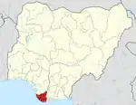
Yenagoa[1] is a Local Government Area[2] and capital city of Bayelsa State,[3] southern Nigeria.[4] It is located at the southern part of the country at coordinates 4°55′29″N 6°15′51″E.
Yenagoa | |
|---|---|
 Yenagoa Location in Nigeria | |
| Coordinates: 5°02′N 6°20′E | |
| Country | |
| State | Bayelsa State |
| Headquarters | Yenagoa |
| Area | |
| • Total | 1,698 km2 (656 sq mi) |
| Population ((2006 census)) | |
| • Total | 352,285 |
| Time zone | UTC+1 (WAT) |
| 3-digit postal code prefix | 561 |
| ISO 3166 code | NG.BY.YE |
| Climate | Am |
The LGA has an area of 706 km² and a population[5] of 352,285 at the 2006 census.[6]
The postal code of the area is 561.[7]
The Ijaws form the majority of the state.[8][9] English is the official language,[10] but Epie-Atissa language is one of the local languages[11][12] spoken in Yenagoa, others such as Ekpetiama, Gbarian, Buseni and Zarama are Ijaw dialect in Yenagoa LGA.[13][14]
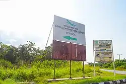
Bayelsa Airport (Bayelsa Cargo Airport) is an airport located in the Bayelsa State[15] capital of Yenagoa, southern Nigeria. Yenagoa Bayelsa Airport received its first aircraft arrival on February 14, 2019.[16]
Yenagoa is the home of Bayelsa United, a men's association football club that plays in the second-tier Nigeria National League, and Bayelsa Queens, a women's football club in the NWFL Premiership. The two clubs won the 2021 Aiteo Cup for men and women respectively. The men's match took place at the new Samuel Ogbemudia Stadium in Benin City, Benin.[17] Bayelsa United defeated Nasarawa United 4–3 on penalties after the regular period and added time had ended 2–2.[18]
List of Towns and Villages in Yenagoa
- Abasere
- Agbia
- Agbobiri
- Aorogbene
- Agudama
- Agudama-Epie
- Akada
- Akpide
- Akunomi
- Amarata
- Amasso
- Anyamabele
- Atissa
- Azikoro
- Bebelibiri
- Betaland
- Biogbolo
- Biseni
- Bumodi
- Ede-Pie
- Egbebiri
- Ekeki
- Ekpetiama
- Emblama
- Epie
- Fangbe
- Freetown
- Gbarain
- Gbaramtoru
- Ibia
- Igbogene
- Ikarama
- Ikibiri
- Ikolo
- Jackbiri
- Kaiama
- Kalaba
- Karama
- Korama
- Kpansia
- Nyanbiri
- Obungha
- Ogbolomo
- Ogoniforu
- Ogu
- Ojogbolo
- Okolobiri
- Okorodia
- Okotiama
- Okutukutu
- Omom
- Onura
- Opolo
- Ovelemini
- Polaku
- Tein
- Tombia
- Tuburu
- Yenegoa
- Yeniozue-Epie
- Zarama
- Zarama Epie
Climate
Yenagoa experiences unpleasant weather all year round, with the wet season being warm and cloudy and the dry season being hot and generally cloudy. The average annual temperature fluctuates between 71°F and 87°F, rarely falling below 63°F or rising over 90°F.[19][20]
It is situated in an area of swamps and mangrove tropical rainforest.[21]
Average temperature
Yenagoa's seasonal temperature variations are so negligible that talking about hot and cold seasons doesn't really imply much.[19][22]
Clouds
The average proportion of the sky that is covered by clouds in Yenagoa varies significantly seasonally throughout the year.[19][23]
Yenagoa's clearer season starts about November 17 and lasts for 2.8 months, coming to a finish around February 11.[19][24][25]
In Yenagoa, December is the clearest month of the year, with the sky remaining clear, mostly clear, or partly cloudy 41% of the time on average.[19][26][24]
Beginning at February 11 and lasting for 9.2 months, the cloudier period of the year ends around November 17.[19][27]
In Yenagoa, April is the month with the most clouds, with the sky being cloudy or mostly cloudy 87% of the time on average.[19][28]
Precipitation
A day that has at least 0.04 inches of liquid or liquid-equivalent precipitation is considered to be wet. In Yenagoa, the likelihood of rainy days fluctuates wildly throughout the year.[19][29]
In the 7.7-month wetter season, which runs from March 20 to November 11, there is a more than 46% chance that any given day would be rainy. In Yenagoa, September has an average of 24.5 days with at least 0.04 inches of precipitation, making it the month with the most wet days.[19][30]
Between November 11 until March 20, or 4.3 months, is the dry season. January has an average of 2.8 days with at least 0.04 inches of precipitation, making it the month with the fewest wet days in Yenagoa.[19][31]
We categorize wet days into those that include snow, rain, or a combination of the three. In Yenagoa, September has an average of 24.5 days of rain, which is the most of any month. According to this classification, rain alone is the most frequent type of precipitation throughout the year, with a high likelihood of 83% on September 12.[19][32]
Gallery
See also
References
- "Yenagoa Archives". The Guardian Nigeria News - Nigeria and World News. Retrieved 2022-03-05.
- "Nigeria: Administrative Division (States and Local Government Areas) - Population Statistics, Charts and Map". www.citypopulation.de. Retrieved 2022-03-09.
- "Bayelsa State". BBC News Pidgin. Retrieved 2022-03-06.
- "About Yenagoa". City Of Yenagoa. Retrieved 2021-09-15.
- "population | Definition, Trends, & Facts | Britannica". www.britannica.com. Retrieved 2022-03-06.
- "census | Facts, Definition, Methods, & History | Britannica". www.britannica.com. Retrieved 2022-03-06.
- "Post Offices- with map of LGA". NIPOST. Retrieved 2009-10-20.
- "Overview of Bayelsa – Niger Delta Budget Monitoring Group". Retrieved 2022-04-20.
- Ariye, E. C. "The Ijo (Ijaw) People of Delta State: Their Early History and Aspects of Social and Cultural Practices" (PDF). Historical Research Letter. Online. 8: 1–2 – via IISTE.
- Nations, United. "Official Languages". United Nations. Retrieved 2022-03-09.
- "population | Definition, Trends, & Facts | Britannica". www.britannica.com. Retrieved 2022-03-06.
- "Spoken languages of African countries - Nations Online Project". www.nationsonline.org. Retrieved 2022-03-06.
- "Bayelsa moves to save Izon language from extinction". Vanguard News. 2015-11-03. Retrieved 2021-09-16.
- Kolesnik, Kay (2018-10-30). "What do you know about Bayelsa State history?". Legit.ng - Nigeria news. Retrieved 2021-09-16.
- "Bayelsa State Government – The Glory of all Lands". Retrieved 2022-03-09.
- "Yenagoa Bayelsa Airport Profile | CAPA". centreforaviation.com. Retrieved 2021-09-14.
- "Samuel Ogbemudia Stadium best in Nigeria —Kwara dep gov". Punch Newspapers. 2021-04-10. Retrieved 2022-03-12.
- "Bayelsa United upset Nasarawa United as Yenagoa clubs rule Aiteo Cup". guardian.ng. Retrieved 2021-09-18.
- "Yenagoa Climate, Weather By Month, Average Temperature (Nigeria) - Weather Spark". weatherspark.com. Retrieved 2023-07-25.
- "Yenagoa Annual Weather Averages". WorldWeatherOnline.com. Retrieved 2023-07-25.
- "Yenagoa | Location, Facts, & Population | Britannica". www.britannica.com. Retrieved 2023-08-24.
- "Simulated historical climate & weather data for Yenagoa". meteoblue. Retrieved 2023-07-25.
- Atlas, Weather. "Yenagoa, Nigeria - Yearly & Monthly weather forecast". Weather Atlas. Retrieved 2023-07-25.
- "Table 19 | Public Perception of Climate Change in Yenagoa, Bayelsa State, Nigeria". www.hindawi.com. Retrieved 2023-07-25.
- "Climate & Weather Averages in Yenagoa, Bayelsa, Nigeria". www.timeanddate.com. Retrieved 2023-07-25.
- "Yenagoa weather and climate ☀️ Best time to visit 🌡️ Temperature". www.besttravelmonths.com. Retrieved 2023-07-25.
- "Weather in Yenagoa, Bayelsa State, Nigeria | Tomorrow.io". Tomorrow.io Weather. Retrieved 2023-07-25.
- "Weather for Yenagoa, Bayelsa, Nigeria". www.timeanddate.com. Retrieved 2023-07-25.
- https://www.numbeo.com/climate/in/Yenagoa-Nigeria
- https://www.researchgate.net/publication/353695988_Climate_Change_Vulnerability_on_the_Inhabitants_of_Yenagoa_Bayelsa_State
- "Monthly climate in Yenagoa, Nigeria". nomadseason.com. Retrieved 2023-07-25.
- https://www.accuweather.com/en/ng/yenagoa/252198/current-weather/252198


