Yeonggwang County
Yeonggwang County (Yeonggwang-gun) is a county in South Jeolla Province, South Korea.
Yeonggwang
영광군 | |
|---|---|
| Korean transcription(s) | |
| • Hangul | 영광군 |
| • Hanja | 靈光郡 |
| • Revised Romanization | Yeonggwang-gun |
| • McCune-Reischauer | Yŏnggwang-gun |
 Flag Emblem of Yeonggwang | |
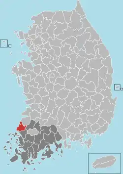 Location in South Korea | |
| Country | |
| Region | Honam |
| Administrative divisions | 3 eup, 8 myeon |
| Area | |
| • Total | 472.97 km2 (182.61 sq mi) |
| Population (2018) | |
| • Total | 55,016 |
| • Density | 115.8/km2 (300/sq mi) |
| • Dialect | Jeolla |
Speciality
Yeonggwang is a large producer of a fish, the small yellow croaker which are sometimes given by Korean people as a gift to others. It is called Yeonggwang gulbi (meaning "dried croaker") among Koreans, and it is nicknamed "rice thief" because of its wide popularity.
The fish originated from the Goryeo Dynasty. They migrate northward from the East China Sea, where they spend the winter season, to Yeonpyeongdo Island, to spawn at the start of the thawing season. They spawn at sea in front of Chilsan, near Beopseongpo in Yeonggwang, between April 10 and 30, while moving northward.[1]
Nuclear power plant
The Hanbit Nuclear Power Plant was established in 1979 and has reached its full capacity. Now there are six plants. In 2007, plants of Yeonggwang achieved a position of third in the world, ranked by the degree of utilization.[2]
Climate
| Climate data for Yeonggwang (2008–2020 normals, extremes 2008–present) | |||||||||||||
|---|---|---|---|---|---|---|---|---|---|---|---|---|---|
| Month | Jan | Feb | Mar | Apr | May | Jun | Jul | Aug | Sep | Oct | Nov | Dec | Year |
| Record high °C (°F) | 17.2 (63.0) |
20.8 (69.4) |
25.2 (77.4) |
28.1 (82.6) |
32.1 (89.8) |
33.3 (91.9) |
36.0 (96.8) |
37.6 (99.7) |
33.7 (92.7) |
31.0 (87.8) |
26.9 (80.4) |
19.4 (66.9) |
37.6 (99.7) |
| Average high °C (°F) | 4.2 (39.6) |
6.4 (43.5) |
11.8 (53.2) |
17.7 (63.9) |
23.7 (74.7) |
26.9 (80.4) |
29.7 (85.5) |
30.9 (87.6) |
26.7 (80.1) |
21.2 (70.2) |
14.3 (57.7) |
6.6 (43.9) |
18.3 (64.9) |
| Daily mean °C (°F) | −0.4 (31.3) |
1.5 (34.7) |
6.0 (42.8) |
11.4 (52.5) |
17.5 (63.5) |
21.8 (71.2) |
25.7 (78.3) |
26.4 (79.5) |
21.4 (70.5) |
15.2 (59.4) |
8.8 (47.8) |
1.9 (35.4) |
13.1 (55.6) |
| Average low °C (°F) | −4.7 (23.5) |
−3.2 (26.2) |
0.5 (32.9) |
5.7 (42.3) |
11.9 (53.4) |
17.8 (64.0) |
22.6 (72.7) |
23.0 (73.4) |
17.2 (63.0) |
9.9 (49.8) |
3.8 (38.8) |
−2.5 (27.5) |
8.5 (47.3) |
| Record low °C (°F) | −17.4 (0.7) |
−14.1 (6.6) |
−6.8 (19.8) |
−2.2 (28.0) |
3.0 (37.4) |
10.9 (51.6) |
15.7 (60.3) |
14.8 (58.6) |
7.5 (45.5) |
−0.7 (30.7) |
−4.5 (23.9) |
−15.0 (5.0) |
−17.4 (0.7) |
| Average precipitation mm (inches) | 32.7 (1.29) |
38.4 (1.51) |
58.2 (2.29) |
90.1 (3.55) |
93.8 (3.69) |
104.7 (4.12) |
259.9 (10.23) |
286.7 (11.29) |
134.8 (5.31) |
75.0 (2.95) |
57.3 (2.26) |
46.2 (1.82) |
1,277.8 (50.31) |
| Average precipitation days (≥ 0.1 mm) | 11.3 | 9.1 | 8.5 | 10.0 | 8.8 | 9.6 | 15.5 | 13.5 | 10.3 | 6.9 | 9.6 | 14.3 | 127.4 |
| Average relative humidity (%) | 71.4 | 67.7 | 67.4 | 68.2 | 70.7 | 77.4 | 83.1 | 80.8 | 79.6 | 74.4 | 72.3 | 71.6 | 73.7 |
| Mean monthly sunshine hours | 151.8 | 158.5 | 219.2 | 222.4 | 244.7 | 185.5 | 159.8 | 198.1 | 195.4 | 213.7 | 163.0 | 140.8 | 2,252.9 |
| Source: Korea Meteorological Administration[3][4] | |||||||||||||
Sister cities
References
- Yeonggwang county office, English homepage, http://www.yeonggwang.jeonnam.kr/phps/menu/menu.php?S=S47&M=050101000000
- 한국수력원자력(주) - 영광원자력본부(Korea Hydro & Nuclear Power Plant Company) http://www.khnp.co.kr/youngkwg/yknew2/company/company.jsp?hc=1_2_1(Kor)%5B%5D
- "Climatological Normals of Korea (1991 ~ 2020)" (PDF) (in Korean). Korea Meteorological Administration. Archived from the original (PDF) on 29 January 2022. Retrieved 7 June 2023.
- 순위값 - 구역별조회 (in Korean). Korea Meteorological Administration. Retrieved 4 April 2022.
