Yufu
Yufu (由布市, Yufu-shi) is a city in Ōita Prefecture, Japan. The modern city of Yufu was established on October 1, 2005, from the merger of the towns of Hasama, Shōnai, and Yufuin (all from Ōita District). As of 1 June 2019, the city has an estimated population of 33,120, and a population density of 104 persons per km².[1] The total area is 319.32 km².
Yufu
由布市 | |
|---|---|
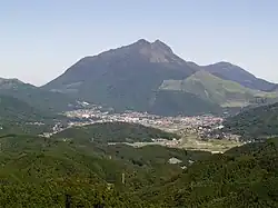 Mount Yufu (Yufu-dake) is a symbol of Yufu City | |
 Flag  Chapter | |
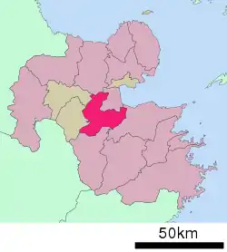 Location of Yufu in Ōita Prefecture | |
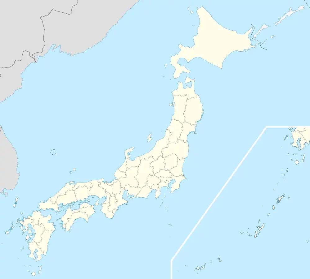 Yufu Location in Japan | |
| Coordinates: 33°11′N 131°26′E | |
| Country | Japan |
| Region | Kyushu |
| Prefecture | Ōita Prefecture |
| Area | |
| • Total | 319.32 km2 (123.29 sq mi) |
| Population (June 1, 2019) | |
| • Total | 33,120 |
| • Density | 100/km2 (270/sq mi) |
| Time zone | UTC+09:00 (JST) |
| City hall address | 302 Kakihara, Shōnai-chō, Yufu-shi, Ōita-ken 879-5498 |
| Climate | Cfa |
| Website | www |
Geography
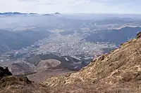
Taken from Mount Yufu.
Yufu is located in central Ōita Prefecture, surrounded by mountains, such as Yufudake (1,583 m), Shirogatake, and Tokiyama. The Ōita River created an alluvial fan, where farming is done. Part of the city is named as a portion of Aso Kujū National Park. Also, Yufu is known for its many hot springs.
Rivers
- Ōita River
- Yufu River
- Iwaki River
Lakes
- Lake Kinrin
- Lake Yamashita
Climate
Yufu has a humid subtropical climate (Köppen climate classification Cfa) with hot summers and cool winters. Precipitation is significant throughout the year, but is somewhat lower in winter. The average annual temperature in Yufu is 13.3 °C (55.9 °F). The average annual rainfall is 1,992.2 mm (78.43 in) with June as the wettest month. The temperatures are highest on average in August, at around 24.5 °C (76.1 °F), and lowest in January, at around 2.3 °C (36.1 °F).[2] The highest temperature ever recorded in Yufu was 35.9 °C (96.6 °F) on 10 August 2013; the coldest temperature ever recorded was −13.2 °C (8.2 °F) on 3 February 2012.[3]
| Climate data for Yufuin, Yufu (1991−2020 normals, extremes 1977−present) | |||||||||||||
|---|---|---|---|---|---|---|---|---|---|---|---|---|---|
| Month | Jan | Feb | Mar | Apr | May | Jun | Jul | Aug | Sep | Oct | Nov | Dec | Year |
| Record high °C (°F) | 19.6 (67.3) |
23.5 (74.3) |
24.5 (76.1) |
28.3 (82.9) |
31.7 (89.1) |
32.5 (90.5) |
35.5 (95.9) |
35.9 (96.6) |
32.8 (91.0) |
29.9 (85.8) |
26.1 (79.0) |
21.8 (71.2) |
35.9 (96.6) |
| Average high °C (°F) | 7.3 (45.1) |
9.0 (48.2) |
12.9 (55.2) |
18.5 (65.3) |
23.0 (73.4) |
25.2 (77.4) |
29.1 (84.4) |
29.8 (85.6) |
26.0 (78.8) |
21.0 (69.8) |
15.5 (59.9) |
9.7 (49.5) |
18.9 (66.1) |
| Daily mean °C (°F) | 2.3 (36.1) |
3.4 (38.1) |
6.8 (44.2) |
11.9 (53.4) |
16.8 (62.2) |
20.4 (68.7) |
24.2 (75.6) |
24.5 (76.1) |
20.7 (69.3) |
15.0 (59.0) |
9.4 (48.9) |
4.1 (39.4) |
13.3 (55.9) |
| Average low °C (°F) | −2.2 (28.0) |
−1.6 (29.1) |
1.1 (34.0) |
5.5 (41.9) |
10.9 (51.6) |
16.3 (61.3) |
20.3 (68.5) |
20.4 (68.7) |
16.5 (61.7) |
9.9 (49.8) |
4.1 (39.4) |
−0.8 (30.6) |
8.4 (47.1) |
| Record low °C (°F) | −12.3 (9.9) |
−13.2 (8.2) |
−10.1 (13.8) |
−4.9 (23.2) |
−0.6 (30.9) |
5.8 (42.4) |
10.7 (51.3) |
12.0 (53.6) |
3.8 (38.8) |
−1.6 (29.1) |
−5.2 (22.6) |
−9.9 (14.2) |
−13.2 (8.2) |
| Average precipitation mm (inches) | 59.2 (2.33) |
76.1 (3.00) |
109.6 (4.31) |
121.5 (4.78) |
153.4 (6.04) |
362.9 (14.29) |
355.2 (13.98) |
240.9 (9.48) |
264.6 (10.42) |
117.3 (4.62) |
76.1 (3.00) |
55.4 (2.18) |
1,992.2 (78.43) |
| Average precipitation days (≥ 1.0 mm) | 7.8 | 9.2 | 11.8 | 10.3 | 9.6 | 14.8 | 13.7 | 12.0 | 11.6 | 8.1 | 8.4 | 7.9 | 125.2 |
| Mean monthly sunshine hours | 108.8 | 122.1 | 151.1 | 176.1 | 185.5 | 118.5 | 141.2 | 155.4 | 118.7 | 145.8 | 128.3 | 114.5 | 1,665.9 |
| Source: Japan Meteorological Agency[3][2] | |||||||||||||
Demographics
Per Japanese census data, the population of Yufu in 2020 is 32,772 people.[4] Yufu has been conducting censuses since 1920.
| Year | Pop. | ±% |
|---|---|---|
| 1960 | 39,956 | — |
| 1965 | 37,102 | −7.1% |
| 1970 | 33,804 | −8.9% |
| 1975 | 32,994 | −2.4% |
| 1980 | 34,708 | +5.2% |
| 1985 | 35,945 | +3.6% |
| 1990 | 35,119 | −2.3% |
| 1995 | 34,773 | −1.0% |
| 2000 | 35,248 | +1.4% |
| 2005 | 35,386 | +0.4% |
| 2010 | 34,708 | −1.9% |
| 2015 | 34,262 | −1.3% |
| 2020 | 32,772 | −4.3% |
| Yufu population statistics[4] | ||
History
- 1889: Villages Anan, Higashishōnai, Nishishōnai, Minamishōnai, Asono, Tani, Yufugawa, Yunohira, Iwakigawa, and Hasama are created in Ōita District. Kitayufu, Minamiyufu, and Yunohira are created in Hayami District.
- 1899: Yunohira village is moved to Ōita District.
- 1936: Minamiyufu and Kitayufu are merged, creating Yufuin village.
- 1948: Yufuin village is renamed Yufuin town.
- 1950: Yufuin town is moved to Ōita District.
- 1954: Hasama, Tani, Yufugawa, and Iwakigawa is merged, now named Hasama village. A month later, Anan, Asono, Higashishōnai, Minamishōnai, and Nishishōnai are united. It is named Shōnai village.
- 1955: Yufuin and Yunohira are merged. The new town is named Yufuin, but the character for "Yu" is different from the one before. In the same year, Shōnai village is renamed Shōnai town and Hasama village is renamed Hasama town.
- 2005: Hasama, Shōnai, and Yufuin are united, the new city named Yufu.
References
- "Official website of Yufu city" (in Japanese). Japan: Yufu City. Retrieved 17 April 2017.
- 気象庁 / 平年値(年・月ごとの値). JMA. Retrieved April 22, 2022.
- 観測史上1~10位の値(年間を通じての値). JMA. Retrieved April 22, 2022.
- Yufu population statistics
External links
 Yufu travel guide from Wikivoyage
- Official website (in Japanese)