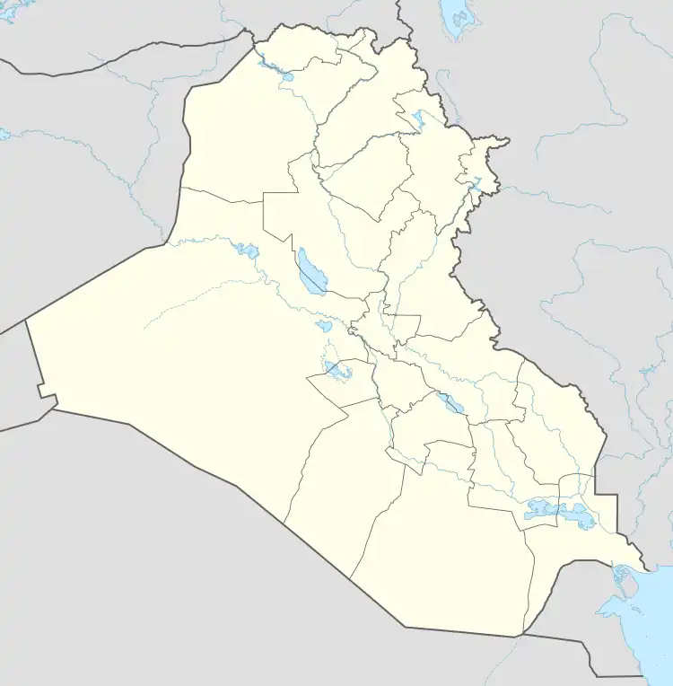
Zurbatiyah
Zurbatiyah (Arabic: زرباطية) is a city located in Wasit Governorate, Iraq and is a busy port of entry from Iran. It was previously inhabited by majority Arabs and minority Turkoman up until the late 20th century where Kurds now are a majority.[1][2] The Ottoman treaty of 1639 identifies three settlements as part of the ottoman empire, being Jassan, Badra and Zurbatiyah.[2] This arrangement left Zurbatiyah on the Ottoman side and rejected the Banu Lam's tenuous assertions to Bayat and Dehloran which split the Arab tribes living there. Feyli Kurds migrated during the 19th century under Safavid Iran.[3] Hursid pasha explains the heightened presence of Feyli Kurds was relatively recent as before the rule of Davud mamluk pasha, Baghdad's governors had oppressed the regions original Arab inhabitants, forcing them to sell land to the Feyli Kurd.
Zurbatiyah | |
|---|---|
 Zurbatiyah | |
| Coordinates: 33°09′0″N 46°03′0″E | |
| Country | |
| Governorate | Wasit |
| Municipality | Badra District |
| Population (2011) | |
| • Total | 22,400 |
Most of Zurbatiya and Badra were Sunni Shafi'i, with minority Shia Muslims.[4] Their language is unique, noted as being Turkish mixed with Arabic, Kurdish and Persian.[5] It is just across the border from Mehran, Ilam, in Iran. In 1982, there were approximately 6000 inhabitants.[6] In fact, of the settlements referred to in the 1639 Treaty, only Mendeli was a fairly important town, whereas Zurbatiya, Badrai (Badra), and Jassan were villages. Between these places and Muhammarah, they encountered only desert dotted lands.[2]
In the Badra - Zurbatiya area the salinity is generally higher than in the Mandali alluvial fan , usually up to 2-3 or even 4 g / L . This may be due to higher annual precipitation in the Mandali area ( almost 300 mm ) than in the Badra area.[7] The Zurbatiyah port of ref entry, east of Baghdad, is one of Iraq's busiest crossing points. Hundreds of Iranians, mainly pilgrims heading for the Shiite holy cities of Najaf and Karbala, cross the border on foot each day.[8] UAE, China awarded rights to develop oil in Iraq's northeast in 2018.[9]
History
During the 1980's, Iranian forces bombarded the two Iraqi townships of Khanagin and Zurbatiya with heavy artillery, forcing many of the Arab population to leave alongside Iraqi troops, advancing towards the borders instead.[10] Most of the small houses and buildings were destroyed as a result, leaving the town in ruins with only few Iranian Kurds living in these after migration from west Iran.[11] Following 2003 fall of iraq saw the largest influx of Feyli Kurds from Iran into the town as well as the Arab, Turkoman and minority Chechen population to migrate from Zurbatiyah.[12]
Climate
Baghdad is 169 kilometers from Zurbāţīyah, so the actual climate in Zurbāţīyah can vary a bit.
Based on weather reports collected during 2005–2015.[13]
All Year Climate & Weather Averages in Zurbāţīyah [14]
High Temp: 37 °C
Low Temp: -1 °C
Mean Temp: 17 °C
Precipitation: 39.2 mm
Humidity: 40%
Dew Point: 1 °C
Wind: 5 mph
Pressure: 1011 mbar
Visibility: 9 km
Geography
Gypsum rocks of Fatha Formation in Zurbatiyah area, eastern Iraq were studied in terms of mineralogy and petrography. Mineralogically, X-ray diffractometry results reveal that gypsum rocks are predominantly composed of gypsum minerals with minor amounts of calcite, anhydrite, basanite and dolomite minerals. Scanning electron microscopy has shown that gypsum rocks rich inclusion with (Mg) in some samples. Fatha gypsum rocks have higher thickness in the succession of formation with marl, clay and limestone forming multi cyclic deposition. The thickness of Fatha formation in the studied area reach to 525 m. Petrographically and textural analyses reveal the common petrographically texture types of gypsum, alabastrine, satin spar, selenite, porphyroblastic, blocky, and columnar gypsum texture reflect evolutionary alterations relationships such as crystallization and recrystallization of gypsum rocks. The secondary hydration of anhydrite to gypsum and other alteration changes refer to shallow marine, supra-tidal and continental environments to the Fatha Formation.[5]
See also
- Combat Outpost Shocker- U.S. Coalition base located in Zurbatiyah, Iraq.
References
- Yomtov, Nelson (2018). Iraq. ISBN 978-0-531-23590-4. OCLC 988580446.
- Ateş, Sabri (2013-10-21). Ottoman-Iranian Borderlands: Making a Boundary, 1843–1914. Cambridge University Press. ISBN 978-1-107-24508-2.
- "The Displacement of Kurds in Iraq", The Kurds in Iraq, Pluto Press, pp. 64–67, doi:10.2307/j.ctt18fs45h.14, retrieved 2022-10-25
- Haddad, Fanar (2020-03-15), "Sunni–Shi'a Relations", Understanding 'Sectarianism', Oxford University Press, pp. 167–216, doi:10.1093/oso/9780197510629.003.0006, ISBN 978-0-19-751062-9, retrieved 2022-10-25
- AL-hadadi, Ajel Swain Yaseen (2020-04-01). "Mineralogy and Petrography of Fatha gypsum rocks in Zurbatiyah area, eastern Iraq". Basra Journal of Science. 38 (2): 328–346. doi:10.29072/basjs.202029. ISSN 2664-8288. S2CID 251331272.
- Message of Revolution. Islamic Revolution Guards Corps.
- Jassim, Saad Z.; Goff, Jeremy C. (2006). Geology of Iraq. DOLIN, s.r.o., distributed by Geological Society of London. ISBN 978-80-7028-287-8.
- "U.S. Takes Battle Against Iraq Violence to Border". Washington Post. 2008-10-30. Retrieved 2009-09-07.
- "UAE, China awarded rights to develop oil in Iraq's northeast". Daily Sabah. Associated Press. 2018-04-26. Retrieved 2022-10-25.
- Nigeria: Bulletin on Foreign Affairs. Nigerian Institute of International Affairs. 1980.
- AMINPOUR, MARDIN, "Representation of the Iran-Iraq War in Kurdish Fiction", Moments of Silence, NYU Press, pp. 193–205, doi:10.2307/j.ctt1bj4sc8.14, retrieved 2022-10-25
- Sanderson, Thomas. Russian-Speaking Foreign Fighters in Iraq and Syria. OCLC 1019674661.
- "Zurbatiyah, IQ Weather In December 2010". tcktcktck.org. Retrieved 2022-10-25.
- "Climate & Weather Averages in Zurbāţīyah, Iraq". www.timeanddate.com. Retrieved 2022-10-25.