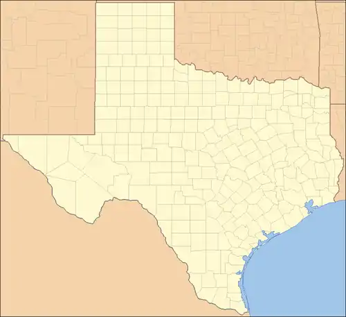
List of counties in Texas
The U.S. state of Texas is divided into 254 counties, more than any other U.S. state.[1] Over 20% of Texas counties are generally located within the Houston-Dallas—San Antonio—Austin areas, serving about 20,000,000 people, the majority of the state's population.
| Counties of Texas | |
|---|---|
 EP
HZ
CU
RV
JD
PS
BS
PC
TE
CX
VV
SU
ED
KY
UV
ZV
MV
DM
WB
DV
JH
ZP
SR
HG
QM
WY
KN
BK
JW
KL
NU
SP
LK
MC
LS
FR
ME
BX
AT
WN
KA
BE
GD
RF
AS
CL
VT
JK
LC
DW
GZ
GU
CM
KE
BN
RE
KR
GL
KM
MN
SL
IR
RG
UT
CR
WR
LV
WK
EC
MD
GC
ST
TG
CK
RN
CC
CN
MK
MS
SS
LL
BT
BC
HY
TV
CW
BP
FY
CD
WH
MG
FB
AU
WT
LE
BU
BZ
RT
MM
BL
FA
LT
ML
CV
LM
MI
BR
QC
HM
BQ
ER
SV
HD
JN
HI
EL
NV
FT
LN
MA
GM
WL
GV
CH
LB
MQ
WA
HO
TN
SJ
PK
HN
JF
OR
NW
JP
TL
AG
SA
SB
SY
NA
CE
AN
HE
KF
VN
RA
WD
UR
SM
GG
RK
PN
HS
MR
CS
BW
←MX
RR
TT
CP
FK↗
HP
DT→
LR
FN
HU
RW→
QL
GS
CO
DN
PR
WS
MU
CY
JC
PP
EA
SE
YN
AR
WC
WG
BY
TH
SF
CA
TA
JS
HK
KX
FD
HX
CI
CT
KG
SN
FS
NL
MH
SC
KT
DK
MY
HL
BI
FL
CB
GR
BD
HW
MT
AD
GA
DS
LY
LU
HA
SW
QS
LA
HQ
TY
YK
CQ
BA
PM
DF
RD
AM
DY
CG
WE
GY
CZ
PT
OL
HT
MO
HC
RB
HH
LP
OC
HF
SH
DA
| |
| Location | State of Texas |
| Number | 254 |
| Populations | 57 (Loving) – 4,728,030 (Harris) |
| Areas | 149 square miles (390 km2) (Rockwall) – 6,192 square miles (16,040 km2) (Brewster) |
| Government | |
| Subdivisions |
|
Texas was originally divided into municipalities (municipios in Spanish), a unit of local government under Spanish and Mexican rule. When the Republic of Texas gained its independence in 1836, the 23 municipalities became the original Texas counties. Many of these were later divided into new counties. The last county to be initially created was Kenedy County in 1921, but Loving County is the newest organized county; it was first organized in 1893 in an apparent scheme to defraud, abolished in 1897, then reorganized in 1931. Most of these recent counties, especially near the northwest, were created from Bexar County during the 1870s.[2][3][4]
Each county is run by a commissioners' court, consisting of four elected commissioners (one from each of four precincts drawn based on population) and a county judge elected from all the voters of the county. In smaller counties, the county judge actually does perform judicial duties, but in larger counties, the county judge functions as the county's chief executive officer. Certain officials, such as the sheriff and tax collector, are elected separately by the voters, but the commissioners' court determines their office budgets, and sets overall county policy. All county elections are partisan; the one exception is the board of trustees of the Dallas County department of education (the Harris County trustees were elected on a nonpartisan basis until 1984).[5]
While the counties have eminent domain power and control all unincorporated land within their boundaries, they have neither home-rule authority nor zoning power. The county is responsible for providing essential services (except for fire and ambulance, which are often supplied by volunteer fire departments). Unlike other US states, Texas does not allow for consolidated city-county governments. Cities and counties (as well as other political entities) are permitted to enter "interlocal agreements" to share services (as an example, a city and a school district may enter into agreements with the county whereby the county bills for and collects property taxes for the city and school district; thus, only one tax bill is sent instead of three).[6] School districts are independent of county and city government (with the exception of the Stafford Municipal School District, which is city controlled).
The Federal Information Processing Standard (FIPS) code, which is used by the United States government to uniquely identify states and counties, is provided with each entry.[7] Texas' code is 48, which when combined with any county code would be written in the form of 48XXX. The FIPS code for each county in the table links to census data for that county.
List
| County |
FIPS code[8] | County seat[9] | Est.[9] | Origin | Etymology | Population[10] | Area[9] | Map |
|---|---|---|---|---|---|---|---|---|
| Anderson County | 001 | Palestine | 1846 | Houston County | Kenneth Lewis Anderson (1805–1845), the last vice president of the Republic of Texas | 58,402 | 1,071 sq mi (2,774 km2) | 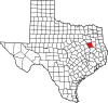 |
| Andrews County | 003 | Andrews | 1876 | Bexar County | Richard Andrews (1800–1835), the first Texan soldier to die in the Texas Revolution | 18,440 | 1,501 sq mi (3,888 km2) | 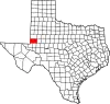 |
| Angelina County | 005 | Lufkin | 1846 | Nacogdoches County | A Hainai Native American woman who assisted early Spanish missionaries, whom they called "Little Angel" (Spanish: Angelina) | 86,506 | 802 sq mi (2,077 km2) | 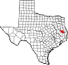 |
| Aransas County | 007 | Rockport | 1871 | Refugio County | Aransas Bay, named in turn for an early Spanish fort; this support was supposedly named in turn for a Spanish palace Aránzazu, possibly related to the Sanctuario de Aránzazu. (Arantzazu is Basque for "place of thorns") | 24,510 | 252 sq mi (653 km2) | 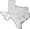 |
| Archer County | 009 | Archer City | 1858 | Fannin County | Branch Tanner Archer, a commissioner for the Republic of Texas | 8,681 | 910 sq mi (2,357 km2) | 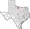 |
| Armstrong County | 011 | Claude | 1876 | Bexar County | One of several Texas pioneer families, although it is not certain which one | 1,839 | 914 sq mi (2,367 km2) |  |
| Atascosa County | 013 | Jourdanton | 1856 | Bexar County | The Spanish word for "boggy" | 49,939 | 1,232 sq mi (3,191 km2) | 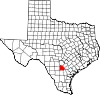 |
| Austin County | 015 | Bellville | 1836 | One of the original 23 counties | Stephen F. Austin (1793–1836), known as the Father of Texas | 30,380 | 653 sq mi (1,691 km2) |  |
| Bailey County | 017 | Muleshoe | 1876 | Bexar County | Peter James Bailey III, a soldier and defender of the Alamo | 6,835 | 827 sq mi (2,142 km2) | 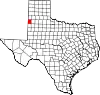 |
| Bandera County | 019 | Bandera | 1856 | Bexar County | Bandera Pass, named in turn for the Spanish word for "flag" | 21,565 | 792 sq mi (2,051 km2) | 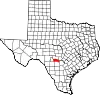 |
| Bastrop County | 021 | Bastrop | 1836 | One of the original 23 counties | Baron Felipe Enrique Neri de Bastrop, the Dutch settler who provided essential help to Stephen F. Austin in obtaining his original land grants | 102,058 | 888 sq mi (2,300 km2) | 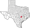 |
| Baylor County | 023 | Seymour | 1858 | Fannin County | Henry Weidner Baylor, a surgeon in the Texas Rangers during the Mexican–American War | 3,477 | 871 sq mi (2,256 km2) |  |
| Bee County | 025 | Beeville | 1857 | San Patricio County, Goliad County, Refugio County, Live Oak County, and Karnes County | Barnard Elliott Bee, Sr. (1787–1853), a secretary of state of the Republic of Texas | 30,924 | 880 sq mi (2,279 km2) | 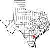 |
| Bell County | 027 | Belton | 1850 | Milam County | Peter Hansborough Bell, the third governor of Texas (1849–1853) | 379,617 | 1,059 sq mi (2,743 km2) |  |
| Bexar County | 029 | San Antonio | 1836 | One of the original 23 counties | San Antonio de Béxar, the major presidio in Mexican Texas, named in turn for the San Antonio River and the Spanish viceroy's family, who were Dukes of Béjar in Spain | 2,028,236 | 1,247 sq mi (3,230 km2) | 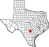 |
| Blanco County | 031 | Johnson City | 1858 | Burnet County, Comal County, Gillespie County and Hays County | The Blanco River. (Blanco is Spanish for "white") | 11,886 | 711 sq mi (1,841 km2) |  |
| Borden County | 033 | Gail | 1876 | Bexar County | Gail Borden, Jr. (1801–1874), businessman, publisher, surveyor, and inventor of condensed milk | 617 | 899 sq mi (2,328 km2) |  |
| Bosque County | 035 | Meridian | 1854 | McLennan County | The Bosque River. (Bosque is Spanish for "wooded") | 18,503 | 989 sq mi (2,561 km2) |  |
| Bowie County | 037 | New Boston | 1840 | Red River County | James Bowie (1796–1836), the legendary knife fighter who died at the Battle of the Alamo | 92,581 | 888 sq mi (2,300 km2) | 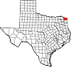 |
| Brazoria County | 039 | Angleton | 1836 | One of the original 23 counties | Brazoria, Texas, an early port on the Brazos River | 379,689 | 1,387 sq mi (3,592 km2) |  |
| Brazos County | 041 | Bryan | 1841 | Washington County. Named Navasota County until 1842 | The Brazos River | 237,032 | 586 sq mi (1,518 km2) |  |
| Brewster County | 043 | Alpine | 1887 | Presidio County | Henry Percy Brewster (1816–1884), a secretary of war for the Republic of Texas and soldier in the Civil War | 9,450 | 6,193 sq mi (16,040 km2) | 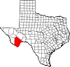 |
| Briscoe County | 045 | Silverton | 1876 | Bexar County | Andrew Briscoe (1810–1849), a signatory of the Texan Declaration of Independence and soldier during the Texan Revolution | 1,403 | 900 sq mi (2,331 km2) |  |
| Brooks County | 047 | Falfurrias | 1911 | Starr County | James Abijah Brooks, a Texas Ranger and state legislator | 6,994 | 943 sq mi (2,442 km2) | 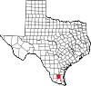 |
| Brown County | 049 | Brownwood | 1856 | Comanche County and Travis County | Henry Stevenson Brown, a commander at the Battle of Velasco | 38,192 | 944 sq mi (2,445 km2) |  |
| Burleson County | 051 | Caldwell | 1846 | Milam County | Edward Burleson (1798–1851), a general of the Texas Revolution and Vice President of the Republic of Texas | 18,051 | 666 sq mi (1,725 km2) |  |
| Burnet County | 053 | Burnet | 1852 | Bell County, Travis County and Williamson County | David Gouverneur Burnet, the first president of the Republic of Texas (1836) | 50,954 | 995 sq mi (2,577 km2) | 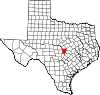 |
| Caldwell County | 055 | Lockhart | 1848 | Bastrop County and Gonzales County | Mathew Caldwell, a signer of the Texas Declaration of Independence and soldier during the Texas Revolution | 46,791 | 546 sq mi (1,414 km2) |  |
| Calhoun County | 057 | Port Lavaca | 1846 | Jackson County, Matagorda County and Victoria County | John C. Calhoun, the seventh vice president of the United States (1825–1832) | 19,727 | 512 sq mi (1,326 km2) |  |
| Callahan County | 059 | Baird | 1858 | Bexar County, Bosque County, and Travis County | James Hughes Callahan, a soldier during the Texas Revolution | 14,115 | 899 sq mi (2,328 km2) |  |
| Cameron County | 061 | Brownsville | 1848 | Nueces County and lands ceded by Mexico | Ewen Cameron, a soldier during the Texas Revolution killed during the Black Bean Episode | 423,029 | 906 sq mi (2,347 km2) |  |
| Camp County | 063 | Pittsburg | 1874 | Upshur County | John Lafayette Camp (1828–1891), a Texas state senator | 12,616 | 198 sq mi (513 km2) |  |
| Carson County | 065 | Panhandle | 1876 | Bexar County | Samuel Price Carson, the first secretary of state of the Republic of Texas (1836–1838) | 5,746 | 923 sq mi (2,391 km2) |  |
| Cass County | 067 | Linden | 1846 | Bowie County | Lewis Cass (1782–1866), a senator from Michigan, who had favored the annexation of Texas to the United States. Named Davis County 1861-1871 |
28,560 | 938 sq mi (2,429 km2) |  |
| Castro County | 069 | Dimmitt | 1876 | Bexar County | Henri Castro (1786–1865), a French consul general for the Republic of Texas and founder of a colony in Texas | 7,374 | 898 sq mi (2,326 km2) |  |
| Chambers County | 071 | Anahuac | 1858 | Jefferson County and Liberty County | Thomas Jefferson Chambers, lawyer and surveyor who helped to resolve land disputes for Americans in Mexican Texas | 48,865 | 599 sq mi (1,551 km2) | 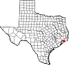 |
| Cherokee County | 073 | Rusk | 1846 | Nacogdoches County | The Cherokee Native American tribe | 51,097 | 1,052 sq mi (2,725 km2) |  |
| Childress County | 075 | Childress | 1876 | Bexar County | George Campbell Childress (1804–1841), one of the authors of the Texas Declaration of Independence | 6,736 | 710 sq mi (1,839 km2) | 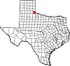 |
| Clay County | 077 | Henrietta | 1857 | Cooke County | Henry Clay, U.S. Senator from Kentucky and ninth secretary of state of the United States (1825–1829) | 10,263 | 1,098 sq mi (2,844 km2) |  |
| Cochran County | 079 | Morton | 1876 | Bexar County | Robert E. Cochran (1810–1836), a defender of the Alamo | 2,516 | 775 sq mi (2,007 km2) |  |
| Coke County | 081 | Robert Lee | 1889 | Tom Green County | Richard Coke, the 15th governor of Texas (1874–1876) | 3,321 | 899 sq mi (2,328 km2) | 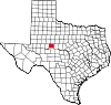 |
| Coleman County | 083 | Coleman | 1858 | Brown County and Travis County | Robert M. Coleman, a signer of the Texas Declaration of Independence and soldier at the Battle of San Jacinto | 7,735 | 1,273 sq mi (3,297 km2) |  |
| Collin County | 085 | McKinney | 1846 | Fannin County | Collin McKinney (1766–1861), an author of the Texas Declaration of Independence and the oldest person to sign it | 1,109,462 | 848 sq mi (2,196 km2) |  |
| Collingsworth County | 087 | Wellington | 1876 | Bexar County | James Collinsworth, a signer of the Texas Declaration of Independence and first chief justice of the Republic of Texas. (spelling differs due to an error in the bill creating the county) | 2,615 | 919 sq mi (2,380 km2) |  |
| Colorado County | 089 | Columbus | 1836 | One of the original 23 counties | The Colorado River of Texas (Colorado is Spanish for "colored") |
20,630 | 963 sq mi (2,494 km2) | 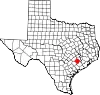 |
| Comal County | 091 | New Braunfels | 1846 | Bexar County | The Comal River. (Comal is Spanish for "basin") | 174,986 | 562 sq mi (1,456 km2) |  |
| Comanche County | 093 | Comanche | 1856 | Bosque County and Coryell County | The Comanche Native American tribe | 13,775 | 938 sq mi (2,429 km2) |  |
| Concho County | 095 | Paint Rock | 1858 | Bexar County | The Concho River. (Concho is Spanish for "shell") | 3,341 | 992 sq mi (2,569 km2) |  |
| Cooke County | 097 | Gainesville | 1848 | Fannin County | William Gordon Cooke, a soldier during the Texas Revolution | 42,244 | 874 sq mi (2,264 km2) |  |
| Coryell County | 099 | Gatesville | 1854 | Bell County | James Coryell, a frontiersman and Texas Ranger who was killed by Native Americans | 84,232 | 1,052 sq mi (2,725 km2) |  |
| Cottle County | 101 | Paducah | 1876 | Fannin County | George Washington Cottle, who died defending the Alamo | 1,381 | 901 sq mi (2,334 km2) |  |
| Crane County | 103 | Crane | 1887 | Tom Green County | William Carey Crane, a president of Baylor University | 4,680 | 786 sq mi (2,036 km2) |  |
| Crockett County | 105 | Ozona | 1875 | Bexar County | David Crockett (1786–1836), the legendary frontiersman who died at the Battle of the Alamo | 3,068 | 2,808 sq mi (7,273 km2) |  |
| Crosby County | 107 | Crosbyton | 1876 | Bexar County | Stephen Crosby, a Texas Land Commissioner | 5,106 | 900 sq mi (2,331 km2) |  |
| Culberson County | 109 | Van Horn | 1911 | El Paso County | David Browning Culberson, a lawyer, U.S. Congressman, and soldier in the Civil War | 2,193 | 3,813 sq mi (9,876 km2) | 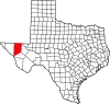 |
| Dallam County | 111 | Dalhart | 1876 | Bexar County | James Wilmer Dallam, a lawyer and newspaper publisher who had a close association with the Supreme Court of Texas | 7,172 | 1,505 sq mi (3,898 km2) | 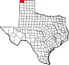 |
| Dallas County | 113 | Dallas | 1846 | Nacogdoches County and Robertson County | George Mifflin Dallas, the eleventh vice president of the United States (1845–1849) (Disputed) |
2,586,050 | 880 sq mi (2,279 km2) |  |
| Dawson County | 115 | Lamesa | 1876 | Bexar County | Nicholas Mosby Dawson, a soldier of the Texan Revolution and victim of the Dawson Massacre | 12,413 | 902 sq mi (2,336 km2) |  |
| Deaf Smith County | 117 | Hereford | 1876 | Bexar County | Erastus "Deaf" Smith (1787–1837), a scout during the Texan Revolution | 18,329 | 1,497 sq mi (3,877 km2) |  |
| Delta County | 119 | Cooper | 1870 | Hopkins County and Lamar County | Its triangular shape, much like the Greek letter Delta | 5,392 | 277 sq mi (717 km2) |  |
| Denton County | 121 | Denton | 1846 | Fannin County | John Bunyan Denton (1806–1841), a preacher, lawyer, and soldier killed during a raid on a Native American camp | 941,647 | 888 sq mi (2,300 km2) |  |
| DeWitt County | 123 | Cuero | 1846 | Goliad County, Gonzales County and Victoria County | Green DeWitt, an empresario who founded an early colony in Texas | 19,918 | 909 sq mi (2,354 km2) |  |
| Dickens County | 125 | Dickens | 1876 | Bexar County | J.A. Dickens, who died at the Battle of the Alamo | 1,740 | 904 sq mi (2,341 km2) | 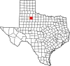 |
| Dimmit County | 127 | Carrizo Springs | 1858 | Bexar County, Maverick County, Uvalde County and Webb County | Philip Dimmitt, a major figure in the Texas Revolution | 8,473 | 1,331 sq mi (3,447 km2) | 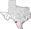 |
| Donley County | 129 | Clarendon | 1876 | Bexar County | Stockton P. Donley, a frontier lawyer and Texas Supreme Court justice | 3,268 | 930 sq mi (2,409 km2) | 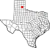 |
| Duval County | 131 | San Diego | 1858 | Live Oak County, Nueces County and Starr County | Burr Harrison DuVal (1809–1836), a soldier in the Texas Revolution who died in the Goliad Massacre | 9,756 | 1,793 sq mi (4,644 km2) | 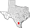 |
| Eastland County | 133 | Eastland | 1858 | Bosque County, Coryell County and Travis County | William Mosby Eastland, a soldier during the Texas Revolution | 17,864 | 926 sq mi (2,398 km2) |  |
| Ector County | 135 | Odessa | 1887 | Tom Green County | Mathew Ector (1822–1879), a Confederate general during the Civil War | 161,091 | 901 sq mi (2,334 km2) |  |
| Edwards County | 137 | Rocksprings | 1858 | Bexar County | Haden Edwards (1771–1849), empresario and filibuster who led the Fredonian Rebellion | 1,438 | 2,120 sq mi (5,491 km2) | 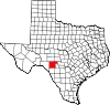 |
| Ellis County | 139 | Waxahachie | 1849 | Navarro County | Richard Ellis (1781–1846), president of the convention that produced the Texas Declaration of Independence | 202,678 | 940 sq mi (2,435 km2) |  |
| El Paso County | 141 | El Paso | 1848 | Santa Fe County | Neighboring Ciudad Juárez, Mexico, formerly called El Paso del Norte as it served as the pass north from central Mexico to the settlements of New Mexico | 867,947 | 1,013 sq mi (2,624 km2) | 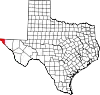 |
| Erath County | 143 | Stephenville | 1856 | Bosque County and Coryell County | George Bernard Erath, an early surveyor and a soldier at the Battle of San Jacinto | 43,378 | 1,086 sq mi (2,813 km2) |  |
| Falls County | 145 | Marlin | 1850 | Limestone County and Milam County | The Falls on the Brazos | 17,313 | 769 sq mi (1,992 km2) | 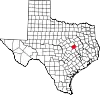 |
| Fannin County | 147 | Bonham | 1837 | Red River County | James Walker Fannin, Jr. (1805–1836), the commander of the Texans killed in the Goliad Massacre | 36,569 | 892 sq mi (2,310 km2) | 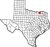 |
| Fayette County | 149 | La Grange | 1837 | Bastrop County | Gilbert du Motier, marquis de La Fayette (1757–1834), the French-born general and hero of the American Revolutionary War | 24,687 | 950 sq mi (2,460 km2) | 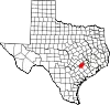 |
| Fisher County | 151 | Roby | 1876 | Bexar County | Samuel Rhoads Fisher (1794–1839), a signer of the Texas Declaration of Independence and secretary of the Navy under the Republic of Texas | 3,706 | 901 sq mi (2,334 km2) |  |
| Floyd County | 153 | Floydada | 1876 | Bexar County | Dolphin Ward Floyd, who died defending the Alamo | 5,350 | 992 sq mi (2,569 km2) |  |
| Foard County | 155 | Crowell | 1891 | Cottle County, Hardeman County, King County and Knox County | Robert Levi Foard, an attorney and Confederate major in the Civil War | 1,080 | 707 sq mi (1,831 km2) |  |
| Fort Bend County | 157 | Richmond | 1837 | Austin County, Brazoria County and Harris County | A blockhouse positioned in a bend of the Brazos River | 858,527 | 875 sq mi (2,266 km2) |  |
| Franklin County | 159 | Mount Vernon | 1875 | Titus County | Benjamin Cromwell Franklin (1805–1873), a judge and Texas State Senator | 10,464 | 286 sq mi (741 km2) |  |
| Freestone County | 161 | Fairfield | 1850 | Limestone County | A type of peach grown in the area[11] | 19,774 | 885 sq mi (2,292 km2) | 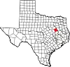 |
| Frio County | 163 | Pearsall | 1858 | Atascosa County, Bexar County and Uvalde County | The Frio River (Frío is Spanish for "cold") |
18,436 | 1,133 sq mi (2,934 km2) |  |
| Gaines County | 165 | Seminole | 1876 | Bexar County | James Gaines, merchant and signer of the Texas Declaration of Independence | 21,895 | 1,502 sq mi (3,890 km2) | 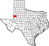 |
| Galveston County | 167 | Galveston | 1838 | Brazoria County, Harris County and Liberty County | Bernardo de Gálvez, Spanish governor of the Louisiana Territory (1777–1785) | 355,062 | 399 sq mi (1,033 km2) |  |
| Garza County | 169 | Post | 1876 | Bexar County | José Antonio de la Garza, pioneering settler and first Mayor of San Antonio | 5,863 | 896 sq mi (2,321 km2) |  |
| Gillespie County | 171 | Fredericksburg | 1848 | Bexar County and Travis County | Robert Addison Gillespie, a merchant, Mexican–American War soldier, and Texas Ranger | 27,297 | 1,061 sq mi (2,748 km2) |  |
| Glasscock County | 173 | Garden City | 1887 | Tom Green County | George Washington Glasscock (1810–1868), an early Texian settler, businessman, soldier, and state representative | 1,149 | 901 sq mi (2,334 km2) | 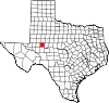 |
| Goliad County | 175 | Goliad | 1836 | One of the original 23 counties | Its county seat, named in turn as an anagram of Miguel Hidalgo, the inspirational figure behind the Mexican War of Independence | 7,163 | 854 sq mi (2,212 km2) | 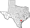 |
| Gonzales County | 177 | Gonzales | 1836 | One of the original 23 counties | Its county seat, named in turn for Coahuila y Tejas governor Rafael Gonzales | 19,641 | 1,068 sq mi (2,766 km2) | 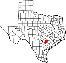 |
| Gray County | 179 | Pampa | 1876 | Bexar County | Peter W. Gray (1819–1874), a lawyer, state senator, and soldier in the Civil War | 21,030 | 928 sq mi (2,404 km2) | 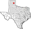 |
| Grayson County | 181 | Sherman | 1846 | Fannin County | Peter Wagener Grayson, an attorney general of the Republic of Texas | 139,336 | 934 sq mi (2,419 km2) | 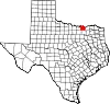 |
| Gregg County | 183 | Longview | 1873 | Upshur County | John Gregg (1828–1864), a Confederate general during the Civil War | 124,201 | 274 sq mi (710 km2) |  |
| Grimes County | 185 | Anderson | 1846 | Montgomery County | Jesse Grimes (1788–1866), a signer of the Texas Declaration of Independence and early settler of the future county | 30,287 | 794 sq mi (2,056 km2) |  |
| Guadalupe County | 187 | Seguin | 1846 | Bexar County and Gonzales County | The Guadalupe River, named in turn for the Mexican spiritual icon Our Lady of Guadalupe | 177,036 | 711 sq mi (1,841 km2) | 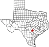 |
| Hale County | 189 | Plainview | 1876 | Bexar County | John C. Hale, a lieutenant killed in action at the Battle of San Jacinto | 32,220 | 1,005 sq mi (2,603 km2) | 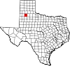 |
| Hall County | 191 | Memphis | 1876 | Bexar County | Warren DeWitt Clinton Hall, a secretary of war for the Republic of Texas (1836) | 2,845 | 903 sq mi (2,339 km2) | 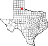 |
| Hamilton County | 193 | Hamilton | 1856 | Bosque County, Comanche County and Lampasas County | James Hamilton Jr., governor of South Carolina (1830–1832) who gave financial aid to the Republic of Texas | 8,229 | 836 sq mi (2,165 km2) | 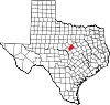 |
| Hansford County | 195 | Spearman | 1876 | Bexar County | John M. Hansford, a Texas state representative and judge | 5,159 | 920 sq mi (2,383 km2) | 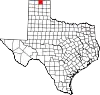 |
| Hardeman County | 197 | Quanah | 1858 | Fannin County | Bailey Hardeman, the first secretary of the treasury for the Republic of Texas, and his brother Thomas Jones Hardeman, state representative and judge | 3,552 | 695 sq mi (1,800 km2) | 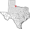 |
| Hardin County | 199 | Kountze | 1858 | Jefferson County and Liberty County | The Hardin family, earliest settlers of Liberty County | 56,973 | 894 sq mi (2,315 km2) |  |
| Harris County | 201 | Houston | 1836 | One of the original 23 counties | John Richardson Harris, early settler and founder of Harrisburg, Texas, which eventually became known as Houston Named Harrisburg County until 1839 |
4,728,030 | 1,729 sq mi (4,478 km2) | 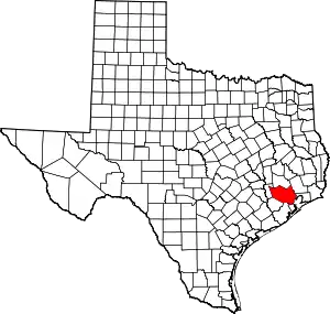 |
| Harrison County | 203 | Marshall | 1839 | Shelby County | Jonas Harrison, a lawyer and soldier in the Texas Revolution | 69,150 | 899 sq mi (2,328 km2) |  |
| Hartley County | 205 | Channing | 1876 | Bexar County | Oliver C. and Rufus K. Hartley, brothers and original reporters for the Texas Supreme Court | 5,397 | 1,462 sq mi (3,787 km2) |  |
| Haskell County | 207 | Haskell | 1858 | Fannin County and Milam County | Charles Ready Haskell, Texas revolutionary soldier killed in the Goliad Massacre | 5,411 | 903 sq mi (2,339 km2) |  |
| Hays County | 209 | San Marcos | 1848 | Travis County | John Coffee Hays (1817–1883), a leading Texas Ranger and Mexican–American War officer | 255,397 | 678 sq mi (1,756 km2) |  |
| Hemphill County | 211 | Canadian | 1876 | Bexar County | John Hemphill (1803–1862), U.S. Senator and Chief Justice of the Texas Supreme Court | 3,271 | 910 sq mi (2,357 km2) |  |
| Henderson County | 213 | Athens | 1846 | Houston County and Nacogdoches County | James Pinckney Henderson, the first governor of Texas (1846–1847) | 83,667 | 874 sq mi (2,264 km2) |  |
| Hidalgo County | 215 | Edinburg | 1852 | Cameron County | Miguel Hidalgo y Costilla (1753–1811), the priest who raised the call for Mexico's independence from Spain | 880,356 | 1,569 sq mi (4,064 km2) |  |
| Hill County | 217 | Hillsboro | 1853 | Navarro County | George Washington Hill, a secretary of war and secretary of the navy under the Republic of Texas | 36,471 | 962 sq mi (2,492 km2) |  |
| Hockley County | 219 | Levelland | 1876 | Bexar County | George Washington Hockley (1802–1854), Chief of Staff of the Texas Army during the Texas Revolution and secretary of war of the Republic of Texas | 21,363 | 908 sq mi (2,352 km2) |  |
| Hood County | 221 | Granbury | 1866 | Johnson County | John Bell Hood (1831–1879), a Confederate lieutenant general and the commander of Hood's Texas Brigade | 64,222 | 422 sq mi (1,093 km2) |  |
| Hopkins County | 223 | Sulphur Springs | 1846 | Lamar County and Nacogdoches County | David Hopkins, an early settler in the future county | 37,211 | 785 sq mi (2,033 km2) |  |
| Houston County | 225 | Crockett | 1837 | Nacogdoches County | Sam Houston (1793–1863), general of the Texan Revolution, commander at the Battle of San Jacinto and later president of the Republic of Texas, U.S. Senator and governor of the state of Texas | 22,241 | 1,231 sq mi (3,188 km2) |  |
| Howard County | 227 | Big Spring | 1876 | Bexar County | Volney Eskine Howard, U.S. Representative from Texas (1849–1853) | 34,128 | 903 sq mi (2,339 km2) | 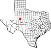 |
| Hudspeth County | 229 | Sierra Blanca | 1917 | El Paso County | Claude Benton Hudspeth, a U.S. Congressman (1919–1931), rancher, and newspaper publisher | 3,287 | 4,571 sq mi (11,839 km2) | 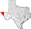 |
| Hunt County | 231 | Greenville | 1846 | Fannin County and Nacogdoches County | Memucan Hunt, Jr. (1807–1856), a secretary of the navy under the Republic of Texas | 103,394 | 841 sq mi (2,178 km2) | 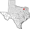 |
| Hutchinson County | 233 | Stinnett | 1876 | Bexar County | Andrew Hutchinson, an early settler and attorney | 20,495 | 887 sq mi (2,297 km2) | 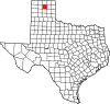 |
| Irion County | 235 | Mertzon | 1889 | Tom Green County | Robert Anderson Irion (1804–1861), a secretary of state in the Republic of Texas | 1,552 | 1,052 sq mi (2,725 km2) |  |
| Jack County | 237 | Jacksboro | 1856 | Cooke County | Patrick and William Jack, brothers, participants in the Anahuac Disturbance, and veterans of the Texas Revolution | 8,712 | 917 sq mi (2,375 km2) |  |
| Jackson County | 239 | Edna | 1836 | One of the original 23 counties | Andrew Jackson, hero of the Battle of New Orleans and the seventh president of the United States (1829–1837) | 15,121 | 830 sq mi (2,150 km2) |  |
| Jasper County | 241 | Jasper | 1836 | One of the original 23 counties | William Jasper (1750–1779), an American Revolutionary War hero | 32,975 | 938 sq mi (2,429 km2) | 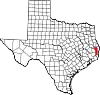 |
| Jeff Davis County | 243 | Fort Davis | 1887 | Presidio County | Jefferson Davis, president of the Confederate States of America (1861–1865) | 1,949 | 2,265 sq mi (5,866 km2) | 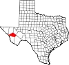 |
| Jefferson County | 245 | Beaumont | 1836 | One of the original 23 counties | Thomas Jefferson, the third president of the United States and the principal author of the Declaration of Independence (1801–1809) | 253,704 | 904 sq mi (2,341 km2) | 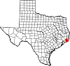 |
| Jim Hogg County | 247 | Hebbronville | 1913 | Brooks County and Duval County | James Stephen Hogg, the twentieth (and first native-born) governor of Texas (1891–1895) | 4,801 | 1,136 sq mi (2,942 km2) |  |
| Jim Wells County | 249 | Alice | 1911 | Nueces County | James Babbage Wells Jr., judge and Democratic party boss in southern Texas | 38,847 | 865 sq mi (2,240 km2) | 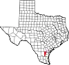 |
| Johnson County | 251 | Cleburne | 1854 | Ellis County, Hill County and Navarro County | Middleton Tate Johnson, a Texas Ranger, soldier in the Mexican–American War, and senator for the Republic of Texas | 187,280 | 729 sq mi (1,888 km2) |  |
| Jones County | 253 | Anson | 1854 | Bexar County and Bosque County | Anson Jones, the fifth president of the Republic of Texas (1844–1846) | 19,873 | 931 sq mi (2,411 km2) |  |
| Karnes County | 255 | Karnes City | 1854 | Bexar County, DeWitt County, Goliad County, Gonzales County and San Patricio County | Henry Karnes (1812–1840), a soldier in the Texas Revolution | 14,754 | 750 sq mi (1,942 km2) | 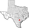 |
| Kaufman County | 257 | Kaufman | 1848 | Henderson County | David Spangler Kaufman, a Jewish Texas state senator and the second Jewish member of the United States House of Representatives | 157,768 | 786 sq mi (2,036 km2) |  |
| Kendall County | 259 | Boerne | 1862 | Blanco County and Kerr County | George Wilkins Kendall, an early journalist and sheep rancher who gained national fame as a war correspondent during the Mexican–American War | 46,788 | 662 sq mi (1,715 km2) |  |
| Kenedy County | 261 | Sarita | 1921 | Hidalgo County and Willacy County (Due to a reorganization of Willacy County) | Mifflin Kenedy, an early rancher and land speculator | 340 | 1,457 sq mi (3,774 km2) | 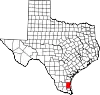 |
| Kent County | 263 | Jayton | 1876 | Bexar County | Andrew Kent, who died at the Battle of the Alamo | 749 | 902 sq mi (2,336 km2) |  |
| Kerr County | 265 | Kerrville | 1856 | Bexar County | James Kerr (1790–1850), an early colonist in Texas and soldier in the Texas Revolution | 53,161 | 1,106 sq mi (2,865 km2) | 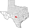 |
| Kimble County | 267 | Junction | 1858 | Bexar County | George C. Kimbell, who died at the Battle of the Alamo (spelling differs due to an error in the bill creating the county) | 4,365 | 1,251 sq mi (3,240 km2) | 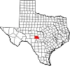 |
| King County | 269 | Guthrie | 1876 | Bexar County | William Phillip King, who died at the Battle of the Alamo | 258 | 912 sq mi (2,362 km2) | 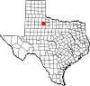 |
| Kinney County | 271 | Brackettville | 1850 | Bexar County | Henry Lawrence Kinney, a Texas state senator and unsuccessful land speculator | 3,130 | 1,364 sq mi (3,533 km2) | 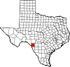 |
| Kleberg County | 273 | Kingsville | 1913 | Nueces County | Robert Justus Kleberg (1803–1888), an early German settler and soldier at the Battle of San Jacinto | 30,635 | 871 sq mi (2,256 km2) | 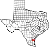 |
| Knox County | 275 | Benjamin | 1858 | Bexar County | Henry Knox, the first secretary of war of the United States (1785–1794) | 3,351 | 854 sq mi (2,212 km2) |  |
| Lamar County | 277 | Paris | 1840 | Red River County | Mirabeau Buonaparte Lamar, the third president of the Republic of Texas (1838–1842) | 50,098 | 917 sq mi (2,375 km2) |  |
| Lamb County | 279 | Littlefield | 1876 | Bexar County | George A. Lamb, who died at the Battle of San Jacinto | 12,898 | 1,016 sq mi (2,631 km2) |  |
| Lampasas County | 281 | Lampasas | 1856 | Bell County, Coryell County and Travis County | The Lampasas River (Lampasas is Spanish for "lilies") |
22,252 | 712 sq mi (1,844 km2) | 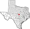 |
| La Salle County | 283 | Cotulla | 1858 | Bexar County | René Robert Cavelier, Sieur de La Salle (1643–1687), the French explorer who traveled through Texas | 6,670 | 1,489 sq mi (3,856 km2) |  |
| Lavaca County | 285 | Hallettsville | 1842 | Colorado County, Fayette County, Gonzales County, Jackson County and Victoria County Named La Buca County until 1846 | The Lavaca River (La vaca is Spanish for "the cow") |
20,544 | 970 sq mi (2,512 km2) | 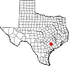 |
| Lee County | 287 | Giddings | 1874 | Bastrop County, Burleson County, Fayette County and Washington County | Robert Edward Lee (1807–1870), the commanding general of the Confederate forces during the Civil War | 17,706 | 629 sq mi (1,629 km2) |  |
| Leon County | 289 | Centerville | 1846 | Robertson County | Disputed: Either Mexican empresario Martín De León, who founded Victoria, Texas; or the león, a local variety of yellow wolf |
15,959 | 1,072 sq mi (2,776 km2) | 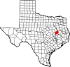 |
| Liberty County | 291 | Liberty | 1836 | One of the original 23 counties | Its county seat, which was named either for the recent success of the Mexican War of Independence or for Liberty, Mississippi | 97,621 | 1,160 sq mi (3,004 km2) | 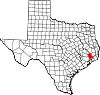 |
| Limestone County | 293 | Groesbeck | 1846 | Robertson County | The limestone deposits in the region | 22,119 | 909 sq mi (2,354 km2) | 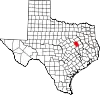 |
| Lipscomb County | 295 | Lipscomb | 1876 | Bexar County | Abner Smith Lipscomb, justice of the Texas Supreme Court (1846–1856) and secretary of state of the Republic of Texas (1840) | 2,931 | 932 sq mi (2,414 km2) | 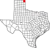 |
| Live Oak County | 297 | George West | 1856 | Nueces County and San Patricio County | The Texas live oak tree under which the petition for a new county was signed | 11,377 | 1,036 sq mi (2,683 km2) |  |
| Llano County | 299 | Llano | 1856 | Bexar County, Gillespie County | The Llano River (Llano is Spanish for "plains") |
21,978 | 935 sq mi (2,422 km2) |  |
| Loving County | 301 | Mentone | 1887 | Tom Green County (1891) Reeves County (1931) | Oliver Loving (1812–1867), a cattle rancher and pioneer of the cattle drive who, with Charles Goodnight, developed the Goodnight–Loving Trail | 57 | 673 sq mi (1,743 km2) | 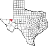 |
| Lubbock County | 303 | Lubbock | 1876 | Bexar County | Thomas Saltus Lubbock (1817–1862), a Texas Ranger and Confederate colonel during the Civil War | 314,451 | 900 sq mi (2,331 km2) | 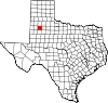 |
| Lynn County | 305 | Tahoka | 1876 | Bexar County | William Lynn, a soldier in the Texas Revolution from Massachusetts who is believed to have died defending the Alamo | 5,688 | 892 sq mi (2,310 km2) |  |
| McCulloch County | 307 | Brady | 1856 | Bexar County | Benjamin McCulloch (1811–1862), veteran of San Jacinto, Texas Ranger, and Confederate general | 7,533 | 1,069 sq mi (2,769 km2) |  |
| McLennan County | 309 | Waco | 1850 | Limestone County and Milam County | Neil McLennan, an early settler in the future county | 263,115 | 1,042 sq mi (2,699 km2) | 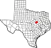 |
| McMullen County | 311 | Tilden | 1858 | Atascosa County, Bexar County and Live Oak County | John McMullen (1832–1883), an Irish-born empresario in Texas | 608 | 1,113 sq mi (2,883 km2) | 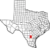 |
| Madison County | 313 | Madisonville | 1853 | Grimes County, Leon County and Walker County | James Madison, the fourth president of the United States (1809–1817) | 13,718 | 470 sq mi (1,217 km2) | 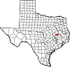 |
| Marion County | 315 | Jefferson | 1860 | Cass County | Francis Marion (1732–1795), American Revolutionary War general | 9,645 | 381 sq mi (987 km2) |  |
| Martin County | 317 | Stanton | 1876 | Bexar County | Wylie Martin, a Texas Revolutionary soldier and legislative representative for the Republic of Texas | 5,211 | 915 sq mi (2,370 km2) |  |
| Mason County | 319 | Mason | 1858 | Gillespie County | Fort Mason, which was named for either Lt. George T. Mason, killed during the Mexican–American War in fighting near Brownsville, or for Gen. Richard Barnes Mason, military governor of California | 3,943 | 932 sq mi (2,414 km2) |  |
| Matagorda County | 321 | Bay City | 1836 | One of the original 23 counties | The canebrakes which once grew along the coast (Mata gorda is Spanish for "fat bush") |
36,344 | 1,114 sq mi (2,885 km2) |  |
| Maverick County | 323 | Eagle Pass | 1856 | Kinney County | Samuel Augustus Maverick (1803–1870), a rancher, signer of the Texas Declaration of Independence, and representative in the Republic of Texas legislature | 58,056 | 1,280 sq mi (3,315 km2) |  |
| Medina County | 325 | Hondo | 1848 | Bexar County | The Medina River, named for Spanish engineer Pedro de Medina | 51,981 | 1,328 sq mi (3,440 km2) |  |
| Menard County | 327 | Menard | 1858 | Bexar County | Michel Branamour Menard, the founder of Galveston, Texas | 1,982 | 902 sq mi (2,336 km2) |  |
| Midland County | 329 | Midland | 1885 | Tom Green County | Its county seat, which was named for its location halfway between Fort Worth and El Paso on the Texas and Pacific Railway (and "Midway, Texas", being already in use) | 167,969 | 900 sq mi (2,331 km2) |  |
| Milam County | 331 | Cameron | 1836 | One of the original 23 counties | Benjamin Rush Milam (1788–1835), an early Texas colonizer and soldier in the Texas Revolution | 25,106 | 1,017 sq mi (2,634 km2) | 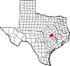 |
| Mills County | 333 | Goldthwaite | 1887 | Brown County, Comanche County, Hamilton County and Lampasas County | John T. Mills (1817–1871), a Texas Supreme Court judge | 4,480 | 748 sq mi (1,937 km2) |  |
| Mitchell County | 335 | Colorado City | 1876 | Bexar County | Asa and Eli Mitchell, two early settlers and soldiers in the Texas Revolution | 9,070 | 910 sq mi (2,357 km2) | 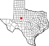 |
| Montague County | 337 | Montague | 1857 | Cooke County | Daniel Montague, a state senator and early surveyor in the future county | 20,409 | 931 sq mi (2,411 km2) |  |
| Montgomery County | 339 | Conroe | 1837 | Washington County | Montgomery, Texas, which was named for Montgomery County, Alabama, which was named for Major Lemuel P. Montgomery, Sam Houston's commanding officer in the Battle of Horseshoe Bend (1814) | 648,886 | 1,044 sq mi (2,704 km2) |  |
| Moore County | 341 | Dumas | 1876 | Bexar County | Edwin Ward Moore (1810–1865), commodore of the Texan Navy | 21,118 | 900 sq mi (2,331 km2) |  |
| Morris County | 343 | Daingerfield | 1875 | Titus County | William Wright Morris, a planter and state legislator | 12,030 | 254 sq mi (658 km2) | 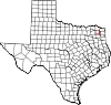 |
| Motley County | 345 | Matador | 1876 | Bexar County | Junius William Mottley, a signer of the Texas Declaration of Independence | 1,067 | 989 sq mi (2,561 km2) | 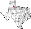 |
| Nacogdoches County | 347 | Nacogdoches | 1836 | One of the original 23 counties | Its county seat, which was named for the Nacogdoche Native American tribe | 64,668 | 947 sq mi (2,453 km2) | 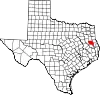 |
| Navarro County | 349 | Corsicana | 1846 | Robertson County | José Antonio Navarro (1795–1871), a leading Tejano participant in the Texan Revolution and signer of the Texan Declaration of Independence | 53,591 | 1,071 sq mi (2,774 km2) |  |
| Newton County | 351 | Newton | 1846 | Jasper County | John Newton (1755–1780), a veteran of the Revolutionary War | 12,241 | 933 sq mi (2,416 km2) |  |
| Nolan County | 353 | Sweetwater | 1876 | Bexar County | Philip Nolan (1771–1801), a mustanger who was killed by Spanish troops while on a mission into Texas | 14,597 | 912 sq mi (2,362 km2) |  |
| Nueces County | 355 | Corpus Christi | 1846 | San Patricio County | The Nueces River (Nueces is Spanish for "nuts") |
353,079 | 836 sq mi (2,165 km2) | 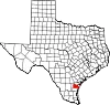 |
| Ochiltree County | 357 | Perryton | 1876 | Bexar County | William Beck Ochiltree (1811–1867), secretary of the treasury for the Republic of Texas and legislator for the state of Texas | 9,782 | 918 sq mi (2,378 km2) | 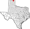 |
| Oldham County | 359 | Vega | 1876 | Bexar County | Williamson Simpson Oldham, a Confederate Senator for Texas | 1,717 | 1,501 sq mi (3,888 km2) | 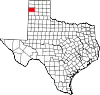 |
| Orange County | 361 | Orange | 1852 | Jefferson County | An orange grove planted by early settlers at the mouth of the Sabine River | 84,742 | 356 sq mi (922 km2) | 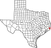 |
| Palo Pinto County | 363 | Palo Pinto | 1856 | Bosque County and Navarro County | The Palo Pinto Creek (Palo Pinto is Spanish for "painted stick") |
28,686 | 953 sq mi (2,468 km2) |  |
| Panola County | 365 | Carthage | 1846 | Harrison County and Shelby County | A Native American word for cotton. | 22,675 | 801 sq mi (2,075 km2) |  |
| Parker County | 367 | Weatherford | 1855 | Bosque County and Navarro County | Isaac Parker, legislator for both the Republic of Texas and the state of Texas | 156,764 | 904 sq mi (2,341 km2) |  |
| Parmer County | 369 | Farwell | 1876 | Bexar County | Martin Parmer (1778–1850), a Republic of Texas legislator, judge, and signer of the Texas Declaration of Independence | 9,813 | 882 sq mi (2,284 km2) | 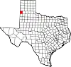 |
| Pecos County | 371 | Fort Stockton | 1871 | Presidio County | The Pecos River, which was named for the Pecos Pueblo, which is of unknown etymology | 15,118 | 4,764 sq mi (12,339 km2) | 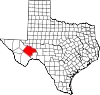 |
| Polk County | 373 | Livingston | 1846 | Liberty County | James Knox Polk, the eleventh president of the United States (1845–1849) | 51,899 | 1,057 sq mi (2,738 km2) |  |
| Potter County | 375 | Amarillo | 1876 | Bexar County | Robert Potter (1800–1842), secretary of the navy for the Republic of Texas, and signer of the Texas Declaration of Independence | 116,547 | 909 sq mi (2,354 km2) | 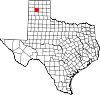 |
| Presidio County | 377 | Marfa | 1850 | Santa Fe County | Presidio del Norte, an eighteenth-century fort and settlement on the south side of the Rio Grande | 6,140 | 3,856 sq mi (9,987 km2) |  |
| Rains County | 379 | Emory | 1870 | Hopkins County, Hunt County and Wood County | Emory Rains (1800–1878), a state senator and surveyor of the future county | 12,509 | 259 sq mi (671 km2) | 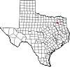 |
| Randall County | 381 | Canyon | 1876 | Bexar County | Horace Randal, a Confederate brigadier general in the Civil War | 143,854 | 914 sq mi (2,367 km2) |  |
| Reagan County | 383 | Big Lake | 1903 | Tom Green County | John H. Reagan (1818–1905), Confederate postmaster general, U.S. Congressman, and Governor of Texas | 3,253 | 1,175 sq mi (3,043 km2) |  |
| Real County | 385 | Leakey | 1913 | Bandera County, Edwards County and Kerr County | Julius Real, a rancher and state senator | 2,826 | 700 sq mi (1,813 km2) |  |
| Red River County | 387 | Clarksville | 1836 | One of the original 23 counties | The Red River of Texas | 11,555 | 1,050 sq mi (2,719 km2) |  |
| Reeves County | 389 | Pecos | 1883 | Pecos County | George Robertson Reeves, a Texas state representative and colonel in the Confederate army | 14,487 | 2,636 sq mi (6,827 km2) | 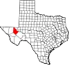 |
| Refugio County | 391 | Refugio | 1836 | One of the original 23 counties | Its county seat, which was named for the Spanish mission Nuestra Señora del Refugio, "Our Lady of Refuge" | 6,756 | 770 sq mi (1,994 km2) | 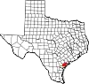 |
| Roberts County | 393 | Miami | 1876 | Bexar County | John S. Roberts, a signer of the Texan Declaration of Independence, and his brother Oran Milo Roberts, attorney general for the Republic of Texas and the seventeenth governor of Texas | 797 | 924 sq mi (2,393 km2) |  |
| Robertson County | 395 | Franklin | 1837 | Bexar County, Milam County and Nacogdoches County | Sterling Clack Robertson, an empresario in Mexican Texas | 16,958 | 855 sq mi (2,214 km2) | 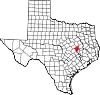 |
| Rockwall County | 397 | Rockwall | 1873 | Kaufman County | Its county seat, which was named for a submerged stone wall found by its initial settlers | 116,381 | 149 sq mi (386 km2) |  |
| Runnels County | 399 | Ballinger | 1858 | Bexar County and Travis County | Hiram Runnels, the ninth governor of Mississippi (1833–1835) and planter in Texas | 9,943 | 1,054 sq mi (2,730 km2) | 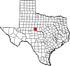 |
| Rusk County | 401 | Henderson | 1843 | Nacogdoches County | Thomas Jefferson Rusk (1803–1857), a general in the Texas Revolution | 52,743 | 924 sq mi (2,393 km2) |  |
| Sabine County | 403 | Hemphill | 1836 | One of the original 23 counties | The Sabine River, which forms its eastern border (Sabina is Spanish for "cypress") |
10,039 | 490 sq mi (1,269 km2) |  |
| San Augustine County | 405 | San Augustine | 1836 | One of the original 23 counties | Presumably Augustine of Hippo (354–430) | 7,922 | 528 sq mi (1,368 km2) |  |
| San Jacinto County | 407 | Coldspring | 1870 | Liberty County, Montgomery County, Polk County and Walker County | The Battle of San Jacinto, which won Texas its independence from Mexico | 27,878 | 571 sq mi (1,479 km2) |  |
| San Patricio County | 409 | Sinton | 1836 | One of the original 23 counties | Its former county seat San Patricio de Hibernia, an Irish colony named for Saint Patrick | 69,699 | 692 sq mi (1,792 km2) |  |
| San Saba County | 411 | San Saba | 1856 | Bexar County | The San Saba River, discovered on the Catholic feast of Saint Sabbas | 5,827 | 1,134 sq mi (2,937 km2) |  |
| Schleicher County | 413 | Eldorado | 1887 | Crockett County | Gustav Schleicher, engineer and U.S. Congressman from Texas | 2,429 | 1,311 sq mi (3,395 km2) | 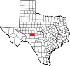 |
| Scurry County | 415 | Snyder | 1876 | Bexar County | William Read Scurry (1821–1864), a Texas state legislator and Confederate general | 16,824 | 903 sq mi (2,339 km2) |  |
| Shackelford County | 417 | Albany | 1858 | Bosque County | Jack Shackelford, a soldier of the Texas Revolution | 3,212 | 914 sq mi (2,367 km2) |  |
| Shelby County | 419 | Center | 1836 | One of the original 23 counties | Isaac Shelby, a Revolutionary War soldier from Tennessee and governor of Kentucky (1792–1796) (1812–1816) | 23,939 | 794 sq mi (2,056 km2) |  |
| Sherman County | 421 | Stratford | 1876 | Bexar County | Sidney Sherman (1805–1873), a soldier in the Texas Revolution | 2,798 | 923 sq mi (2,391 km2) |  |
| Smith County | 423 | Tyler | 1846 | Nacogdoches County | James Smith, a general during the Texas Revolution | 237,186 | 928 sq mi (2,404 km2) |  |
| Somervell County | 425 | Glen Rose | 1875 | Hood County | Alexander Somervell, a soldier in the Texas Revolution and leader of the Somervell Expedition | 9,469 | 187 sq mi (484 km2) |  |
| Starr County | 427 | Rio Grande City | 1848 | Nueces County | James Harper Starr (1809–1890), a treasurer for the Republic of Texas and Confederate official | 66,049 | 1,223 sq mi (3,168 km2) |  |
| Stephens County | 429 | Breckenridge | 1858 | Bosque County Named Buchanan County until 1861 | Alexander Hamilton Stephens, the only vice-president of the Confederate States of America (1861–1865) | 9,173 | 895 sq mi (2,318 km2) |  |
| Sterling County | 431 | Sterling City | 1891 | Tom Green County | W. S. Sterling, an early rancher, buffalo hunter, and Native American fighter | 1,381 | 923 sq mi (2,391 km2) |  |
| Stonewall County | 433 | Aspermont | 1876 | Bexar County | Thomas Jonathan "Stonewall" Jackson (1824–1863), the famous Confederate General | 1,217 | 919 sq mi (2,380 km2) |  |
| Sutton County | 435 | Sonora | 1887 | Crockett County | John Schuyler Sutton, a Texas Ranger and soldier in the Texas Revolution and Mexican–American War | 3,319 | 1,454 sq mi (3,766 km2) |  |
| Swisher County | 437 | Tulia | 1876 | Bexar County | James Gibson Swisher, a soldier of the Texas Revolution | 7,008 | 900 sq mi (2,331 km2) |  |
| Tarrant County | 439 | Fort Worth | 1849 | Navarro County | Edward H. Tarrant, a U.S. Army general who drove the Native Americans out of the future county | 2,126,477 | 864 sq mi (2,238 km2) |  |
| Taylor County | 441 | Abilene | 1858 | Bexar County and Travis County | Edward Taylor (1812–1836), George Taylor (1816–1836), and James Taylor (1814–1836), three brothers who died at the Alamo | 143,326 | 916 sq mi (2,372 km2) |  |
| Terrell County | 443 | Sanderson | 1905 | Pecos County | Alexander Watkins Terrell, attorney, judge, state legislator, diplomat, and Confederate cavalry officer | 724 | 2,358 sq mi (6,107 km2) | 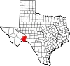 |
| Terry County | 445 | Brownfield | 1876 | Bexar County | Frank Terry, a Confederate colonel and commander of Terry's Texas Rangers | 11,754 | 890 sq mi (2,305 km2) |  |
| Throckmorton County | 447 | Throckmorton | 1858 | Fannin County | William Edward Throckmorton, an early Collin County settler | 1,495 | 912 sq mi (2,362 km2) |  |
| Titus County | 449 | Mount Pleasant | 1846 | Bowie County | Andrew Jackson Titus, planter and Texas state representative | 31,183 | 411 sq mi (1,064 km2) |  |
| Tom Green County | 451 | San Angelo | 1874 | Bexar County | Thomas Green (1814–1864), a Confederate brigadier general | 119,411 | 1,522 sq mi (3,942 km2) |  |
| Travis County | 453 | Austin | 1840 | Bastrop County | William Barret Travis (1809–1836), the commander of the Texan forces at the Alamo | 1,305,154 | 989 sq mi (2,561 km2) |  |
| Trinity County | 455 | Groveton | 1850 | Houston County | The Trinity River, named for the spiritual concept of the Trinity | 13,827 | 693 sq mi (1,795 km2) | 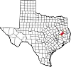 |
| Tyler County | 457 | Woodville | 1846 | Liberty County | John Tyler, the tenth president of the United States (1841–1845) | 20,077 | 923 sq mi (2,391 km2) |  |
| Upshur County | 459 | Gilmer | 1846 | Harrison County | Abel Parker Upshur, the fifteenth secretary of state of the United States (1843–1844) | 41,774 | 588 sq mi (1,523 km2) |  |
| Upton County | 461 | Rankin | 1887 | Tom Green County | John C. & William F. Upton, brothers and lieutenant colonels in the Confederate army during the Civil War | 3,265 | 1,242 sq mi (3,217 km2) |  |
| Uvalde County | 463 | Uvalde | 1850 | Bexar County | The Cañón de Ugalde, a nearby battlefield where Spanish General Juan de Ugalde was victorious in a skirmish with over 300 Apaches | 24,729 | 1,557 sq mi (4,033 km2) | 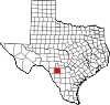 |
| Val Verde County | 465 | Del Rio | 1885 | Crockett County, Kinney County and Pecos County | Civil War Battle of Val Verde (Val Verde is Spanish for "green valley") |
47,564 | 3,171 sq mi (8,213 km2) | 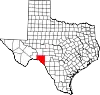 |
| Van Zandt County | 467 | Canton | 1848 | Henderson County | Isaac Van Zandt (1813–1847), attorney, Texas state representative, and diplomat | 61,275 | 849 sq mi (2,199 km2) |  |
| Victoria County | 469 | Victoria | 1836 | One of the original 23 counties | Its county seat, which was named for Guadalupe Victoria, Mexican revolutionary and its first president (1824–1829) | 90,964 | 883 sq mi (2,287 km2) |  |
| Walker County | 471 | Huntsville | 1846 | Montgomery County | Robert J. Walker (1801–1869); officially renamed after Samuel Hamilton Walker (no relation) (1815–1847), a Texas Ranger and soldier in the Mexican–American War | 77,977 | 788 sq mi (2,041 km2) | 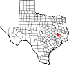 |
| Waller County | 473 | Hempstead | 1873 | Austin County and Grimes County | Edwin Waller (1800–1881), a signer of the Texas Declaration of Independence and the first mayor of Austin, Texas | 59,781 | 514 sq mi (1,331 km2) |  |
| Ward County | 475 | Monahans | 1887 | Tom Green County | Thomas William Ward, a commissioner for the General Land Office of Texas and mayor of Austin, Texas | 11,194 | 836 sq mi (2,165 km2) |  |
| Washington County | 477 | Brenham | 1836 | One of the original 23 counties | George Washington, the first president of the United States (1789–1797) | 35,891 | 609 sq mi (1,577 km2) | 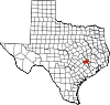 |
| Webb County | 479 | Laredo | 1848 | Nueces County | James Webb, who served as secretary of the Treasury, secretary of State, and Attorney General of the Republic of Texas | 267,945 | 3,357 sq mi (8,695 km2) | 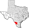 |
| Wharton County | 481 | Wharton | 1846 | Colorado County, Jackson County and Matagorda County | William Harris Wharton (1802–1839) and John Austin Wharton (1828–1865), brothers and officers in the Texas Revolution | 41,721 | 1,090 sq mi (2,823 km2) | 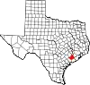 |
| Wheeler County | 483 | Wheeler | 1876 | Bexar County | Royal Tyler Wheeler, the second Chief Justice of the Texas Supreme Court | 4,927 | 914 sq mi (2,367 km2) | 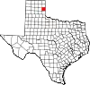 |
| Wichita County | 485 | Wichita Falls | 1858 | Cooke County | The Wichita Native American tribe | 130,069 | 628 sq mi (1,627 km2) | 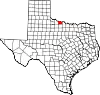 |
| Wilbarger County | 487 | Vernon | 1858 | Bexar County | Josiah P. (1801–1845) and Mathias Wilbarger, brothers and early settlers; Josiah became a mythical figure for living 11 years after being scalped | 12,731 | 971 sq mi (2,515 km2) |  |
| Willacy County | 489 | Raymondville | 1911 | Cameron County and Hidalgo County | John G. Willacy, Texas state senator who was the author of the bill that established the county | 20,316 | 597 sq mi (1,546 km2) | 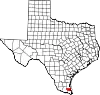 |
| Williamson County | 491 | Georgetown | 1848 | Milam County | Robert McAlpin Williamson, a leader and veteran of the Battle of San Jacinto | 643,026 | 1,124 sq mi (2,911 km2) | 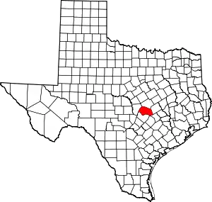 |
| Wilson County | 493 | Floresville | 1860 | Bexar County, Guadalupe County and Karnes County | James Charles Wilson, a Texas state senator (1851–1853) | 51,257 | 807 sq mi (2,090 km2) |  |
| Winkler County | 495 | Kermit | 1887 | Tom Green County | Clinton Winkler, an appeals court judge, Texas state representative, and Confederate colonel | 7,415 | 841 sq mi (2,178 km2) | 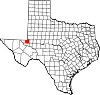 |
| Wise County | 497 | Decatur | 1856 | Cooke County | Henry Alexander Wise, the U.S. Congressman and future thirty-eighth governor of Virginia (1856–1860) who supported the annexation of Texas | 71,714 | 905 sq mi (2,344 km2) | 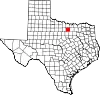 |
| Wood County | 499 | Quitman | 1850 | Van Zandt County | George Tyler Wood, the second governor of Texas (1847–1849) | 45,875 | 650 sq mi (1,683 km2) |  |
| Yoakum County | 501 | Plains | 1876 | Bexar County | Henderson King Yoakum (1810–1856), soldier, attorney, and Texas historian | 7,607 | 800 sq mi (2,072 km2) | 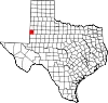 |
| Young County | 503 | Graham | 1856 | Bosque County and Fannin County | William Cocke Young, early Texas settler, attorney, sheriff, and United States Marshal | 17,977 | 922 sq mi (2,388 km2) | 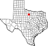 |
| Zapata County | 505 | Zapata | 1858 | Starr County and Webb County | José Antonio Zapata, a local rancher and colonel of the short-lived Republic of the Rio Grande | 13,908 | 997 sq mi (2,582 km2) |  |
| Zavala County | 507 | Crystal City | 1846 | Maverick County | Lorenzo de Zavala (1788–1836), signer of the Texas Declaration of Independence and the first Vice-President of the Republic of Texas | 9,534 | 1,299 sq mi (3,364 km2) | 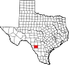 |
Defunct counties
There have been at least thirty-two counties established by Texas law that no longer exist. These fall into five categories: judicial counties; counties established by the Constitutional Convention of 1868–69; counties never organized which were abolished by legislative act; counties whose territory is no longer considered part of the state; and counties whose names have been changed.[12]
- Buchel County, formed in 1887 from Presidio County. Annexed in 1897 to Brewster County.
- Dawson County, formed in 1858 in what is now Kinney County and Uvalde County and abolished in 1866 (not to be confused with the present-day Dawson County).
- Encinal County, formed in 1856. Abolished in 1899 and annexed to Webb County.
- Foley County, formed in 1887 from Presidio County. Annexed in 1897 to Brewster County.
- Greer County, formed in 1860. Separated from Texas by U.S. Supreme Court ruling in United States v. the State of Texas, 162 U.S. 1 (1896) and is now part of southwestern Oklahoma.
- Perdido County, formed in 1824 and forgotten during the upheavals of the 1840s. Perdido was reportedly abolished in 1858 and again in 1871. Records of annexation to Dawson County are also inconclusive.
- Santa Fe County, Texas formed in 1848 from lands claimed by the Republic of Texas and ceded by Mexico. It included a vast area later becoming portions of several states from New Mexico east of the Rio Grande extending northward into south-central Wyoming. Within Texas' modern boundaries, the county included the Trans-Pecos and most of the Panhandle. The county was abolished when Texas ceded its western lands under the Compromise of 1850.
- Wegefarth County, formed in 1873 in the Texas Panhandle and abolished in 1876.
- Worth County, formed in 1850 from part of Santa Fe County. Abolished under the Compromise of 1850 and is now part of east-central New Mexico.
See also
- Texas census statistical areas
- List of Texas county seat name etymologies
References
- "How Many Counties are in Your State?". Click and Learn. Archived from the original on 2009-04-22. Retrieved 2009-08-26.
- "TSHA: County organization". The Texas State Historical Association. Retrieved 2011-08-19.
- "TSHA: Kenedy County". The Texas State Historical Association. Retrieved 2011-08-19.
- "TSHA: Loving County". The Texas State Historical Association. Retrieved 2011-08-19.
- "County government structure". Texas Association of Counties. Archived from the original on 2007-04-08. Retrieved 2007-04-27.
- "County official information". Texas Association of Counties. Archived from the original on 2007-04-06. Retrieved 2007-04-27.
- "FIPS Publish 6-4". National Institute of Standards and Technology. Archived from the original on 2013-09-29. Retrieved 2007-04-11.
- "EPA County FIPS Code Listing". EPA. Archived from the original on 2006-04-27. Retrieved 2007-04-09.
- National Association of Counties. "NACo - Find a county". Archived from the original on 2007-02-13. Retrieved 2007-04-26.
- "U.S. Census Bureau QuickFacts: Texas". U.S. Census Bureau. Retrieved 2022-03-29.
- "Texas Association of Counties facts". Texas Association of Counties. Archived from the original on 2007-04-08. Retrieved 2007-04-12.
- "TSHA Defunct Counties". The Texas State Historical Association. Retrieved 2007-04-20.
Sources
- "Find a County". National Association of Counties. Archived from the original on 2007-03-13. Retrieved 2007-04-22. - Counties, county seats, county formation, and areas
- "CountyState.info Texas". Official County Websites. Retrieved 2007-09-13. - official sites
- "Texas County Progress". Official Publication of the County Judges and Commissioners Association. Retrieved 2017-07-13. - official sites
- "Updated List of Texas Cities and Counties By Population in 2019". - Google Doc
External links
Austin (capital) | |
| Topics |
|
| Society |
|
| Regions |
|
| Metropolitan areas |
|
| Counties | |