Anexo:Distritos de la India
La India tiene 36 Divisiones Territoriales (28 Estados y 8 territorios). Hay un total de 771 distritos.
.svg.png.webp)
Estados
|
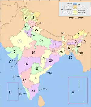 Estados y territorios de la India, numerados según la tabla | ||||||||||||||||||||||||||||||||||||||||||||||||||||||||||||||||||||||||||||||||||||||||||||||||||||||||||||||||||||||||||||||||||||||
Las tablas siguientes muestran los datos de población de diversos estados. Las columnas que forman parte son: los códigos jerárquicos de subdivisión administrativa, el nombre del distrito, la sede del distrito, la población según el censo del año 2001, la superficie en kilómetros cuadrados, y la densidad de población por kilómetro cuadrado. Algunos distritos son totalmente urbanos, como el de la ciudad de Bombay, o muy pequeños, como el de Yanam en el distrito de Pondicherry que no tiene un lugar separado como sede de distrito, razón por la que se han omitido en esta tabla.
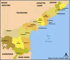
Andhra Pradesh (AP)
Desde la independencia de Telangana en 2014, el estado de Andhra Pradesh en la India consta de dos regiones divididas en 13 distritos:[1]
- Rayalaseema: Kurnool, Chittoor, Kadapa, Anantapur
- Coastal Andhra: Godavari Este, Godavari Oeste, Krishna, Guntur, Prakasam, Nellore, Srikakulam, Vizianagaram, Visakhapatnam
Arunachal Pradesh (AR)
En el año 2011, el estado de Arunachal Pradesh cuenta con 16 distritos, la mayoría de ellos habitados por diversos grupos tribales. Son los siguientes:[2]
Assam (AS)
El estado de Assam está organizado en 33 distritos.[5]
| ° | |||||||||
|---|---|---|---|---|---|---|---|---|---|
| Ranking | Sede | Población[6] | Área | Densidad | |||||
| Pob. | Área | Distrito | Código[7] | (capital) | (2011) | km² | hab./km² | Web Oficial | Mapa |
| AS-19 | AS-16 | Distrito de Baksa# | AS-BK | Mushalpur | 953 773 | 2400 | 398 |  | |
| AS-06 | AS-09 | Distrito de Barpeta | AS-BP | Barpeta | 1 693 190 | 3245 | 506 | http://barpeta.gov.in/ | |
| AS-27 | AS-29 | Distrito de Biswanath [8] | AS-BS | Biswanath Chariali [9] | 580 000 | 1100 | 530 | ||
| AS-02 | AS-21 | Distrito de Bongaigaon | AS-BO | Bongaigaon | 2 060 550 | 1724 | 425 | http://bongaigaon.gov.in/ | |
| AS-05 | AS-06 | Distrito de Cachar | AS-CA | Silchar | 1 736 319 | 3786 | 381 | http://cachar.gov.in/ | |
| AS-? | AS- | Distrito de Charaideo[8] | AS-CD | Sonari[10] | |||||
| AS-29 | AS-27 | Distrito de Chirang# | AS-CH | Kajalgaon | 481 818 | 1468 | 328 | ||
| AS-22 | AS-24 | Distrito de Darrang | AS-DR | Mangaldai | 908 090 | 1585 | 432 | http://darrang.gov.in/ | |
| AS-25 | AS-10 | Distrito de Dhemaji | AS-DM | Dhemaji | 688 077 | 3237 | 176 | http://dhemaji.gov.in/ | |
| AS-03 | AS-14 | Distrito de Dhubri | AS-DU | Dhubri | 1 948 632 | 2838 | 576 | http://dhubri.gov.in/ | |
| AS-08 | AS-08 | Distrito de Dibrugarh | AS-DI | Dibrugarh | 1 327 748 | 3381 | 347 | http://dibrugarh.gov.in/ | |
| AS-31 | AS-03 | Distrito de Dima Hasao | AS-DH | Haflong | 214 102 | 4888 | 44 | ||
| AS-16 | AS-19 | Distrito de Goalpara | AS-GP | Goalpara | 1 008 959 | 1824 | 451 | http://goalpara.gov.in/ | |
| AS-14 | AS-07 | Distrito de Golaghat | AS-GC | Golaghat | 1 058 674 | 3502 | 270 | http://golaghat.gov.in/ | |
| AS-26 | AS-28 | Distrito de Hailakandi | AS-HA | Hailakandi | 659,260 | 1327 | 409 | http://hailakandi.nic.in/ | |
| AS-20 | AS- | Distrito de Hojai[8] | AS-HJ | Hojai[11] | 931 218 | ||||
| AS-13 | AS-13 | Distrito de Jorhat | AS-JO | Jorhat | 1 091 295 | 2851 | 354 | http://jorhat.gov.in/ | |
| AS-10 | AS-25 | Distrito metropolitano de Kamrup | AS-KM | Guwahati | 1 260 419 | 1528 | 820 | ||
| AS-07 | AS-26 | Distrito de Kamrup | AS-KU | Amingaon | 1 517 202 | 1527,84 | 520 | ||
| AS-17 | AS-01 | Distrito de Karbi Anglong | AS-KG | Diphu | 965 280 | 10 434 | 78 | http://karbianglong.gov.in/ | |
| AS-30 | AS-12 | Distrito de Karbi Anglong occidental[8] | AS-WK | Hamren[12] | 300 320 | 3035 | 99 | ||
| AS-11 | AS-20 | Distrito de Karimganj | AS-KR | Karimganj | 1 217 002 | 1809 | 555 | http://karimganj.gov.in/ | |
| AS-21 | AS-11 | Distrito de Kokrajhar# | AS-KJ | Kokrajhar | 930 404 | 3129 | 297 | http://kokrajhar.gov.in/ | |
| AS-15 | AS-17 | Distrito de Lakhimpur | AS-LA | North Lakhimpur | 1 040 644 | 2277 | 391 | http://lakhimpur.gov.in/ | |
| AS-32 | AS-30 | Distrito de Majuli | AS-MJ | Garamur[13] | 167 304 | 880 | 300 | ||
| AS-18 | AS-22 | Distrito de Morigaon | AS-MA | Morigaon | 957 853 | 1704 | 455 | http://morigaon.nic.in/ | |
| AS-01 | AS-04 | Distrito de Nagaon | AS-NN | Nagaon | 2 826 007 | 3831 | 604 | http://nagaon.gov.in/ | |
| AS-24 | AS-18 | Distrito de Nalbari | AS-NB | Nalbari | 769 919 | 2257 | 504 | http://nalbari.nic.in/ | |
| AS-28 | AS-31 | Distrito de Salmara-Mankachar meridional[8] | AS-SM | Hatsingimari[14] | 555 114 | 568 | 980 | ||
| AS-12 | AS-15 | Distrito de Sivasagar | AS-SV | Sivasagar | 1 150 253 | 2668 | 395 | http://sivasagar.nic.in | |
| AS-04 | AS-02 | Distrito de Sonitpur | AS-ST | Tezpur | 1 925 975 | 5324 | 315 | http://sonitpur.gov.in/ | |
| AS-09 | AS-05 | Distrito de Tinsukia | AS-TI | Tinsukia | 1 316 948 | 3790 | 303 | http://tinsukia.gov.in/ | |
| AS-23 | AS-23 | Distrito de Udalguri# | AS-UD | Udalguri | 832 769 | 1676 | 497 | http://udalguri.gov.in/ | |
Bihar (BR)
Bihar, un estado de la India, cuenta (en 2011) con 38 distritos administrativos.
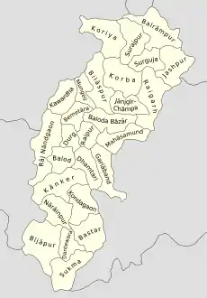
Chhattisgarh (CT)
Tras la creación de nuevos distritos en 2012, Chhattisgarh consta de 27 distritos,[15][16][17][18][19] agrupados en cinco divisiones:
- División de Surguja: Koriya, Balrampur-Ramanujganj, Surajpur, Jashpur y Surguja;
- División de Bilaspur: Bilaspur, Mungeli, Korba, Distrito de Janjgir-Champa y Raigarh;
- División de Durg: Kabirdham (Kawardha), Bemetara, Durg, Balod y Rajnandgaon;
- División de Raipur: Mahasamund, Baloda Bazar, Gariaband, Raipur y Dhamtari;
- División de Bastar: Kanker, Narayanpur, Kondagaon, Bastar,Dantewada, Bijapur y Sukma.
Delhi (DL)
- Véase también: Distritos de Delhi
| Código | Distrito | Sede | Población (2001) | Área (km²) | Densidad (/km²) | web Oficial |
| CD | Distrito de Delhi central | Darya Ganj | 644,005 | 25 | 25,759 | http://dccentral.delhigovt.nic.in/ |
| ED | Distrito de Delhi oriental | Preet Vihar | 1,448,770 | 440 | 3293 | http://dceast.delhigovt.nic.in/ |
| ND | Distrito de Nueva Delhi | Connaught Place | 302,363 | 22 | 13744 | http://dcnewdelhi.delhigovt.nic.in/ |
| NO | Distrito de Delhi norte | Sadar Bazar | 779,788 | 59 | 12996 | http://dcnorth.delhigovt.nic.in/ |
| NE | Distrito de Delhi noreste | Shahdara | 1,763,712 | 52 | 33917 | http://dcnortheast.delhigovt.nic.in/ |
| NW | Distrito de Delhi noroeste | Kanjhawala | 785,284 | 130 | 6041 | http://dcnorthwest.delhigovt.nic.in/ |
| SD | Distrito de Delhi sur | Saket | 2,258,367 | 250 | 9033 | http://dcsouth.delhigovt.nic.in/ |
| SW | Distrito de Delhi sudoeste | Vasant Vihar | 1,749,492 | 395 | 4430 | http://dcsouthwest.delhigovt.nic.in/ |
| WD | Distrito de Delhi occidental | Rajouri Garden | 2,119,641 | 112 | 18925 | http://dcwestrev.delhigovt.nic.in/ |
Goa (GA)
- Véase también: Distritos de Goa
| Código | Distrito | Sede | Población (2001) | Área (km²) | Densidad (/km²) | web Oficial |
| NG | Distrito de Goa del Norte | Panaji | 757,407 | 1,736 | 436 | http://northgoa.nic.in/ |
| SG | Distrito de Goa del Sur | Margao | 586,591 | 1,966 | 298 | http://southgoa.nic.in/ |
Guyarat (GJ)
| ° | |||||||||||||
|---|---|---|---|---|---|---|---|---|---|---|---|---|---|
| Ranking | Sede | Población | Área | Densidad | Taluka/tehsil | ||||||||
| Pob. | Área | Distrito | Código | (capital) | (2001)[20] | (2011)[20] | (km²) | (hab./km²) | Formación | Nombre | Total | Web oficial | Mapa |
| GJ-01 | GJ-07 | Distrito de Ahmedabad | GJ-AH | Ahmedabad | 5 673 090 | 7 045 313 | 7170 | 983 | 1960 | Ahmedabad, Bavla, Daskroi, Detroj-Rampura, Dhandhuka, Dholera, Dholka, Mandal, Sanand, Viramgam | 10 |  | |
| GJ-17 | GJ-08 | Distrito de Amreli | GJ-AM | Amreli | 1 393 880 | 1 513 614 | 6760 | 224 | 1960 | Amreli, Babra, Bagasara, Dhari, Jafrabad, Khambha, Kunkavav vadia, Lathi, Lilia, Rajula, Savarkundla | 11 | ||
| GJ-09 | GJ-14 | Distrito de Anand | GJ-AN | Anand | 1 856 712 | 2 090 276 | 4690 | 446 | 1997 | Anand, Anklav, Borsad, Khambhat, Petlad, Sojitra, Tarapur, Umreth | 8 | ||
| GJ-25 | GJ-25 | Distrito de Aravalli | GJ-AR | Modasa | 908 797 | 1 039 918 | 3217 | 323 | 2013 | Bayad, Bhiloda, Dhansura, Malpur, Meghraj y Modasa | 6 | ||
| GJ-03 | GJ-02 | Distrito de Banaskantha | GJ-BK | Palanpur | 2 502 843 | 3 116 045 | 12 703 | 245 | 1960 | Amirgadh, Bhabhar, Danta, Dantiwada, Deesa, Deodar, Dhanera, Kankrej, Lakhani, Palanpur, Suigam, Tharad, Vadgam y Vav | 14 | ||
| GJ-15 | GJ-09 | Distrito de Bharuch | GJ-BR | Bharuch | 1 370 104 | 1 550 822 | 6524 | 238 | 1960 | Bharuch, Amod, Ankleshwar, Hansot, Jambusar, Jhagadia, Netrang, Vagra y Valia | 9 | ||
| GJ-06 | GJ-05 | Distrito de Bhavnagar | GJ-BV | Bhavnagar | 2 065 492 | 2 393 272 | 8334 | 287 | 1960 | Bhavnagar, Gariadhar, Ghogha, Jesar, Mahuva, Palitana, Sihor, Talaja, Umrala, Vallabhipur | 10 | ||
| GJ-30 | GJ-28 | Distrito de Botad | GJ- | Botad | 547 567 | 656 005 | 2564 | 256 | 2013 | Botad, Barwala, Gadhada, Ranpur | 4 | ||
| GJ-24 | GJ-24 | Distrito de Chhota Udaipur | GJ- | Chhota Udaipur | 909 799 | 1 071 831 | 3237 | 331 | 2013 | Chhota Udepur, Bodeli, Jetpur pavi, Kavant, Nasvadi, Sankheda | 6 | ||
| GJ-07 | GJ-21 | Distrito de Dahod | GJ-DA | Dahod | 1 635 374 | 2 126 558 | 3643 | 583 | 1997 | Dahod, Devgadh baria, Dhanpur, Fatepura, Garbada, Limkheda, Sanjeli, Jhalod, Singvad | 9 | ||
| GJ-33 | GJ-33 | Distrito de Dangs | GJ-DG | Ahwa | 186 712 | 226 769 | 1764 | 129 | 1960 | Ahwa, Subir, Waghai | 3 | ||
| GJ-29 | GJ-11 | Distrito de Devbhoomi Dwarka | GJ- | Khambhalia | 623 091 | 752 484 | 5684 | 132 | 2013 | Bhanvad, Kalyanpur, Khambhalia, Okhamandal | 4 | ||
| GJ-20 | GJ-32 | Distrito de Gandhinagar | GJ-GA | Gandhinagar | 1 334 731 | 1 387 478 | 2163 | 641 | 1964 | Gandhinagar, Dehgam, Kalol, Mansa | 4 | ||
| GJ-23 | GJ-19 | Distrito de Gir Somnath | GJ-SM | Veraval | 1 059 675 | 1 217 477 | 3754 | 324 | 2013 | Gir-Gadhada, Kodinar, Sutrapada, Talala, Una, Patan-Veraval | 6 | ||
| GJ-18 | GJ-04 | Distrito de Jamnagar | GJ-JA | Jamnagar | 1 281 187 | 1 407 635 | 8441 | 167 | 1960 | Jamnagar, Dhrol, Jamjodhpur, Jodiya, Kalavad, Lalpur | 6 | ||
| GJ-16 | GJ-12 | Distrito de Junagadh | GJ-JU | Junagadh | 1 388 498 | 1 525 605 | 5092 | 300 | 1960 | Junagadh City, Bhesana, Junagadh Rural, Keshod, Malia, Manavadar, Mangrol, Mendarda, Vanthali, Visavadar | 10 | ||
| GJ-08 | GJ-01 | Distrito de Kutch | GJ- | Bhuj | 1 526 321 | 2 090 313 | 45 652 | 46 | 1960 | Abdasa, Anjar, Bhachau, Bhuj, Gandhidham, Lakhpat, Mandvi, Mundra, Nakhatrana, Rapar | 10 | ||
| GJ-10 | GJ-20 | Distrito de Kheda | GJ-KH | Nadiad | 1 806 929 | 2 053 769 | 3667 | 560 | 1960 | Kheda, Galteshwar, Kapadvanj, Kathlal, Mahudha, Matar, Mehmedabad, Nadiad, Thasra, Vaso | 10 | ||
| GJ-26 | GJ-29 | Distrito de Mahisagar | GJ- | Lunavada | 861 562 | 994 624 | 2500 | 398 | 2013 | Balasinor, Kadana, Khanpur, Lunawada, Santrampur, Virpur | 6 | ||
| GJ-11 | GJ-16 | Distrito de Mahesana | GJ-MA | Mahesana | 1 837 696 | 2 027 727 | 4386 | 419 | 1960 | Mehsana, Becharaji, Jotana, Kadi, Kheralu, Satlasana, Unjha, Vadnagar, Vijapur, Visnagar, Gojariya | 11 | ||
| GJ-27 | GJ-13 | Distrito de Morbi | GJ- | Morbi | 825 301 | 960 329 | 4871 | 197 | 2013 | Halvad, Maliya, Morbi, Tankara, Wankaner | 5 | ||
| GJ-31 | GJ-27 | Distrito de Narmada | GJ-NR | Rajpipla | 514 083 | 590 379 | 2749 | 215 | 1997 | Dediapada, Garudeshwar, Nandod, Sagbara, Tilakwada | 5 | ||
| GJ-22 | GJ-31 | Distrito de Navsari | GJ-NV | Navsari | 1 229 250 | 1 330 711 | 2211 | 602 | 1997 | Navsari, Vansda, Chikhli, Gandevi, Jalalpore, Khergam | 6 | ||
| GJ-13 | GJ-22 | Distrito de Panchmahal | GJ-PM | Godhra | 1 381 002 | 1 642 268 | 3272 | 502 | 1960 | Ghoghamba, Godhra, Halol, Jambughoda, Kalol, Morwa Hadaf, Shehera | 7 | ||
| GJ-21 | GJ-10 | Distrito de Patan | GJ-PA | Patan | 1 181 941 | 1 342 746 | 5738 | 234 | 2000 | Patan, Chanasma, Harij, Radhanpur, Sami, Sankheswar, Santalpur, Sarasvati, Sidhpur | 9 | ||
| GJ-32 | GJ-30 | Distrito de Porbandar | GJ-PO | Porbandar | 536 854 | 586 062 | 2294 | 255 | 1997 | Porbandar, Kutiyana, Ranavav | 3 | ||
| GJ-05 | GJ-06 | Distrito de Rajkot | GJ-RA | Rajkot | 2 488 885 | 3 015 229 | 7550 | 399 | 1960 | Rajkot, Dhoraji, Gondal, Jamkandorna, Jasdan, Jetpur, Kotada Sangani, Lodhika, Paddhari, Upleta, Vinchchiya | 11 | ||
| GJ-19 | GJ-18 | Distrito de Sabarkantha | GJ-SK | Himmatnagar | 1 173 734 | 1 388 671 | 4173 | 333 | 1960 | Himatnagar, Idar, Khedbrahma, Poshina, Prantij, Talod, Vadali, Vijaynagar | 8 | ||
| GJ-02 | GJ-15 | Distrito de Surat | GJ-ST | Surat | 4 996 391 | 6 079 231 | 4418 | 1337 | 1960 | Surat, Bardoli, Choryasi, Kamrej, Mahuva, Mandvi, Mangrol , Olpad, Palsana, Umarpada | 10 | ||
| GJ-14 | GJ-03 | Distrito de Surendranagar | GJ-SR | Surendranagar | 1 370 843 | 1 585 268 | 9271 | 171 | 1960 | Chotila, Chuda, Dasada, Dhrangadhra, Lakhtar, Limbdi, Muli, Sayla, Thangadh, Wadhwan | 10 | ||
| GJ-28 | GJ-23 | Distrito de Tapi | GJ- | Vyara | 719 634 | 806 489 | 3249 | 248 | 2007 | Nizar, Songadh, Uchhal, Valod, Vyara, Kukarmunda, Dolvan, | 7 | ||
| GJ-04 | GJ-17 | Distrito de Vadodara | GJ-VD | Vadodara | 2 732 003 | 3 093 795 | 4312 | 718 | 1960 | Vadodara, Dabhoi, Desar, Karjan, Padra, Savli, Sinor, Vaghodia | 8 | ||
| GJ-12 | GJ-26 | Distrito de Valsad | GJ-VA | Valsad | 1 410 680 | 1 703 068 | 3034 | 561 | 1966 | Valsad, Dharampur, Kaprada, Pardi, Umbergaon, Vapi | 6 | ||
| Total (estado) | 250 | ||||||||||||
Haryana (HR)
El gobierno de Haryana ha dividido el estado de Haryana en los siguientes 22 distritos:
| º | |||||||||||
|---|---|---|---|---|---|---|---|---|---|---|---|
| Ranking | Sede | Población | Área | Densidad | |||||||
| Pob. | Área | Distrito | Código[21][22] | (capital) | (2012)[23] | (km²) | (hab./km²) | Formación | Web oficial | Mapa loc. | Mapa |
| HR-11 | HR-16 | Distrito de Ambala | HR-AM | Ambala | 1 136 784 | 1574 | 722 | 1 de noviembre de 1966 | 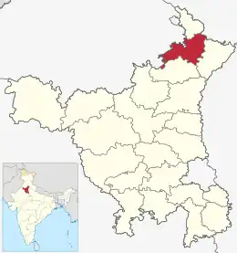 | 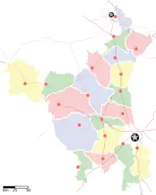 | |
| HR-03 | HR-03 | Distrito de Bhiwani | HR-BH | Bhiwani | 1 629 109 | 3432 | 475 | 22 de diciembre de 1972 | 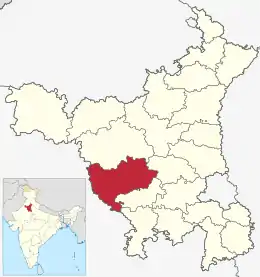 | ||
| HR-22 | HR-18 | Distrito de Charkhi Dadri | HR-CD | Charkhi Dadri | 502 276 | 1370,11 | 366 | 18 de septiembre de 2016 | 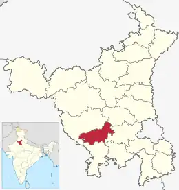 | ||
| HR-01 | HR-10 | Distrito de Faridabad | HR-FR | Faridabad | 1 798 954 | 792 | 2271 | 15 de agosto de 1979 | 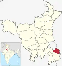 | ||
| HR-18 | HR-05 | Distrito de Fatehabad | HR-FT | Fatehabad | 941 522 | 2538 | 371 | 15 de julio de 1997 | 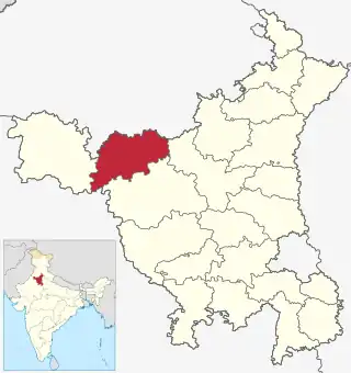 | ||
| HR-04 | HR-21 | Distrito de Gurgaon | HR-GU | Gurgaon | 1 514 085 | 1253 | 1208 | 1 de noviembre de 1966 | 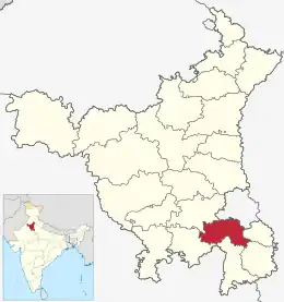 | ||
| HR-02 | HR-02 | Distrito de Hisar | HR-HI | Hisar | 1 742 815 | 3983 | 437 | 1 de noviembre de 1966 | 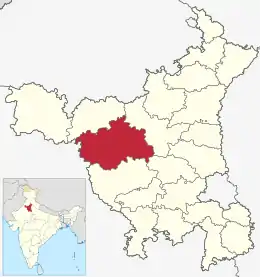 | ||
| HR-17 | HR-12 | Distrito de Jhajjar | HR-JH | Jhajjar | 956 907 | 1834 | 521 | 15 de julio de 1997 | 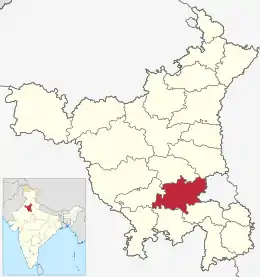 | ||
| HR-07 | HR-04 | Distrito de Jind | HR-JI | Jind | 1 332 042 | 2702 | 493 | 1 de noviembre de 1966 | 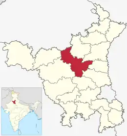 | ||
| HR-13 | HR-07 | Distrito de Kaithal | HR-KT | Kaithal | 1 072 861 | 2317 | 463 | 1 de noviembre de 1989 | 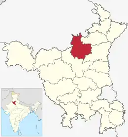 | ||
| HR-05 | HR-06 | Distrito de Karnal | HR-KR | Karnal | 1 506 323 | 2520 | 597 | 1 de noviembre de 1966 | 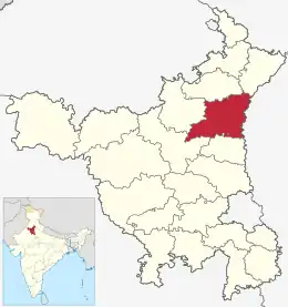 | ||
| HR-16 | HR-17 | Distrito de Kurukshetra | HR-KU | Kurukshetra | 964 231 | 1530 | 630 | 23 de julio de 1973 | 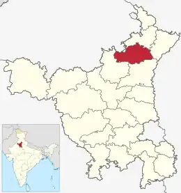 | ||
| HR-19 | HR-11 | Distrito de Mahendragarh | HR-MA | Narnaul | 921 680 | 1859 | 495 | 1 de noviembre de 1966 | 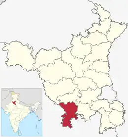 | ||
| HR-12 | HR-09 | Distrito de Mewat[24] | HR-MW | Nuh | 1 089 406 | 1874 | 581 | 4 de abril de 2005 | .svg.png.webp) | ||
| HR-15 | HR-19 | Distrito de Palwal[25] | HR-PW | Palwal | 1 040 493 | 1359 | 765 | 15 de agosto de 2008 | 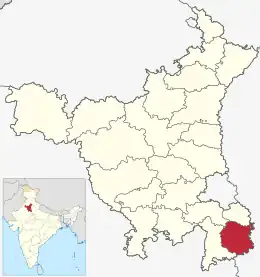 | ||
| HR-21 | HR-22 | Distrito de Panchkula | HR-PK | Panchkula | 558 890 | 898 | 622 | 15 de agosto de 1995 | 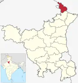 | ||
| HR-10 | HR-20 | Distrito de Panipat | HR-PP | Panipat | 1 202 811 | 1268 | 948 | 1 de noviembre de 1989 | 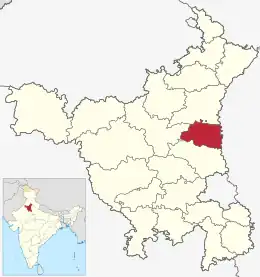 | ||
| HR-20 | HR-15 | Distrito de Rewari | HR-RE | Rewari | 896 129 | 1582 | 566 | 1 de noviembre de 1989 | 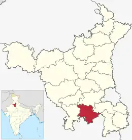 | ||
| HR-14 | HR-14 | Distrito de Rohtak | HR-RO | Rohtak | 1 058 683 | 1745 | 606 | 1 de noviembre de 1966 | 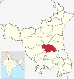 | ||
| HR-08 | HR-01 | Distrito de Sirsa | HR-SI | Sirsa | 1 295 114 | 4277 | 302 | 26 de agosto de 1975 | 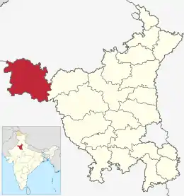 | ||
| HR-06 | HR-08 | Distrito de Sonipat | HR-SNP | Sonipat | 1 480 080 | 2122 | 697 | 22 de diciembre de 1972 | 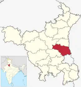 | ||
| HR-09 | HR-13 | Distrito de Yamuna Nagar | HR-YN | Yamuna Nagar | 1 214 162 | 1768 | 686 | 1 de noviembre de 1989 | .svg.png.webp) | ||
Himachal Pradesh (HP)
El estado de Himachal Pradesh está organizado en 12 distritos.[26]
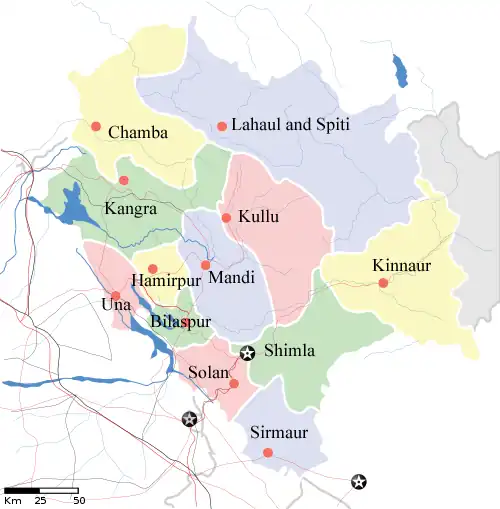 | |||||||||
| Ranking | Sede | Población[26] | Área | Densidad[26] | |||||
| Pob. | Área | Distrito | Código[27] | (capital) | (2011) | km² | hab./km² | ||
| HP-10 | HP-11 | Distrito de Bilaspur | HP-BI | Bilaspur | 382 056 | 1167 | 327 | ||
| HP-07 | HP-02 | Distrito de Chamba | HP-CH | Chamba | 518 844 | 6528 | 80 | ||
| HP-08 | HP-12 | Distrito de Hamirpur | HP-HA | Hamirpur | 454 293 | 1118 | 406 | ||
| HP-01 | HP-04 | Distrito de Kangra | HP-KA | Dharamsala | 1 507 223 | 5739 | 263 | ||
| HP-11 | HP-03 | Distrito de Kinnaur | HP-KI | Reckong Peo | 84 298 | 6401 | 13 | ||
| HP-09 | HP-05 | Distrito de Kullu | HP-KU | Kullu | 437 474 | 5503 | 79 | ||
| HP-12 | HP-01 | Distrito de Lahaul y Spiti | HP-LS | Keylong | 31 528 | 13 835 | 2 | ||
| HP-02 | HP-07 | Distrito de Mandi | HP-MA | Mandi | 999 518 | 3950 | 253 | ||
| HP-03 | HP-06 | Distrito de Shimla | HP-SH | Shimla | 813 384 | 5131 | 159 | ||
| HP-05 | HP-08 | Distrito de Sirmaur | HP-SI | Nahan | 530,164 | 2825 | 188 | ||
| HP-04 | HP-09 | Distrito de Solan | HP-SO | Solan | 576,670 | 1936 | 298 | ||
| HP-06 | HP-10 | Distrito de Una | HP-UN | Una | 521 057 | 1540 | 328 | ||
Jammu y Cachemira (JK)
- Véase también: Anexo:Distritos del estado de Jammu y Cachemira
Jharkhand (JH)
El estado de Jharkhand en India se divide en 24 distritos.[28] En el momento de su formación el estado tenía 18 distritos, pero más adelante, se crearon seis distritos más mediante la reorganización de esos distritos. Los distritos 23 y 24, Khunti y Ramgarh se crearon el 12 de septiembre de 2007. Los 24 distritos se agrupan en 5 divisiones:
- División Palamau (capital en Medininagar): 3 distritos: Palamau, Garhwa, Kechki - Headquarters:
- División Chotanagpur septentrional (capital en Hazaribagh): 7 distritos: Chatra, Hazaribagh, Koderma, Giridih, Ramgarh, Bokaro, Dhanbad;
- División Chotanagpur meridional (capital en Ranchi): 5 distritos: Lohardaga, Gumla, Simdega, Ranchi, Khunti;
- División Kolhan (capital en Chaibasa): 3 distritos: Singhbhum occidental, distrito de Saraikela Kharsawan, Singhbhum oriental;
- División Santhal Pargana (capital en Dumka): 6 distritos: Jamtara, Deoghar, Dumka, Pakur, Godda, Sahibganj.
Karnataka (KA)
- Véase también: Distritos de Karnataka
Kerala (KL)
| ° | ||||||||||
|---|---|---|---|---|---|---|---|---|---|---|
| Ranking | Sede[29] | Población[29] | Área[30] | Densidad | ||||||
| Pob. | Área | Distrito | Código[31] | (capital) | (2011) | km² | hab./km² | Establecido[32] | Subdivisiones | Mapa |
| KL-09 | KL-14 | Alappuzha | KL-AL | Alappuzha | 2 121 943 | 1414 | 1501 | 17 de agosto de 1957[33] | 6 taluks[33] (Ambalapuzha (Alappuzha), Chengannur, Cherthala, Karthikappally (Haripad), Kuttanad (Mankombu) y Mavelikkara) | 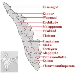 |
| KL-03 | KL-04 | Ernakulam | KL-ER | Kakkanad | 3 279 860 | 3068 | 1069 | 1 de abril de 1958[34] | 7 Taluks[35] (Aluva, Kanayannur (Ernakulam), Kochi (Fort Kochi), Kothamangalam, Kunnathunad (Perumbavoor), Muvattupuzha y North Paravur) | |
| KL-13 | KL-02 | Idukki | KL-ID | Painavu | 1 107 453 | 4358 | 254 | 26 de enero de 1972[36][37] | 5 taluks (Devikulam, Peermade, Udumbanchola (Nedumkandam), Idukki (Painavu) y Thodupuzha) | |
| KL-08 | KL-06 | Kannur | KL-KN | Kannur | 2 525 637 | 2966 | 852 | 1 de enero de 1957[38] | 5 taluks[38] (Thalassery, Iritty, Kannur, Taliparamba y Payyanur) | |
| KL-11 | KL-13 | Kasaragod | KL-KS | Kasaragod | 1 302 600 | 1992 | 654 | 24 de mayo de 1984[39][40] | 4 taluks[41] (Manjeshwar (Uppala), Kasaragod, Vellarikundu y Hosdurg) | |
| KL-07 | KL-08 | Kollam | KL-KL | Kollam | 2 629 703 | 2491 | 1056 | 1 de noviembre de 1956[42] (1 de julio de 1949)[43] |
6 taluks[44] (Kollam (Paravur), Karunagappally, Kunnathur (Sasthamkotta), Kottarakkara, Punalur y Pathanapuram) | |
| KL-10 | KL-10 | Kottayam | KL-KT | Kottayam | 1 979 384 | 2208 | 896 | 1 de noviembre de 1956[45] (1 de julio de 1949 )[43] |
5 taluks[46] (Changanasserry, Kanjirappally, Kottayam, Vaikom y Meenachil (Palai) | |
| KL-05 | KL-09 | Kozhikode | KL-KZ | Kozhikode | 3 089 543 | 2344 | 1318 | 1 de enero de 1957[47] | 4 taluks[48] (Kozhikode, Thamarassery, Koyilandy y Vatakara) | |
| KL-01 | KL-03 | Malappuram | KL-MA | Malappuram | 4 110 956 | 3550 | 1158 | 16 de junio de 1969[49] | 7 taluks[49] (Nilambur, Manjeri (Eranad), Kondotty, Perinthalmanna, Ponnani, Tirur y Tirurangadi) | |
| KL-06 | KL-01 | Palakkad | KL-PL | Palakkad | 2 810 892 | 4480 | 627 | 1 de enero de 1957[50] | 6 taluks[51] (Alathur, Chittur, Palakkad, Pattambi, Ottappalam y Mannarkkad) | |
| KL-12 | KL-07 | Pathanamthitta | KL-PT | Pathanamthitta | 1 195 537 | 2637 | 453 | 1 de noviembre de 1982[52][53] | 6 taluks[54] (Adoor, Konni, Kozhencherry (Pathanamthitta), Ranni, Mallappally y Thiruvalla) | |
| KL-02 | KL-11 | Thiruvananthapuram | KL-TV | Thiruvananthapuram | 3 307 284 | 2192 | 1509 | 1 de noviembre de 1956[55] (1 de julio de 1949)[43] |
6 taluks (Neyyattinkara, Kattakada, Nedumangad, Thiruvananthapuram, Chirayinkeezhu (Attingal) y Varkala) | |
| KL-04 | KL-05 | Thrissur | KL-TS | Thrissur | 3 110 327 | 3032 | 1026 | 1 de noviembre de 1956[56] (1 Jul 1949)[43] |
7 taluks[56] (Kodungallur, Mukundapuram (Irinjalakuda), Chalakudy, Chavakkad, Thalapilly (Wadakkancheri), Thrissur y Kunnamkulam) | |
| KL-14 | KL-12 | Wayanad | KL-WA | Kalpetta | 816 558 | 2131 | 383 | 1 de noviembre de 1980[57] | 3 taluks[57] (Mananthavady, Sultan Bathery y Vythiri Kalpetta) | |
| — | — | Total | — | — | 33 387 677 | 38 863 | 859,11 | — | — | — |
Madhya Pradesh (MP)
:Véase también: Distritos de Madhya Pradesh
Maharashtra (MH)
- Véase también: Distritos de Maharashtra
Manipur (MN)
:Véase también: Distritos de Manipur
| Código | Distrito | Sede | Población (2001) | Área (km²) | Densidad (/km²) | Web Oficial |
| BI | Bishnupur | Bishnupur | 205,907 | 496 | 415 | http://ukhrul.nic.in/ |
| CC | Churachandpur | Churachandpur | 228,707 | 4,574 | 50 | http://churachandpur.nic.in/ |
| CD | Chandel | Chandel | 122,714 | 3,317 | 37 | http://chandel.nic.in/ |
| EI | Imphal oriental | Porompat | 393,780 | 710 | 555 | http://porompat.nic.in/ |
| SE | Senapati | Senapati | 379,214 | 3,269 | 116 | http://Senapati.nic.in/ |
| TA | Tamenglong | Tamenglong | 111,493 | 1,44,460 | 25 | http://tamenglong.nic.in/ |
| TH | Thoubal | Thoubal | 366,341 | 514 | 713 | http://thoubal.nic.in/ |
| UK | Ukhrul | Ukhrul | 140,946 | 4,547 | 31 | http://ukhrul.nic.in/ |
| WI | Imphal occidental | Lamphelpat | 439,532 | 519 | 847 | http://lamphelpat.nic.in/ |
Megalaya (ML)
- Véase también: Distritos de Megalaya
| Código | Distrito | Sede | Población (2001) | Área (km²) | Densidad (/km²) | Web Oficial |
| EG | East Garo Hills | Williamnagar | 247,555 | 2,603 | 95 | http://eastgarohills.nic.in/ |
| EK | East Khasi Hills | Shillong | 660,994 | 2,752 | 240 | http://eastkhasihills.gov.in/ |
| JH | Jaintia Hills | Jowai | 295,692 | 3,819 | 77 | http://jaintia.nic.in/ |
| RB | Ri Bhoi | Nongpoh | 192,795 | 2,378 | 81 | http://ribhoi.gov.in/ |
| SG | South Garo Hills | Baghmara | 99,105 | 1,850 | 54 | http://southgarohills.gov.in/ |
| WG | West Garo Hills | Tura | 515,813 | 3,714 | 139 | http://westgarohills.gov.in/ |
| WK | West Khasi Hills | Nongstoin | 294,115 | 5,247 | 56 | http://westkhasihills.gov.in/ |
Mizoram (MZ)
| ° | ||||||||||
|---|---|---|---|---|---|---|---|---|---|---|
| Ranking | Sede | Población | Área | Densidad | ||||||
| Pob. | Área | Distrito | Código[58] | (capital) | (2011) | (km²) | (hab./km²) | Establecido | Web oficial | Mapa |
| MZ-01 | MZ-02 | Distrito de Aizawl | MZ-AI | Aizawl | 404 054 | 3577 | 113 | ? | http://aizawl.nic.in/ | 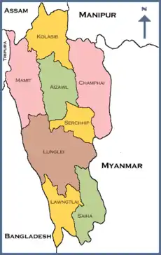 |
| MZ-03 | MZ-03 | Distrito de Champhai | MZ-CH | Champhai | 125 370 | 3168 | 39 | 1998[59] | http://champhai.nic.in/ | |
| MZ-06 | MZ-08 | Distrito de Kolasib | MZ-KO | Kolasib | 83 054 | 1386 | 60 | 1998[60] | http://kolasib.nic.in/ | |
| MZ-04 | MZ-05 | Distrito de Lawngtlai | MZ-LA | Lawngtlai | 117 444 | 2519 | 46 | ? | http://lawngtlai.nic.in/ | |
| MZ-02 | MZ-01 | Distrito de Lunglei | MZ-LU | Lunglei | 154 094 | 4572 | 34 | ? | http://lunglei.nic.in/ | |
| MZ-05 | MZ-04 | Distrito de Mamit | MZ-MA | Mamit | 85 757 | 2967 | 28 | 1998[61] | http://mamit.nic.in/ | |
| MZ-08 | MZ-07 | Distrito de Saiha | MZ-SI | Saiha | 56 366 | 1414 | 40 | 1998 | http://saiha.nic.in/ | |
| MZ-07 | MZ-06 | Distrito de Serchhip | MZ-SE | Serchhip | 64 875 | 1424 | 46 | 1998 | http://serchhip.nic.in/ | |
| — | — | Total | 888 573 | 21 087 | 42 | — | — | |||
Nagaland (NL)
- Véase también: Distritos de Nagaland
| Código | Distrito | Sede | Población (2001) | Área (km²) | Densidad (/km²) | Web Oficial |
| DI | Dimapur | Dimapur | 308,382 | 926 | 333 | http://dimapur.nic.in/ |
| KO | Kohima | Kohima | 314,366 | 3,113 | 101 | http://kohima.nic.in/ |
| MK | Mokokchung | Mokokchung | 227,230 | 1,615 | 141 | http://mokokchung.nic.in/ |
| MN | Mon | Mon | 259,604 | 1,786 | 145 | http://mon.nic.in/ |
| PH | Phek | Phek | 148,246 | 2,026 | 73 | http://phek.nic.in/ |
| TU | Tuensang | Tuensang | 414,801 | 4,228 | 98 | http://tuensang.nic.in/ |
| WO | Wokha | Wokha | 161,098 | 1,628 | 99 | http://wokha.nic.in/ |
| ZU | Zunheboto | Zunheboto | 154,909 | 1,255 | 123 | http://zunheboto.nic.in/ |
| Kifire | Kifire | |||||
| Longleng | Longleng | |||||
| Peren | Peren | |||||
Orissa (OR)
- Véase también: Distritos de Orissa
| Código | Distrito | Sede | Población (2001) | Área (km²) | Densidad (/km²) | Web Oficial |
| AN | Angul | Angul | 1,139,341 | 6,347 | 180 | |
| BD | Boudh | Boudh | 373,038 | 4,289 | 87 | |
| BH | Bhadrak | Bhadrak | 1,332,249 | 2,788 | 478 | |
| BL | Balangir | Balangir | 1,335,760 | 6,552 | 204 | |
| BR | Bargarh | Bargarh | 1,345,601 | 5,832 | 231 | |
| BW | Balasore | Balasore | 2,023,056 | 3,706 | 546 | |
| CU | Cuttack | Cuttack | 2,340,686 | 3,915 | 598 | |
| DE | Deogarh | Deogarh | 274,095 | 2,781 | 99 | |
| DH | Dhenkanal | Dhenkanal | 1,065,983 | 4,597 | 232 | |
| GN | Ganjam | Chhatrapur | 3,136,937 | 8,033 | 391 | http://ganjam.nic.in/ |
| GP | Gajapati | Paralakhemundi | 518,448 | 3,056 | 170 | |
| JH | Jharsuguda | Jharsuguda | 509,056 | 2,202 | 231 | |
| JP | Jajpur | Jajpur | 1,622,868 | 2,885 | 563 | |
| JS | Jagatsinghpur | Jagatsinghpur | 1,056,556 | 1,759 | 601 | |
| KH | Khurdha | Khordha | 1,874,405 | 2,888 | 649 | |
| KJ | Kendujhar | Keonjhar | 1,561,521 | 8,336 | 187 | |
| KL | Kalahandi | Bhawanipatna | 1,334,372 | 8,197 | 163 | http://kalahandi.nic.in/ |
| KN | Kandhamal | Phulbani | 647,912 | 6,004 | 108 | http://kandhamal.nic.in/ |
| KO | Koraput | Koraput | 1,177,954 | 8,534 | 138 | |
| KP | Kendrapara | Kendrapara | 1,301,856 | 2,546 | 511 | |
| ML | Malkangiri | Malkangiri | 480,232 | 6,115 | 79 | |
| MY | Mayurbhanj | Baripada | 2,221,782 | 10,418 | 213 | http://mayurbhanj.nic.in/ |
| NB | Nabarangpur | Nabarangapur | 1,018,171 | 5,135 | 198 | |
| NU | Nuapada | Nuapada | 530,524 | 3,408 | 156 | |
| NY | Nayagarh | Nayagarh | 863,934 | 3,954 | 218 | |
| PU | Puri | Puri | 1,498,604 | 3,055 | 491 | |
| RA | Rayagada | Rayagada | 823,019 | 7,585 | 109 | |
| SA | Sambalpur | Sambalpur | 928,889 | 6,702 | 139 | |
| SU | Subarnapur | Subarnapur | 540,659 | 2,284 | 237 | |
| SU | Sundargarh | Sundargarh | 1,829,412 | 9,942 | 184 | http://sundergarh.nic.in/ |
Puducherry (PY)
- Véase también: Distritos de Puduherry
| Código | Distrito | Sede | Población (2001) | Área (km²) | Densidad (/km²) | Web Oficial |
| KA | Karaikal | Karaikal | 170,640 | 160 | 1,067 | http://Karaikal.gov.in/ |
| MA | Mahe | Mahe | 36,823 | 9 | 4,091 | http://mahe.gov.in/ |
| PO | Puducherry | Pondicherry | 735,004 | 293 | 2,509 | http://puducherry.nic.in/ |
| YA | Yanam | Yanam | 31,362 | 30 | 1,045 | http://web.archive.org/web/http://yanam.nic.in/ |
Punyab (PB)
- Véase también: Distritos de Punyab
Rajastán (RJ)
- Véase también: Distritos de Rajastán
Sikkim (SK)
- Véase también: Distritos de Sikkim
| Código | Distrito | Sede | Población (2001) | Área (km²) | Densidad (/km²) | Web Oficial |
| ES | Sikkim oriental | Gangtok | 244,790 | 954 | 257 | http://esikkim.gov.in/ |
| NS | Sikkim meridional | Mangan | 41,023 | 4,226 | 10 | http://nsikkim.gov.in/ |
| SS | Sikkim septentrional | Namchi | 131,506 | 750 | 175 | http://ssikkim.gov.in/ |
| WS | Sikkim occidental | Gyalshing | 123,174 | 1,166 | 106 | http://wsikkim.gov.in/ |
Tamil Nadu (TN)
- Véase también: Distritos de Tamil Nadu
Tripura (TR)
- Véase también: Distritos de Tripura
| Código | Distrito | Sede | Población (2001) | Área (km²) | Densidad (/km²) | Web Oficial |
| DH | Dhalai | Ambassa | 307,417 | 2,523 | 122 | http://dhalai.gov.in/ |
| NT | Tripura septentrional | Kailasahar | 590,655 | 2,821 | 209 | http://northtripura.nic.in/ |
| ST | Tripura meridional | Udaipur | 762,565 | 2,152 | 354 | http://southtripura.nic.in/ |
| WT | Tripura occidental | Agartala | 1,530,531 | 2,997 | 511 | http://westtripura.nic.in/ |
Uttarakhand (UL)
- Véase también: Distritos de Uttarakhand
| Código | Distrito | Sede | Población (2001) | Área (km²) | Densidad (/km²) | Web Official |
| AL | Almora | Almora | 630,446 | 3,090 | 204 | http://almora.nic.in/ |
| BA | Bageshwar | Bageshwar | 249,453 | 2,310 | 108 | http://bageshwar.nic.in/ |
| CL | Chamoli | Gopeshwar | 369,198 | 7,692 | 48 | http://chamoli.nic.in/ |
| CP | Champawat | Champawat | 224,461 | 1,781 | 126 | http://champawat.nic.in/ |
| DD | Dehradun | Dehradun | 1,279,083 | 13,088 | 414 | http://dehradun.nic.in/ |
| HA | Hardwar | Hardwar | 1,444,213 | 2,360 | 612 | http://haridwar.nic.in/ |
| NA | Nainital | Nainital | 762,912 | 3,853 | 198 | http://nainital.nic.in/ |
| PG | Pauri Garhwal | Pauri | 696,851 | 5,438 | 128 | http://pauri.nic.in/ |
| PI | Pithoragharh | Pithoragarh | 462,149 | 7,110 | 65 | http://pithoragarh.nic.in/ |
| RP | Rudraprayag | Rudraprayag | 227,461 | 1,896 | 120 | http://rudraprayag.nic.in/ |
| TG | Tehri Garhwal | New Tehri | 604,608 | 4,085 | 148 | http://tehri.nic.in/ |
| US | Udham Singh Nagar | Rudrapur | 1,234,548 | 2,912 | 424 | http://usnagar.nic.in/ |
| UT | Uttarkashi | Uttarkashi | 294,179 | 7,951 | 37 | http://uttarkashi.nic.in/ |
Uttar Pradesh (UP)
- Véase también: Distritos de Uttar Pradesh
Bengala Occidental (WB)
- Véase también: Distritos de Bengala Occidental
Referencias
- (en inglés) «Andhra Pradesh Population Census data 2011». Gouvernement de l'Inde. Consultado el 7 de agosto de 2013.
- «At a glance». Government of Arunachal Pradesh website.
- Fue creado el 16 de diciembre de 2001, por escisión del antiguo Distrito del Valle del Dibang (hoy Distrito del Alto Valle del Dibang).
- Creado en 2001 por escisión del Lower Subansiri.
- The Office of Registrar General and Census Commissioner of India.
- «District Census 2011». Census2011.co.in.
- ISO 3166
- «CM Tarun Gogoi announces 5 new districts in Assam on Independence Day». Daily News and Analysis (Guwahati). PTI. 15 de agosto de 2015. Consultado el 15 de agosto de 2015.
- «Biswanath district inaugurated». Assam Tribune. Consultado el 2 de marzo de 2016.
- «Charaideo inaugurated as a new dist». Assam Tribune. Consultado el 15 de febrero de 2016.
- «Hojai inaugurated as new district». Voice of Greater Assam. Consultado el 20 de febrero de 2016.
- «West Karbi Anglong district inaugurated». Assam Tribune. Consultado el 11 de febrero de 2016.
- «Majuli to function as new district from today». Assam Tribune. Consultado el 9 de septiembre de 2016.
- «South Salmara-Mankachar dist inaugurated». Assam Tribune. Consultado el 11 de febrero de 2016.
- Anita (2 de enero de 2012). «Chhattisgarh gets New Year gift - 9 new districts!». Oneindia. Consultado el 16 de febrero de 2016.
- «Electoral rolls». Office of the Chief Electoral Officer, Chhattisgarh. Archivado desde el original el 5 de marzo de 2012.
- Chhattisgarh at a glance-2002 (enlace roto disponible en este archivo). Govt. of Chhattisgarh ofiicial website.
- List of Chhattisgarh District Centres (enlace roto disponible en este archivo). at NIC, Chhattisgarh official Portal
- Mathew, K.M. (ed.). Manorama Yearbook 2008, Kottayam: Malayala Manorama, ISSN 0542-5778, p.518
- «Ranking of Districts by Population Size, 2001 and 2011». 2011 census of India. Government of India. Consultado el 3 de mayo de 2012.
- «Districts of India». Statoids.com. Consultado el 15 de julio de 2011.
- docs/MailService_e-mail_address_Policy_WithCodes.pdf «NIC Policy on format of e-mail Address»]. mail.nic.in. National Informatics Center. Archivado desde docs/MailService_e-mail_address_Policy_WithCodes.pdf el original] el 11 de septiembre de 2008. Consultado el 15 de julio de 2011.
- 2011-prov-results/prov_data_products_haryana.html «District-wise Population of Haryana»] (DOC). censusindia.gov.in. Ministry of Home Affairs – Office of the Register General & Census Commissioner. Consultado el 18 de julio de 2011.
- Establecido el 4 de abril de 2005.
- Establecido el 13 de agosto de 2008.
- «Himachal Pradesh» (en inglés). 2011 census of India, Gouvernement de l'Inde. 2011. Consultado el 9 de agosto de 2013.
- «NIC Policy on format of e-mail Address: Appendix (2): Districts Abbreviations as per ISO 3166–2» (en inglés). Ministry Of Communications and Information Technology, Government of India. 18 de agosto de 2004. pp. 5-10. Consultado el 9 de agosto de 2013.
- (en inglés) «Districts of Jharkhand». 2011 census of India, Gouvernement de l'Inde. 2011. Consultado el 11 de agosto de 2013.
- «Districts : Kerala». Government of India portal. Consultado el 11 de marzo de 2009.
- «Part I: state». Government of India Census portal. Consultado el 8 de diciembre de 2015.
- «NIC Policy on format of e-mail Address: Appendix (2): Districts Abbreviations as per ISO 3166–2» (PDF). Ministry Of Communications and Information Technology, Government of India. 10 de agosto de 2004. pp. 5-10. Archivado desde el original el 11 de septiembre de 2008. Consultado el 24 de noviembre de 2008.
- Here 'Established' means the year of establishment as a district of Kerala. If the district was formed earlier than the formation of the state of Kerala, 1 Nov 1956 will be considered as the day of establishment of the district.
- «Alappuzha : History». alappuzha.nic.in. Archivado desde el original el 10 de abril de 2009. Consultado el 11 de marzo de 2009.
- «History of Ernakulam». ernakulam.nic.in ( Ministry of Communication & Information Technology, Govt. of India). Consultado el 11 de marzo de 2009.
- «Taluks — Ernakulam District». ernakulam.nic.in. Archivado desde el original el 27 de febrero de 2009. Consultado el 11 de marzo de 2009.
- «IDUKKI : History». idukki.nic.in ( Ministry of Communication & Information Technology, Govt. of India). Consultado el 11 de marzo de 2009.
- as per Government notification No 54131/C2/71/RD dated 24 January 1972, Government of Kerala
- «Kannur district : Administration». knr.kerala.gov.in ( Govt. of Kerala). Archivado desde el original el 21 de abril de 2009. Consultado el 11 de marzo de 2009.
- «DISTRICT CAME INTO EXISTENCE...». kasargod.nic.in. Consultado el 11 de marzo de 2009.
- As per GO.(MS)No.520/84/RD dated 19.05.1984 , Government of Kerala
- «Kasaragod District > taluks». kasargod.nic.in. Consultado el 11 de marzo de 2009.
- «Short History of Kollam». kollam.nic.in. Consultado el 11 de marzo de 2009.
- Nota: Esta fecha indica el día en el cual se formó inicialmente el distrito, incluso antes de la creación del estado de Kerala. El 1 de noviembre de 1956 se considera el día de la formación del distrito dentro del estado de Kerala.
- «Taluks and Villages». Kollam.nic.in. Consultado el 11 de marzo de 2009.
- «District Handbooks of Kerala KOTTAYAM». kerala.gov.in. Archivado desde el original el 19 de marzo de 2009. Consultado el 11 de marzo de 2009.
- «KOTTAYAM : Short History». Kerala.gov.in. Consultado el 12 de marzo de 2009.
- «Kozhikode: History». kozhikode.nic.in. Archivado desde el original el 2 de abril de 2007. Consultado el 12 de marzo de 2009.
- «Kozhikode: Administration». kozhikode.nic.in. Archivado desde el original el 7 de febrero de 2009. Consultado el 12 de marzo de 2009.
- «Malappuram: HISTORY». malappuram.nic.in. Consultado el 12 de marzo de 2009.
- «Welcome to Palghat». palghat.net. Consultado el 12 de marzo de 2009.
- «BASIC STATISTICS of PALAKKAD». palakkad.nic.in. Archivado desde el original el 10 de abril de 2009. Consultado el 12 de marzo de 2009.
- «Pathanamthitta : History». pathanamthitta.nic.in. Archivado desde el original el 10 de abril de 2009. Consultado el 12 de marzo de 2009.
- As per GO (MS) No.1026/82/(RD) dated 29.10.1982, Government of Kerala
- «Pathanamthitta : Administration». pathanamthitta.nic.in. Archivado desde el original el 10 de abril de 2009. Consultado el 12 de marzo de 2009.
- «THIRUVANANTHAPURAM». Archivado desde el original el 7 de febrero de 2009. Consultado el 12 de marzo de 2009.
- «Thrissur At A Glance». thrissur.nic.in. Consultado el 12 de marzo de 2009.
- «Wayanad :profile». wayanad.nic.in. Consultado el 12 de marzo de 2009.
- «NIC Policy on format of e-mail Address: Appendix (2): Districts Abbreviations as per ISO 3166-2». Ministry Of Communications and Information Technology, Government of India. 18 de agosto de 2004. pp. 5-10. Archivado desde el original el 11 de septiembre de 2008. Consultado el 24 de noviembre de 2008.
- http://www.censusindia.gov.in/2011census/dchb/1504_PART_B_DCHB_CHAMPHAI.pdf
- «Kolasib - Administrative Setup». kolasib.nic.in. Consultado el 6 de julio de 2016.
- «Official Website of Mamit District». mamit.nic.in. Consultado el 6 de julio de 2016.
