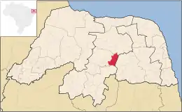
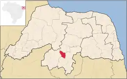
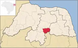
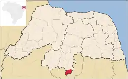
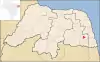
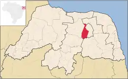
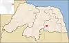
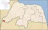
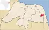
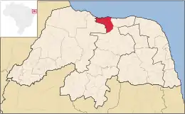
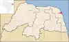
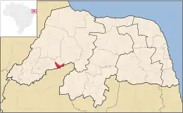
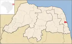
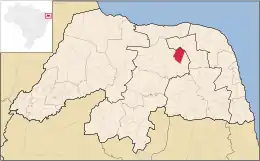
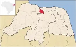
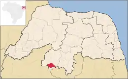
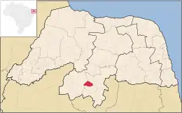
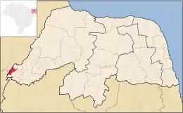
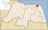
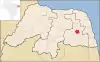
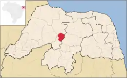
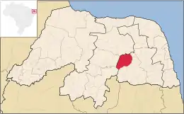
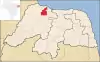
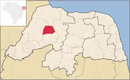
Anexo:Municipios de Río Grande del Norte

Los municipios de Río Grande del Norte son las subdivisiones oficiales del estado brasileño de Río Grande del Norte, localizado en la región nordeste del país. De acuerdo con el IBGE (Instituto Brasileño de Geografía y Estadística), el estado se divide en 167 municipios, siendo la decimotercera unidad de la federación brasileña con el mayor número de municipios del país y a séptima de todo el nordeste, solo superada por los estados de Bahia, Piauí, Paraíba, Pernambuco y Ceará y superando Alagoas y Sergipe.

Mapa de Río Grande del Norte con las subdivisiones oficiales.

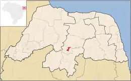
Además de los municipios, el estado de Río Grande del Norte es oficialmente subdividido también en diecinueve microrregiones (Angicos, Agreste Potiguar, Baixa Verde, Borborema Potiguar, Chapada del Apodi, Litoral nordeste, Litoral Sur, Macaíba, Macau, Medio Oeste, Mossoró, Natal, Pau dos Ferros, Seridó Occidental, Seridó Oriental, Sierra de São Miguel, Sierra de Santana, Umarizal y Valle del Açu) y cuatro mesorregiones (Agreste Potiguar, Central Potiguar, Este Potiguar y Oeste Potiguar).[1]

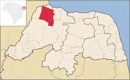
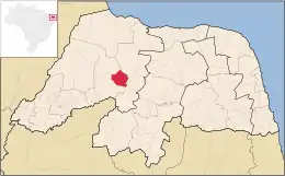
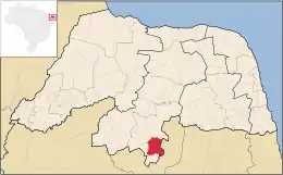
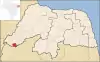
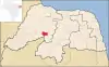
El área total del estado es de 52 796,791, siendo la 22ª mayor del país, con extensión comparable a la de Bosnia y Herzegovina.[2] El municipio con la mayor área es Mossoró, localizado en la mesorregión del Oeste Potiguar y microrregión homónima, con 2110,207 de extensión, mientras que el menor es Senador Georgino Avelino, con 26,383, localizado en la mesorregión del Este Potiguar y microrregión del Litoral Sur.[1] La población del estado recensada en 2010 fue de 3 168 027 habitantes, siendo el decimosexto más poblado del país.[3] Entretanto, apenas tres de sus municipios presentan una población igual o superior a cien mil habitantes: Natal, Mossoró y Parnamirim.[3]

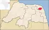
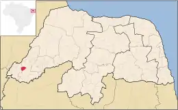
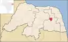
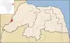
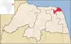
El estado de Río Grande del Norte tiene como estados limítrofes Ceará al oeste y Paraíba al sur, y limita con el Océano Atlántico tanto al norte como al este.[4] La sede del gobierno del estado, ejercida por Robinson Mesquita de Faria, se encuentra en Natal, que es la capital y municipio más poblado del estado.

Debido su localización geográfica en el territorio brasileño, Río Grande del Norte es conocido como «esquina del continente». Es la unidad de la federación más próxima a Europa y África.[5][6]
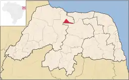
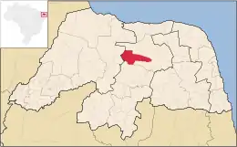
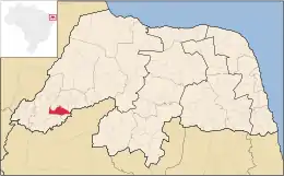
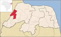
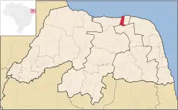
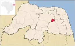
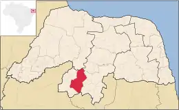
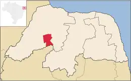
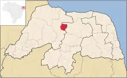
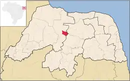
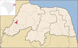
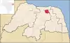
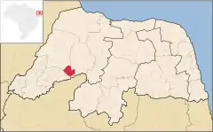
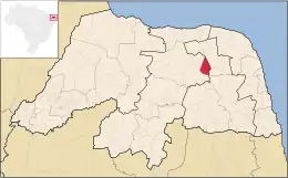
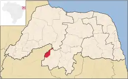
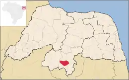
Municipios

Areia Branca
Baía Formosa
Coronel João Pessoa
Doutor Severiano
Encanto
Major Sales
Martins
Rafael Godeiro
Riacho de Santana
Santa Cruz
São Gonçalo do Amarante
São José de Mipibu
São Miguel do Gostoso
São Paulo do Potengi
Tibau
Tibau do Sul
El Faro de Calcanhar, el faro tradicional más grande de Brasil,[7] en la localidad de Touros.
Triunfo Potiguar
Várzea
Venha-Ver
Viçosa
Mapa (coordenadas)[8] Localidad Área
(km²) (millas cuadradas)[9]
Población[10] Mesorregión[9] Microrregión[9]
6°26′8″S 36°38′20″O Acari 608.565 (234.967) 11,035 Central Potiguar Seridó Oriental
5°29′54″S 36°30′20″O Afonso Bezerra 576.248 (222.489) 10,879 Central Potiguar Angicos
6°12′33″S 38°17′50″O Água Nova 50.683 (19.569) 2,984 Oeste Potiguar Sierra de São Miguel
6°24′45″S 38°0′57″O Alexandria 381.202 (147.182) 13,475 Oeste Potiguar Pau dos Ferros
6°9′8″S 37°45′58″O Almino Afonso 128.029 (49.432) 4,880 Oeste Potiguar Umarizal
5°17′18″S 36°45′44″O Alto do Rodrigues 191.311 (73.865) 12,306 Oeste Potiguar Valle del Açu
5°39′56″S 36°36′4″O Angicos 741.654 (286.353) 11,553 Central Potiguar Angicos
6°12′46″S 37°54′20″O Antônio Martins 244.620 (94.448) 6,907 Oeste Potiguar Umarizal
5°39′51″S 37°47′56″O Apodi 1,602.659 (618.787) 34,777 Oeste Potiguar Chapada do Apodi
4°57′22″S 37°8′13″O Areia Branca 357.580 (138.062) 25,263 Oeste Potiguar Mossoró
6°11′40″S 35°9′37″O Arês 112.584 (43.469) 12,931 Este Potiguar Litoral Sur
5°34′36″S 36°54′31″O Assu 1,269.235 (490.052) 53,245 Oeste Potiguar Valle del Açu
6°22′10″S 35°0′28″O Baía Formosa 245.510 (94.791) 8,569 Este Potiguar Litoral Sur
5°4′48″S 37°37′0″O Baraúna 825.802 (318.842) 24,187 Oeste Potiguar Mossoró
5°52′2″S 35°55′35″O Barcelona 152.629 (58.930) 3,957 Agreste Potiguar Borborema Potiguar
5°41′38″S 35°49′11″O Bento Fernandes 301.075 (116.245) 5,110 Agreste Potiguar Baixa Verde
6°9′30″S 35°36′2″O Boa Saúde 187.211 (72.282) 9,009 Agreste Potiguar Agreste Potiguar
5°59′18″S 36°24′47″O Bodó 253.513 (97.881) 2,425 Central Potiguar Sierra de Santana
5°59′2″S 35°34′53″O Bom Jesus 122.033 (47.117) 9,432 Agreste Potiguar Agreste Potiguar
6°11′27″S 35°21′24″O Brejinho 58.528 (22.598) 11,577 Agreste Potiguar Agreste Potiguar
5°3′52″S 36°3′21″O Caiçara do Norte 189.415 (73.133) 6,016 Central Potiguar Macau
5°45′37″S 35°59′54″O Caiçara do Rio do Vento 261.191 (100.846) 3,304 Central Potiguar Angicos
6°27′30″S 37°5′52″O Caicó 1,228.574 (474.352) 62,727 Central Potiguar Seridó Occidental
5°51′50″S 37°18′36″O Campo Grande 896.962 (346.317) 9,289 Oeste Potiguar Medio Oeste
6°14′29″S 36°10′57″O Campo Redondo 213.629 (82.482) 10,266 Agreste Potiguar Borborema Potiguar
6°22′48″S 35°7′44″O Canguaretama 245.529 (94.799) 30,900 Este Potiguar Litoral Sur
5°47′33″S 37°33′24″O Caraúbas 1,095.001 (422.780) 19,582 Oeste Potiguar Chapada do Apodi
6°33′20″S 36°35′42″O Carnaúba dos Dantas 245.648 (94.845) 7,429 Central Potiguar Seridó Oriental
5°20′24″S 36°50′24″O Carnaubais 529.835 (204.569) 9,775 Oeste Potiguar Valle del Açu
5°38′4″S 35°25′2″O Ceará-Mirim 739.686 (285.593) 67,844 Este Potiguar Macaíba
6°2′44″S 36°20′45″O Cerro Corá 393.569 (151.957) 10,916 Central Potiguar Sierra de Santana
6°22′57″S 36°12′53″O Coronel Ezequiel 185.752 (71.719) 5,405 Agreste Potiguar Borborema Potiguar
6°15′35″S 38°26′37″O Coronel João Pessoa 117.140 (45.228) 4,774 Oeste Potiguar Sierra de São Miguel
6°24′42″S 36°47′23″O Cruzeta 295.829 (114.220) 7,968 Central Potiguar Seridó Oriental
6°24′42″S 36°47′23″O Currais Novos 864.431 (333.757) 42,668 Central Potiguar Seridó Oriental
6°5′40″S 38°22′29″O Doutor Severiano 108.277 (41.786) 6,495 Oeste Potiguar Sierra de São Miguel
6°6′38″S 38°18′19″O Encanto 125.747 (48.555) 5,228 Oeste Potiguar Sierra de São Miguel
6°56′42″S 36°43′6″O Equador 264.983 (102.310) 5,822 Central Potiguar Seridó Oriental
6°19′56″S 35°18′34″O Espírito Santo 143.673 (55.472) 10,480 Este Potiguar Litoral Sur
5°42′20″S 35°18′26″O Extremoz 125.665 (48.519) 24,550 Este Potiguar Natal
5°36′9″S 37°41′19″O Felipe Guerra 268.427 (103.640) 5,734 Oeste Potiguar Chapada do Apodi
5°41′50″S 36°31′52″O Fernando Pedroza 322.540 (124.533) 2,850 Central Potiguar Angicos
6°7′38″S 36°49′5″O Florânia 504.022 (194.603) 9,672 Central Potiguar Sierra de Santana
6°4′42″S 38°7′10″O Francisco Dantas 181.593 (70.113) 2,874 Oeste Potiguar Pau dos Ferros
6°9′30″S 37°53′23″O Frutuoso Gomes 63.278 (24.432) 4,233 Oeste Potiguar Umarizal
5°5′26″S 36°16′31″O Galinhos 342.442 (132.217) 2,150 Central Potiguar Macau
6°15′53″S 35°12′35″O Goianinha 192.227 (74.219) 22,467 Este Potiguar Litoral Sur
5°27′32″S 37°31′15″O Governador Dix-Sept Rosado 1,129.373 (436.051) 12,373 Oeste Potiguar Chapada do Apodi
4°58′47″S 37°9′17″O Grossos 126.451 (48.823) 9,393 Oeste Potiguar Mossoró
5°6′27″S 36°19′13″O Guamaré 259.181 (100.070) 12,431 Central Potiguar Macau
5°49′27″S 35°33′10″O Ielmo Marinho 305.185 (117.832) 12,188 Agreste Potiguar Agreste Potiguar
5°29′54″S 36°51′18″O Ipanguaçu 374.239 (144.494) 13,855 Oeste Potiguar Valle del Açu
6°48′51″S 37°11′56″O Ipueira 127.347 (46.169) 2,074 Central Potiguar Seridó Occidental
5°38′39″S 36°52′17″O Itajá 203.623 (78.619) 6,952 Oeste Potiguar Valle del Açu
5°50′23″S 37°59′24″O Itaú 133.032 (51.364) 5,568 Oeste Potiguar Pau dos Ferros
6°25′33″S 36°12′18″O Jaçanã 54.558 (21.065) 7,925 Agreste Potiguar Borborema Potiguar
5°21′23″S 36°7′41″O Jandaíra 435.678 (168.215) 6,796 Agreste Potiguar Baixa Verde
6°00′56″S 37°24′32″O Janduís 304.899 (117.722) 5,350 Oeste Potiguar Medio Oeste
6°27′54″S 35°56′48″O Japi 188.990 (72.969) 5,522 Agreste Potiguar Borborema Potiguar
5°39′13″S 35°58′8″O Jardim de Angicos 254.045 (98.087) 2,607 Central Potiguar Angicos
6°22′43″S 37°21′7″O Jardim de Piranhas 330.553 (127.627) 13,511 Central Potiguar Seridó Occidental
6°35′4″S 36°46′28″O Jardim do Seridó 368.643 (142.333) 12,115 Central Potiguar Seridó Oriental
5°32′15″S 35°49′11″O João Câmara 714.951 (276.043) 32,203 Agreste Potiguar Baixa Verde
6°16′28″S 37°47′46″O João Dias 88.173 (34.044) 2,601 Oeste Potiguar Umarizal
6°19′0″S 38°16′53″O José da Penha 117.634 (45.418) 5,868 Oeste Potiguar Pau dos Ferros
6°2′2″S 37°1′13″O Jucurutu 933.718 (360.509) 17,692 Oeste Potiguar Valle del Açu
6°16′19″S 35°19′37″O Jundiá 45.261 (17.475) 3,585 Agreste Potiguar Agreste Potiguar
6°26′28″S 35°35′54″O Lagoa d'Anta 105.650 (40.791) 6,227 Agreste Potiguar Agreste Potiguar
6°8′57″S 35°26′16″O Lagoa de Pedras 117.660 (45.429) 6,992 Agreste Potiguar Agreste Potiguar
6°0′14″S 35°52′18″O Lagoa de Velhos 112.832 (43.564) 2,632 Agreste Potiguar Borborema Potiguar
6°7′16″S 35°28′38″O Lagoa Nova 176.299 (68.069) 13,990 Central Potiguar Sierra de Santana
6°7′15″S 35°28′38″O Lagoa Salgada 79.515 (30.701) 7,515 Agreste Potiguar Agreste Potiguar
5°42′0″S 36°14′41″O Lajes 676.417 (261.165) 10,385 Central Potiguar Angicos
6°9′1″S 36°7′2″O Lajes Pintadas 120.308 (46.451) 4,614 Agreste Potiguar Borborema Potiguar
6°7′12″S 37°48′56″O Lucrécia 30.935 (11.944) 3,633 Oeste Potiguar Umarizal
6°24′50″S 38°23′19″O Luís Gomes 166.637 (64.235) 9,612 Oeste Potiguar Sierra de São Miguel
5°51′30″S 35°21′14″O Macaíba 512.487 (197.871) 69,538 Este Potiguar Macaíba
5°6′54″S 36°38′4″O Macau 788.022 (304.255) 28,974 Central Potiguar Macau
6°24′22″S 38°19′26″O Major Sales 31.971 (12.344) 3,536 Oeste Potiguar Sierra de São Miguel
6°17′39″S 38°10′2″O Marcelino Vieira 345.707 (133.477) 8,265 Oeste Potiguar Pau dos Ferros
6°5′16″S 37°54′40″O Martins 169.446 (65.423) 8,228 Oeste Potiguar Umarizal
5°31′2″S 35°15′23″O Maxaranguape 131.300 (50.695) 10,442 Este Potiguar Litoral nordeste
6°4′44″S 37°30′15″O Messias Targino 135.094 (52.160) 4,188 Oeste Potiguar Medio Oeste
6°29′9″S 35°17′15″O Montanhas 82.213 (31.742) 11,418 Este Potiguar Litoral Sur
6°4′4″S 35°19′56″O Monte Alegre 199.519 (77.034) 20,670 Agreste Potiguar Agreste Potiguar
6°26′29″S 35°46′57″O Monte das Gameleiras 71.945 (27.778) 2,266 Agreste Potiguar Borborema Potiguar
5°11′15″S 37°20′39″O Mossoró 2,110.207 (814.751) 259,886 Oeste Potiguar Mossoró
5°47′42″S 35°12′34″O Natal 170.298 (65.752) 803,811 Este Potiguar Natal
6°5′28″S 35°12′31″O Nísia Floresta 306.051 (118.166) 23,818 Este Potiguar Macaíba
6°28′41″S 35°26′2″O Nova Cruz 277.657 (107.203) 35,541 Agreste Potiguar Agreste Potiguar
5°57′23″S 37°42′20″O Olho-d'Água do Borges 141.170 (54.506) 4,301 Oeste Potiguar Umarizal
6°42′4″S 36°56′44″O Ouro Branco 253.300 (97.799) 4,699 Central Potiguar Seridó Oriental
6°29′11″S 38°18′47″O Paraná 81.390 (31.425) 3,952 Oeste Potiguar Pau dos Ferros
5°46′28″S 37°6′5″O Paraú 410.858 (158.632) 3,862 Oeste Potiguar Medio Oeste
5°13′23″S 35°50′18″O Parazinho 274.668 (106.057) 4,845 Agreste Potiguar Baixa Verde
6°41′16″S 36°39′27″O Parelhas 513.052 (198.089) 20,670 Central Potiguar Seridó Occidental
5°54′56″S 35°15′46″O Parnamirim 120.202 (46.410) 202,413 Este Potiguar Natal
6°26′8″S 35°38′36″O Passa e Fica 42.137 (16.269) 11,111 Agreste Potiguar Agreste Potiguar
6°16′44″S 35°22′39″O Passagem 41.235 (15.921) 2,899 Agreste Potiguar Agreste Potiguar
6°6′36″S 37°18′12″O Patu 319.932 (123.526) 11,964 Oeste Potiguar Umarizal
6°6′33″S 38°12′16″O Pau dos Ferros 259.960 (100.371) 27,733 Oeste Potiguar Pau dos Ferros
5°9′1″S 35°52′44″O Pedra Grande 221.429 (85.494) 3,521 Este Potiguar Litoral nordeste
5°34′57″S 36°6′17″O Pedra Preta 294.979 (113.891) 2,583 Central Potiguar Angicos
5°31′18″S 36°23′17″O Pedro Avelino 952.688 (367.833) 7,168 Central Potiguar Angicos
6°26′21″S 35°13′17″O Pedro Velho 192.707 (74.404) 14,119 Este Potiguar Litoral Sur
5°15′36″S 36°43′20″O Pendências 419.141 (161.830) 13,436 Oeste Potiguar Valle del Açu
6°16′7″S 38°2′36″O Pilões 82.691 (31.927) 3,453 Oeste Potiguar Pau dos Ferros
5°37′22″S 35°39′46″O Poço Branco 230.730 (89.085) 13,947 Agreste Potiguar Baixa Verde
6°1′26″S 37°59′16″O Portalegre 110.052 (42.491) 7,297 Oeste Potiguar Pau dos Ferros
5°4′4″S 36°46′54″O Porto do Mangue 418.636 (161.635) 5,217 Oeste Potiguar Valle del Açu
5°28′1″S 35°33′22″O Pureza 504.317 (194.717) 8,432 Este Potiguar Litoral nordeste
6°11′41″S 38°13′33″O Rafael Fernandes 78.230 (30.205) 4,692 Oeste Potiguar Pau dos Ferros
6°4′32″S 37°43′0″O Rafael Godeiro 100.073 (38.638) 3,070 Oeste Potiguar Umarizal
5°56′11″S 37°56′47″O Riacho da Cruz 127.221 (49.120) 3,165 Oeste Potiguar Pau dos Ferros
6°15′48″S 38°18′56″O Riacho de Santana 128.104 (49.461) 4,157 Oeste Potiguar Sierra de São Miguel
5°48′54″S 35°49′30″O Riachuelo 262.873 (101.495) 7,067 Agreste Potiguar Agreste Potiguar
5°16′22″S 35°22′59″O Rio do Fogo 150.282 (58.024) 10,060 Este Potiguar Litoral nordeste
5°47′17″S 38°3′36″O Rodolfo Fernandes 154.840 (59.784) 4,417 Oeste Potiguar Pau dos Ferros
5°52′53″S 35°56′5″O Ruy Barbosa 125.813 (48.576) 3,595 Agreste Potiguar Borborema Potiguar
6°13′46″S 36°1′22″O Santa Cruz 624.390 (241.077) 35,759 Agreste Potiguar Borborema Potiguar
5°50′23″S 35°41′43″O Santa Maria 219.572 (84.777) 4,762 Agreste Potiguar Agreste Potiguar
5°57′27″S 36°39′20″O Santana do Matos 1,420.313 (548.383) 13,798 Central Potiguar Sierra de Santana
6°46′14″S 36°44′0″O Santana do Seridó 188.402 (72.742) 2,526 Central Potiguar Seridó Oriental
6°18′38″S 35°28′44″O Santo Antônio 301.052 (116.236) 22,214 Agreste Potiguar Agreste Potiguar
5°3′59″S 36°2′17″O São Bento do Norte 288.637 (111.443) 2,974 Central Potiguar Macau
6°20′30″S 36°5′14″O São Bento do Trairi 190.816 (73.674) 3,909 Agreste Potiguar Borborema Potiguar
6°22′35″S 37°11′4″O São Fernando 404.415 (156.145) 3,401 Central Potiguar Seridó Occidental
5°58′30″S 38°9′6″O São Francisco do Oeste 75.550 (29.170) 3,874 Oeste Potiguar Pau dos Ferros
5°47′36″S 35°19′46″O São Gonçalo do Amarante 251.308 (97.030) 87,700 Este Potiguar Macaíba
6°43′6″S 37°12′2″O São João do Sabugi 277.010 (106.954) 5,914 Central Potiguar Seridó Occidental
6°4′29″S 35°14′16″O São José de Mipibu 293.877 (113.466) 39,771 Este Potiguar Macaíba
5°47′36″S 35°42′50″O São José do Campestre 341.403 (131.816) 12,359 Agreste Potiguar Borborema Potiguar
6°26′57″S 36°52′40″O São José do Seridó 174.504 (67.376) 4,231 Central Potiguar Seridó Oriental
6°12′43″S 38°29′49″O São Miguel 171.690 (66.290) 22,159 Oeste Potiguar Sierra de São Miguel
5°7′29″S 35°38′21″O São Miguel do Gostoso 342.445 (132.218) 8,659 Este Potiguar Litoral nordeste
5°53′42″S 35°45′46″O São Paulo do Potengi 240.435 (92.832) 15,866 Agreste Potiguar Agreste Potiguar
5°53′53″S 35°38′4″O São Pedro 195.238 (75.381) 6,223 Agreste Potiguar Agreste Potiguar
5°47′58″S 36°55′14″O São Rafael 469.096 (181.118) 8,106 Oeste Potiguar Valle del Açu
5°58′21″S 36°4′31″O São Tomé 862.577 (333.041) 10,868 Agreste Potiguar Borborema Potiguar
6°13′2″S 36°41′4″O São Vicente 197.814 (76.376) 6,030 Central Potiguar Sierra de Santana
6°2′8″S 35°41′34″O Senador Elói de Souza 167.592 (64.707) 5,645 Agreste Potiguar Agreste Potiguar
6°9′46″S 35°7′21″O Senador Georgino Avelino 26.383 (10.186) 3,924 Este Potiguar Litoral Sur
6°6′21″S 35°42′46″O Serra Caiada 167.348 (64.613) 8,774 Agreste Potiguar Agreste Potiguar
6°25′2″S 35°42′16″O Serra de São Bento 96.635 (37.311) 5,746 Agreste Potiguar Borborema Potiguar
5°10′12″S 37°1′46″O Serra do Mel 616.509 (238.034) 10,281 Oeste Potiguar Mossoró
6°39′56″S 37°23′50″O Serra Negra do Norte 562.935 (217.349) 7,770 Central Potiguar Seridó Occidental
6°16′34″S 35°29′56″O Serrinha 193.352 (74.653) 6,581 Agreste Potiguar Agreste Potiguar
6°6′36″S 37°57′23″O Serrinha dos Pintos 122.644 (47.353) 4,538 Oeste Potiguar Umarizal
5°46′38″S 37°57′28″O Severiano Melo 157.833 (60.939) 5,752 Oeste Potiguar Pau dos Ferros
6°6′14″S 35°54′40″O Sítio Novo 213.470 (82.421) 5,020 Agreste Potiguar Borborema Potiguar
5°55′48″S 38°2′42″O Taboleiro Grande 124.094 (47.913) 2,317 Oeste Potiguar Pau dos Ferros
5°37′18″S 35°35′48″O Taipu 352.818 (136.223) 11,836 Este Potiguar Litoral nordeste
6°11′58″S 35°48′6″O Tangará 156.780 (60.533) 14,175 Agreste Potiguar Borborema Potiguar
6°27′54″S 38°10′47″O Tenente Ananias 223.670 (86.359) 9,911 Oeste Potiguar Pau dos Ferros
6°8′53″S 36°43′9″O Tenente Laurentino Cruz 74.376 (28.717) 5,406 Central Potiguar Sierra de Santana
4°50′14″S 37°15′9″O Tibau 162.407 (62.705) 3,687 Oeste Potiguar Mossoró
6°11′12″S 35°5′31″O Tibau do Sul 101.793 (39.302) 11,402 Este Potiguar Litoral Sur
6°27′54″S 37°16′28″O Timbaúba dos Batistas 135.450 (52.297) 2,295 Central Potiguar Seridó Occidental
5°11′56″S 35°27′39″O Touros 839.351 (324.073) 31,076 Este Potiguar Litoral nordeste
5°52′1″S 37°11′19″O Triunfo Potiguar 268.706 (103.747) 3,366 Oeste Potiguar Medio Oeste
5°59′26″S 37°48′52″O Umarizal 213.582 (82.464) 10,669 Oeste Potiguar Umarizal
5°38′31″S 37°15′28″O Upanema 811.806 (313.438) 12,985 Oeste Potiguar Medio Oeste
6°20′53″S 35°22′33″O Várzea 67.245 (25.963) 5,227 Agreste Potiguar Agreste Potiguar
6°19′35″S 38°29′3″O Venha-Ver 71.622 (27.653) 3,821 Oeste Potiguar Sierra de São Miguel
6°2′39″S 35°25′42″O Vera Cruz 92.117 (35.566) 10,725 Agreste Potiguar Agreste Potiguar
5°59′40″S 37°56′40″O Viçosa 37.905 (14.635) 1,618 Oeste Potiguar Pau dos Ferros
6°18′52″S 35°4′38″O Vila Flor 47.656 (18.340) 2,872 Este Potiguar Litoral Sur

Referencias

  1. «División Territorial del Brasil». Instituto Brasileiro de Geografia e Estatística (IBGE). 1 de julio de 2008. Consultado el 11 de octubre de 2008.
  2. «Rio Grande do Norte». Consultado el 25 de agosto de 2011.
  3. . Instituto Brasileiro de Geografia e Estatística. 29 de noviembre de 2010 http://www.webcitation.org/5yqlWrP36. Archivado desde el original el 21 de mayo de 2011. Consultado el 23 de agosto de 2011. Falta el |título= (ayuda)
  4. . Só Geografia http://www.webcitation.org/query?url=http%3A%2F%2Fwww.sogeografia.com.br%2FConteudos%2FEstados%2FRioGrandedoNorte%2F&date=2011-05-22. Archivado desde el original el 22 de mayo de 2011. Consultado el 19 de mayo de 2011. Falta el |título= (ayuda)
  5. . Eco Viagem UOL http://www.webcitation.org/query?url=http%3A%2F%2Fecoviagem.uol.com.br%2Fbrasil%2Frio-grande-do-norte%2Fregiao-turistica%2Fnatal-e-regiao%2F&date=2011-05-22. Archivado desde el original el 22 de mayo de 2011. Consultado el 19 de mayo de 2011. Falta el |título= (ayuda)
  6. . Congresso de Gestão Pública do Rio Grande do Norte http://www.webcitation.org/query?url=http%3A%2F%2Fwww.searh.rn.gov.br%2Ficongesprn%2Frn_informacoes.asp&date=2011-05-22. Archivado desde el original el 22 de mayo de 2011. Consultado el 19 de mayo de 2011. Falta el |título= (ayuda)
  7. «São Miguel do Gostoso entra na onda do kitesurf» [São Miguel do Gostoso enters the wave of the kite]. Paraná Online (en portugués). 23 de agosto de 2008. Archivado desde el original el 25 de marzo de 2012. Consultado el 16 de marzo de 2012.
  8. «Rio Grande do Norte» (en portugués). Empresa Brasileira de Pesquisa Agropecuária. Consultado el 18 de febrero de 2012.
  9. «Divisão Territorial do Brasil» [Territorial Divisions of Brazil] (en portugués). Brazilian Institute of Geography and Statistics. 1 de julio de 2008. Consultado el 26 de noviembre de 2011.
  10. «Censo 2010– Rio Grande do Norte» [Census 2010– Rio Grande do Norte] (PDF) (en portugués). Brazilian Institute of Geography and Statistics. 29 de noviembre de 2010. Archivado desde el original el 21 de mayo de 2011. Consultado el 26 de noviembre de 2011.

Véase también

Enlaces externos

Este artículo ha sido escrito por Wikipedia. El texto está disponible bajo la licencia Creative Commons - Atribución - CompartirIgual. Pueden aplicarse cláusulas adicionales a los archivos multimedia.