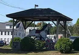
Winchendon (Massachusetts)
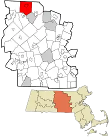
Winchendon est une ville de Nouvelle-Angleterre (en) du comté de Worcester (Massachusetts), aux États-Unis. Sa population est estimée à 10 300 habitants d'après le recensement des États-Unis de 2010.
Pour les articles homonymes, voir Winchendon.
Winchendon
| Pays | |
|---|---|
| État | |
| Comté | |
| Partie de | |
| Superficie |
114,22 km2 |
| Altitude |
305 m |
| Coordonnées |
42° 41′ 10″ N, 72° 02′ 40″ O |
| Population |
10 364 hab. () |
|---|---|
| Nombre de ménages |
3 958 () |
| Densité |
90,7 hab./km2 () |
| Statut |
Town de Nouvelle-Angleterre (en) |
|---|
| Code postal |
01475 |
|---|---|
| Code FIPS |
25-80405 |
| GNIS | |
| Site web |
Histoire
Winchendon est une petite localité au centre-nord du Massachusetts. Elle est habitée originellement par les tribus Pennacooks, puis Nipnet/Nipmucs.
Winchendon est incorporée en 1764[1], nommée en l'honneur de Nether Winchendon (en), Buckinghamshire, Angleterre.
Démographie
| Évolution de la population | ||
|---|---|---|
| Année | Pop. | ±% |
| 1850 | 2 445 | — |
| 1860 | 2 624 | +7.3% |
| 1870 | 3 398 | +29.5% |
| 1880 | 3 722 | +9.5% |
| 1890 | 4 390 | +17.9% |
| 1900 | 5 001 | +13.9% |
| 1910 | 5 678 | +13.5% |
| 1920 | 5 904 | +4.0% |
| 1930 | 6 202 | +5.0% |
| 1940 | 6 575 | +6.0% |
| 1950 | 6 585 | +0.2% |
| 1960 | 6 237 | −5.3% |
| 1970 | 6 635 | +6.4% |
| 1980 | 7 019 | +5.8% |
| 1990 | 8 805 | +25.4% |
| 2000 | 9 611 | +9.2% |
| 2010 | 10 300 | +7.2% |
| * = estimations. Sources : United States Census et Population Estimates Program (en)[2],[3],[4],[5],[6],[7],[8],[9],[10],[11] | ||
Galerie
 Spring Village's Nelson Mill, c. 1860s
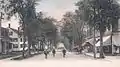 Central Street, 1905
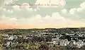 Vue générale, 1906
 Vue du nid d'aigle, c. 1906
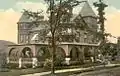 Converse House, c. 1908
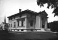 Beals Memorial Library, 1915
 Marchmont, également connu sous le nom de The Castle, construit en 1888, démolit en 1956
Notes et références
- (en) Cet article est partiellement ou en totalité issu de l’article de Wikipédia en anglais intitulé « Winchendon, Massachusetts » (voir la liste des auteurs).
- (en)http://www.townofwinchendon.com/history1.html
- (en) « Total Population (P1), 2010 Census Summary File 1 », American FactFinder, All County Subdivisions within Massachusetts, United States Census Bureau,
- (en) « Massachusetts by Place and County Subdivision - GCT-T1. Population Estimates », United States Census Bureau (consulté le )
- (en) « 1990 Census of Population, General Population Characteristics: Massachusetts », US Census Bureau, (consulté le ), Table 76: General Characteristics of Persons, Households, and Families: 1990
- (en) « 1980 Census of the Population, Number of Inhabitants: Massachusetts », US Census Bureau, (consulté le ), Table 4. Populations of County Subdivisions: 1960 to 1980
- (en) « 1950 Census of Population », Bureau of the Census, (consulté le ), Section 6, Pages 21-10 and 21-11, Massachusetts Table 6. Population of Counties by Minor Civil Divisions: 1930 to 1950
- (en) « 1920 Census of Population », Bureau of the Census (consulté le ), Number of Inhabitants, by Counties and Minor Civil Divisions. Pages 21-5 through 21-7. Massachusetts Table 2. Population of Counties by Minor Civil Divisions: 1920, 1910, and 1920
- (en) « 1890 Census of the Population », Department of the Interior, Census Office (consulté le ), Pages 179 through 182. Massachusetts Table 5. Population of States and Territories by Minor Civil Divisions: 1880 and 1890
- (en) « 1870 Census of the Population », Department of the Interior, Census Office, (consulté le ), Pages 217 through 220. Table IX. Population of Minor Civil Divisions, &c. Massachusetts
- (en) « 1860 Census », Department of the Interior, Census Office, (consulté le ), Pages 220 through 226. State of Massachusetts Table No. 3. Populations of Cities, Towns, &c.
- (en) « 1850 Census », Department of the Interior, Census Office, (consulté le ), Pages 338 through 393. Populations of Cities, Towns, &c.
Cet article est issu de Wikipedia. Le texte est sous licence Creative Commons - Attribution - Partage dans les Mêmes. Des conditions supplémentaires peuvent s'appliquer aux fichiers multimédias.