Concept
Version 15
Created by Boundless
The Compromise of 1850

The United States, 1849–1850
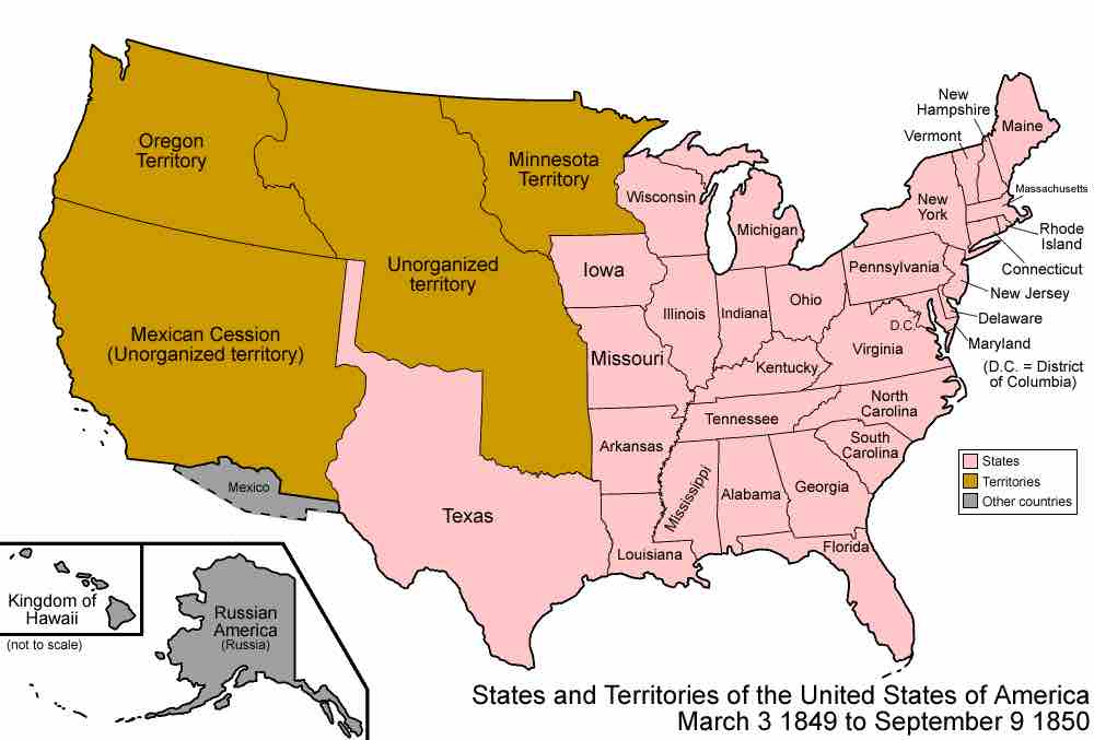
A map of the United States depicting states and territories, and land held by other countries during the time period of 1849–1850.
The map distinguishes between states, territories, and land held by other countries. It shows the following states: Maine, New Hampshire, Vermont, Massachusetts, Rhode Island, Connecticut, New York, New Jersey, Pennsylvania, Delaware, Maryland, Virginia, North Carolina, South Carolina, Georgia, Florida, Ohio, Michigan, Indiana, Illinois, Wisconsin, Iowa, Missouri, Kentucky, Tennessee, Alabama, Mississippi, Arkansas, Louisiana, and Texas. It shows four territories: Minnesota Territory, covering modern-day Minnesota and portions of modern-day North Dakota and South Dakota; Unorganized territory, covering modern-day Nebraska and portions of modern-day North Dakota, South Dakota, Montana, Wyoming, Colorado, Kansas, and Oklahoma; Oregon Territory, covering modern-day Washington, Oregon, Idaho, and portions of modern-day Montana and Wyoming; and Mexican Cession, also labelled "Unorganized territory," covering modern-day California, Nevada, Utah, and portions of modern-day Wyoming, Colorado, Kansas, Oklahoma, Arizona, and New Mexico. Finally, it shows three areas of land held by other countries: the coast of modern-day Arizona and New Mexico, which was part of Mexico; modern-day Hawaii, which was the Kingdom of Hawaii; and modern-day Alaska, which was Russian American.
Source
Boundless vets and curates high-quality, openly licensed content from around the Internet. This particular resource used the following sources:
"United States 1849-1850."
http://en.wikipedia.org/wiki/File:United_States_1849-1850.png
Wikipedia
CC BY-SA 3.0.