Concept
Version 13
Created by Boundless
The Missouri Compromise

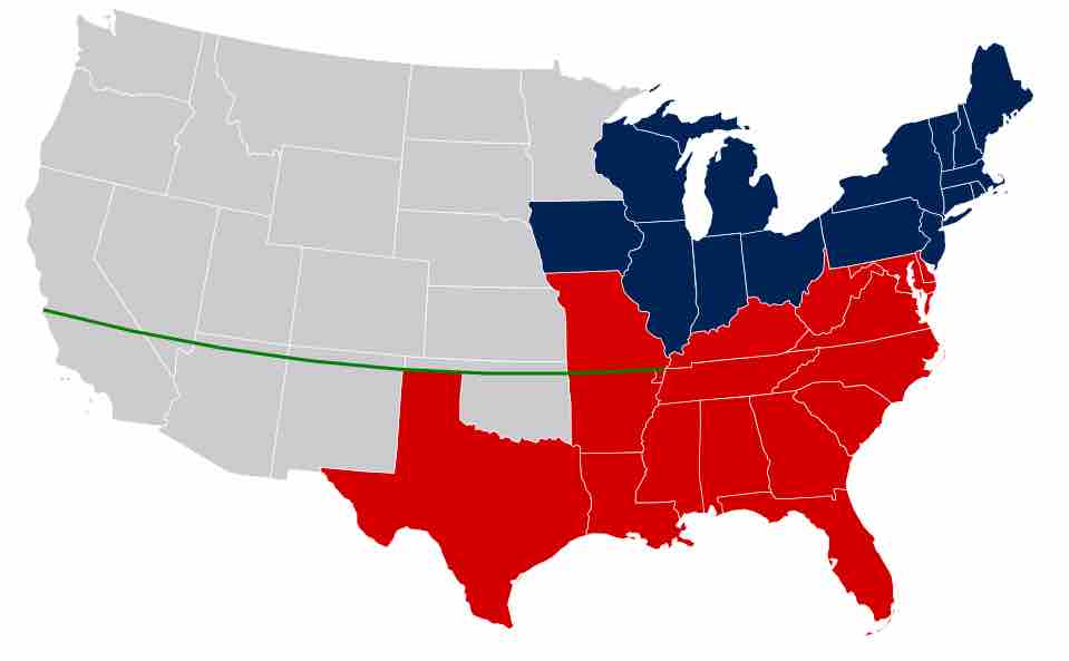
Missouri Compromise line
This map of the United States, circa 1820, shows the line between free and slave states that was established by the Missouri Compromise of 1820. The line extended along the parallel 36°30′ north, which roughly runs along the northern edge of present-day North Carolina, Tennessee, Arkansas, Oklahoma, New Mexico, Arizona, and westward through Nevada and California.
Source
Boundless vets and curates high-quality, openly licensed content from around the Internet. This particular resource used the following sources:
"Missouri Compromise Line."
http://en.wikipedia.org/wiki/File:Missouri_Compromise_Line.svg
Wikipedia
CC BY-SA.