Thirteen original colonies
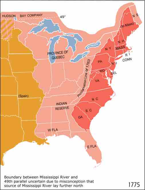
This map illustrates the 13 original colonies under British rule in North America in the 18th century: Georgia, South Carolina, North Carolina, Virginia, Maryland, Delaware, Pennsylvania, New Jersey, New York, Massachusetts, Rhode Island, Connecticut, and New Hampshire. Lands to the west at that time were colonized by France and Spain. Some land to the west was also set aside for Native Americans.
A note on the map states the following: "Boundary between Mississippi River and 49th parallel uncertain due to misconception that source of Mississippi River lay further north."
Source
Boundless vets and curates high-quality, openly licensed content from around the Internet. This particular resource used the following sources:
"506px-Map_of_territorial_growth_1775.svg.png."
https://commons.wikimedia.org/wiki/File:Map_of_territorial_growth_1775.svg
Wikipedia
Public domain.