Political geography of ancient Greece
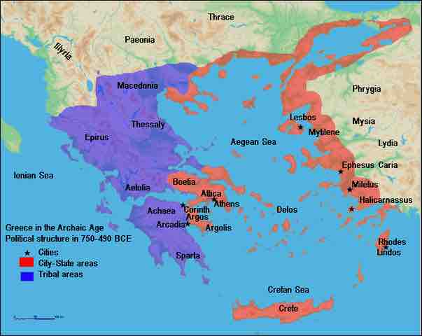
The map shows the political structure of Greece in the Archaic Age.
The map shows the political structure of Greece in the Archaic Age from 750 - 490 BCE. Boetia, Attica, Argolis, Delos, Crete, Lindos, and Mytilene were city-state areas. Spara, Archaea, Aetolia, Epirus, Thessaly, and Macedonia, on the other hand, were tribal areas.
Source
Boundless vets and curates high-quality, openly licensed content from around the Internet. This particular resource used the following sources:
"Archaic Greece."
http://upload.wikimedia.org/wikipedia/commons/thumb/8/87/ArchaicGr.jpg/603px-ArchaicGr.jpg
wikipedia
Public domain.