Map of the Athenian Empire c. 431 BCE
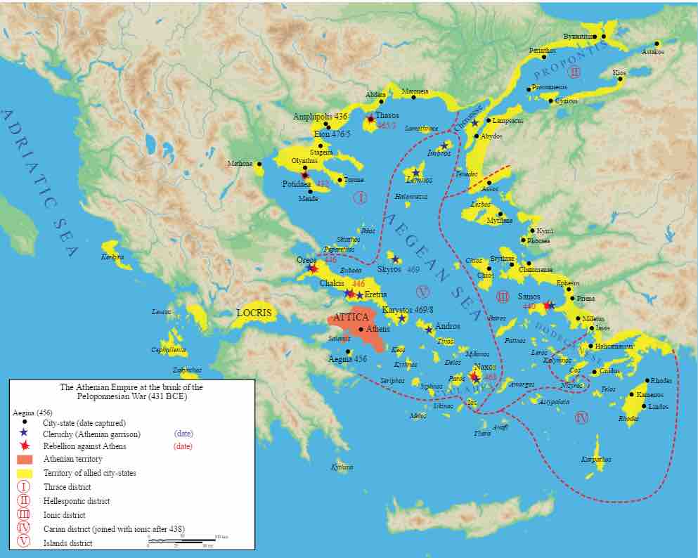
The Delian League was the basis for the Athenian Empire, shown here on the brink of the Peloponnesian War (c. 431 BCE).
The map shows the status of the Athenian Empire at the brink of the Peloponnesian War in 431 BCE. It shows the Athenian territory, centered around Athens, and the territory of allied city states, which were spread across the Adriatic and the Aegean Seas. The territories were divided into five districts: the Thrace District to the north, which included the cities of Potidae (captured in 432), Eion (captured in 475), Amphipolis (captured in 436), and Thasos (captured in 463); The Hellespontic District to the northeast of the Thrace District; the Ionic District south of the Hellespontic District, which included the city of Samos (conquered in 440); the Carian district south of the Ionic District, which joined with the Ionic District after 438; and the Islands District to the west of the Ionic District and south of the Trace District, which included the cities of Athens, Chalcis (captured in 446), and Naxos (captured in 468).
Source
Boundless vets and curates high-quality, openly licensed content from around the Internet. This particular resource used the following sources:
"Map_athenian_empire_431_BC-en.svg."
https://en.wikipedia.org/wiki/File:Map_athenian_empire_431_BC-en.svg
Wikimedia
CC BY-SA 2.5.