England, 650
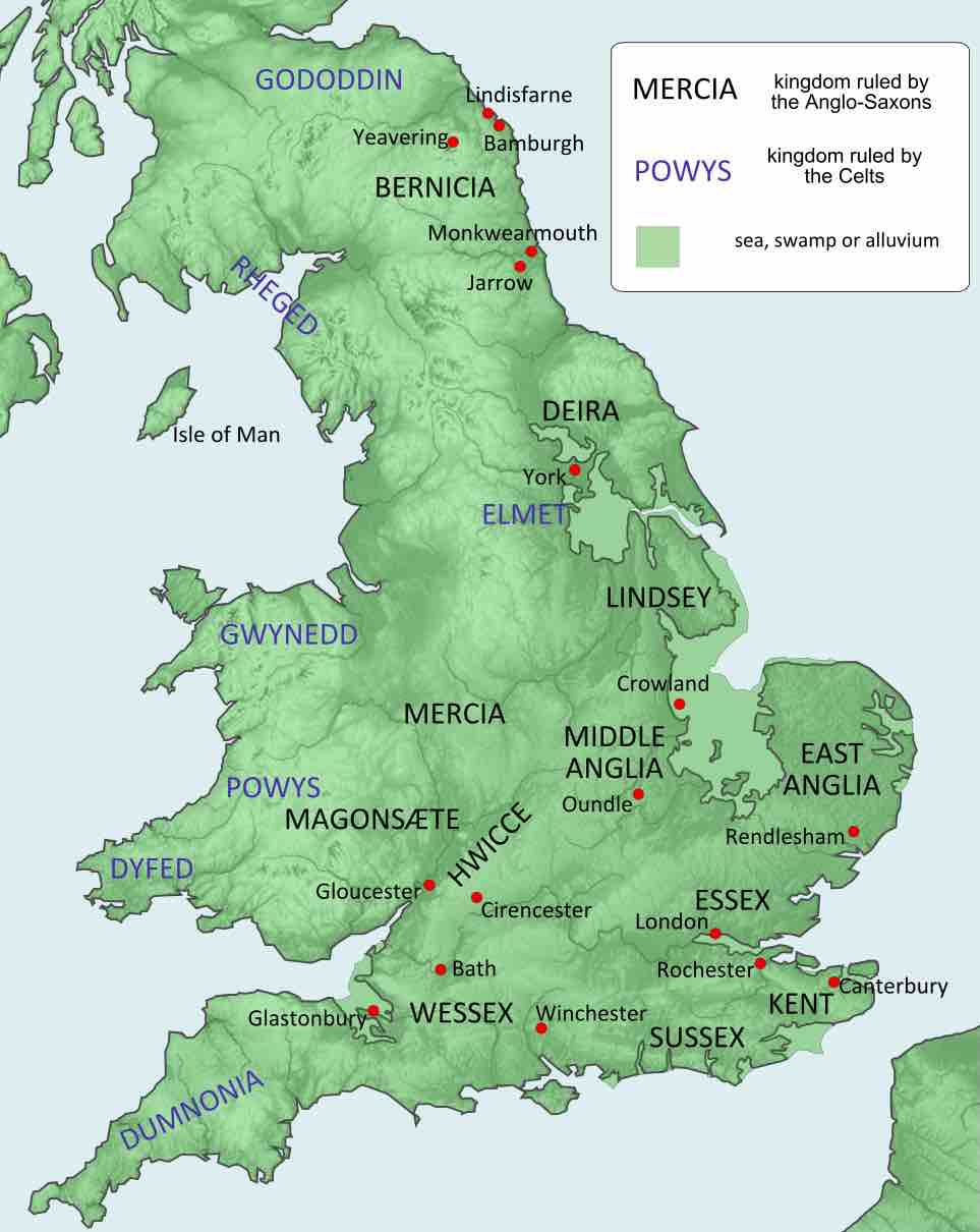
A political map of Britain c. 650 (the names are in modern English); the black text denotes kingdoms ruled by Anglo-Saxons.
The map shows twelve kingdoms ruled by the Anglo-Saxons, stretching from northeastern England to southern England. From north to south, these kingdoms included Bernicia, Deira, Lindsey, Mercia, Middle Anglia, East Anglia, Magonsaete, HWICCE, Essex, Wessex, Kent, and Sussex. The map also shows seven kingdoms ruled by the Celts. stretching from northern England to southwestern England. From north to south, these kingdoms included Gododdin, Rheged, Gwynedd, Powys, Dyfed, and Dumnonia.
Source
Boundless vets and curates high-quality, openly licensed content from around the Internet. This particular resource used the following sources:
"963px-England_green_top.svg.png."
https://en.wikipedia.org/wiki/Anglo-Saxons#/media/File:England_green_top.svg
Wikipedia
CC BY-SA 3.0.